Cold Mornings Chilly Afternoons Continues Into Friday No Major Storms Lie Ahead

Weather in 5/Joe & Joe Weather Show Latest Podcast
Cold Mornings Chilly Afternoons Continues Into Friday No Major Storms Lie Ahead
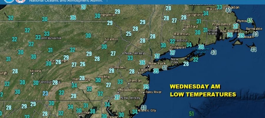
We are definitely in the heart of real autumn weather as frosts and freezes this morning continue to spread across the Eastern US. Once a frost or a freeze occurs warnings and advisories are no longer posted for that particular area. Here are the Wednesday morning lows as of 7am Eastern Time.
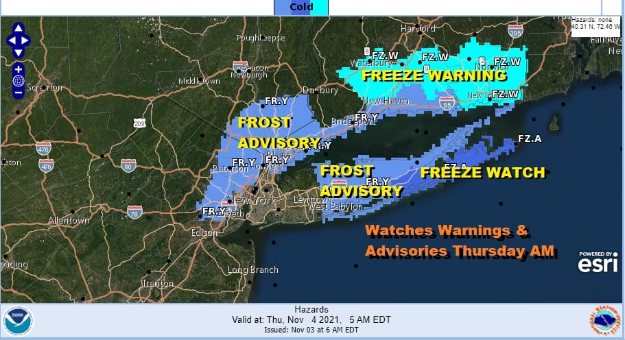
This takes us to the next round of frosts and freezes tonight and the areas shift more to the coast with frost advisories in areas surrounding NYC, the eastern half of Long Island and Southern Connecticut.
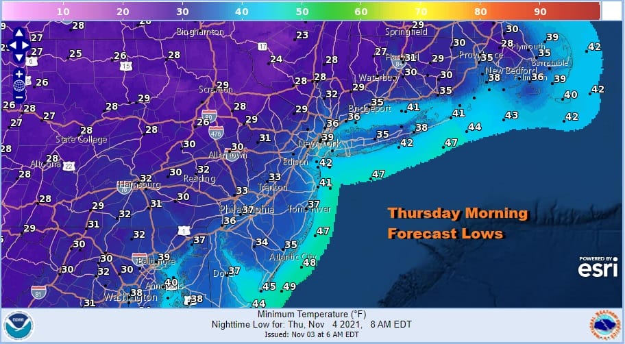
Thursday morning lows will be the coldest of the autumn season so far as temperatures head down to the 20s away from warmer urban centers and the immediate coast. In those warmer spots lows will be in the mid to upper 30s.
SATELLITE

WEATHER RADAR

Before we get to the cold night tonight we have the chilly day today with sunshine and a few passing clouds. Highs will only be in the upper 40s and lower 50s. The satellite shows some patchy clouds moving northwest to southeast and the radars are indicating some lake effect rain and snow showers occurring in Upstate NY.
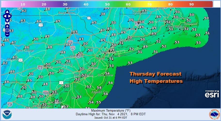
Thursday will be the coldest day this week with sunshine and some high clouds. The first of two waves of low pressure will be moving off the Southeast US coast and heading northeast. Highs Thursday will be in the 40s to near 50 degrees at best and then we head down Thursday night into Friday morning into the 20s and 30s. Friday will be a nice sunny day as temperatures bounce back into the 50s.
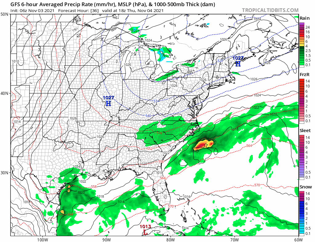
Now back to the two waves of low pressure They will both pass well to our south. The second wave will move out Saturday night and Sunday. This will mean a nice weekend ahead with no rain! In fact the second wave actually strengthens to a powerful ocean storm and that will help the re-enforce the dry air in the Eastern US. Look for sunshine and Saturday with highs in the 50s. Sunday look for high clouds and sunshine as the low passes to the south with highs again in the 50s. Next week looks dry through the first half with temperatures close to average for this time of year and we may have to wait until late next week for any kind of cold front that produces widespread shower activity. Quiet autumn times lie ahead.
BE SURE TO DOWNLOAD THE FREE METEOROLOGIST JOE CIOFFI WEATHER APP &
ANGRY BEN’S FREE WEATHER APP “THE ANGRY WEATHERMAN!

MANY THANKS TO TROPICAL TIDBITS & F5 WEATHER FOR THE USE OF MAPS
Please note that with regards to any severe weather, tropical storms, or hurricanes, should a storm be threatening, please consult your local National Weather Service office or your local government officials about what action you should be taking to protect life and property.


