Cold Front Brings Showers Thunderstorms & Isolated Severe Weather
A cold front is passing through the Northeast & Middle Atlantic states today and that will come with showers, thunderstorms and pockets of severe weather. The Storm Prediction Center is indicating the possibility for isolated severe thunderstorms extending from Eastern Virginia northeastward to Maryland, Delaware, & New Jersey, nosing into the southern portions of the Hudson Valley. General thunderstorm risk lies around the marginal risk zone.
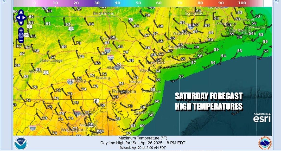
Showers and thunderstorms will be around into early afternoon as a cold front passes from west to east. There is a chance we could see improving weather conditions settle in later this afternoon and evening as the front moves offshore. As for temperatures today they will be in the mid 60s to around 70 degrees. Then once the front passes we will see winds pick up from the northwest and become strong and gusty overnight as skies partially clear and temperatures settle Sunday morning in the low and middle 40s.
SATELLITE WITH LIGHTNING STRIKES
WEATHER RADAR
While Sunday will be a better day in general it will not be picture perfect. The air aloft will be cold and unstable which will lead to “self destructive” sunshine. In other words when the sun comes out and starts to heat the unstable atmosphere, clouds will develop, and winds will increase to 20 to 30 mph from the northwest with gusts to 40 mph. Temperatures Sunday will be in the cooler low and middle 60s.
The gradient will loosen Sunday night leading us to a calmer and partly to mostly sunny day for Monday. High pressure will be moving offshore and we will be setting up for a big warm up Tuesday into Wednesday. Monday highs will be back into the 70s. Temperatures will be a little cooler along south and east facing shorelines as local sea breezes develop.
Tuesday into Wednesday we will have a cold front pushing southeastward into Western NY and Western Pennsylvania and a strong ridge of high pressure offshore. West to southwest winds and no worse than partly sunny skies will likely send temperaures rising into the 80s in most places away from the ocean. Showers and thunderstorms from the next cold front will stay to the west and north through the dayside Tuesday.
We will see this cold front pass through Wednesday and at the moment it seems the front will be dry when it passes, or any showers and thunderstorms that develop ahead of the front will remain in Pennsylvania and Interior Upstate NY before falling apart. Wednesday should be a partly sunny day with leftover highs in the upper 70s to lower 80s before it cools down for the remainder of the week.
BE SURE TO DOWNLOAD THE FREE METEOROLOGIST JOE CIOFFI WEATHER APP &
ANGRY BEN’S FREE WEATHER APP “THE ANGRY WEATHERMAN!
MANY THANKS TO TROPICAL TIDBITS FOR THE USE OF MAPS
Please note that with regards to any severe weather, tropical storms, or hurricanes, should a storm be threatening, please consult your local National Weather Service office or your local government officials about what action you should be taking to protect life and property.