USE THE COUPON CODE “SPRING2025” AND GET 10 PERCENT OFF ON ANY PURCHASE
Cold Front Approaching Rain Late Today
Into Early Thursday Morning
We have a cold front on the way with showers. A coastal storm offshore has been protecting us from weather systems to the west but that low will be sliding southeast today. This allows the cold front and a developing to hold together and bring showers. Ahead of this today we will have sunshine giving way to increasing clouds. Winds are off the ocean so that will put a cap on temperatures as well as the increasing cloud cover. Most highs inland will reach the 60s but along the coast as usual it will be about 10 degrees or so cooler.
SATELLITE WITH LIGHTNING STRIKES
WEATHER RADAR
Look for showers to approach Eastern Pennsylvania to Southern New England in the late afternoon and evening. There could be some heavier downpours in the mix. Most of the rain should be over and done with during the early morning hours though there could be some lingering showers still around toward daybreak. Rainfall amounts will be in a range of a half to three quarters of an inch.
Weather conditions should start to improve during the day Thursday though it will be a slow process. The onshore flow will be gone and winds will be from the northwest which should help to dry things out. The air behind this front is cool so high temperatures will be in the low to middle 60s in most places.
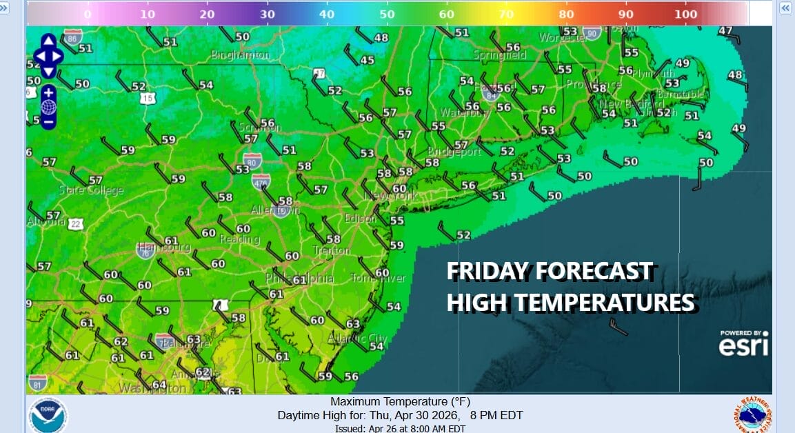
Cold air aloft will make for an unstable atmosphere Friday so any sun will likely give way to some developing clouds. There could be a few scattered showers that will pop up. The best chances for any brief showers will be away from the coast. It will also be quite cool with highs generally in the upper 50s and lower 60s. The weekend looks to be cool and dry however a wave on the old cold front will probably bring some high clouds Saturday and Saturday night and there is a chance that rain could clip areas in Southern New Jersey and points south for a few hours. Otherwise for most of you the weekend will be dry with cooler than average temperatures.
DOWNLOAD THE UPSIDE APP & EARN CASH AT GAS STATIONS, RESTAURANTS, & SUPERMARKETS
BE SURE TO DOWNLOAD THE FREE METEOROLOGIST JOE CIOFFI WEATHER APP &
ANGRY BEN’S FREE WEATHER APP “THE ANGRY WEATHERMAN!
MANY THANKS TO TROPICAL TIDBITS FOR THE USE OF MAPS
Please note that with regards to any severe weather, tropical storms, or hurricanes, should a storm be threatening, please consult your local National Weather Service office or your local government officials about what action you should be taking to protect life and property.