
Cold But Sunny Day Weak System Brings Rain Snow Showers Late Tuesday

Weather in 5/Joe & Joe Weather Show Latest Podcast
Cold But Sunny Day Weak System Brings Rain Snow Showers Late Tuesday
A day like this in January or February and the general attitude is “okay it is supposed to be cold this time of year” When you get to mid March and you have already had a couple of days with temperatures in the 60s and you think “enough already” At least we have the March sun which can at least make it feel a little warmer than what the thermometer is reading.

We continue to have Red Flag Warnings in effect for Southeastern Pennsylvania, Delaware, and most of New Jersey. Dew points are running close to zero and relative humidity levels are running at 25 percent or less. We did see brush fires break out yesterday in parts of New Jersey and we could see the risk for brush fires not only in the Red Flag area, but also in surrounding areas in the Hudson Valley, Long Island and Southern New England.
SATELLITE

The satellite picture and regional radars are signaling we should see sunshine for the rest of the day. The regional radars are quiet. We are starting to see some showers on the Mid Atlantic Regional radar in the western part of its range. Those obviously are not an issue here. Temperatures this afternoon should reach into the 30s though it may be a struggle for most areas. Southern New Jersey and Southern Pennsylvania southward could make it into the lower 40s.
F5 WEATHER RADARS


Tonight we should see clear skies and light winds for most of the night. Some high clouds will start to roll in during the early morning hours from west to east. Temperatures will bottom in the upper teens to mid 20s in most areas. Warmer areas across Southern Pennsylvania and Southern New Jersey southward will bottom in the upper 20s and lower 30s.
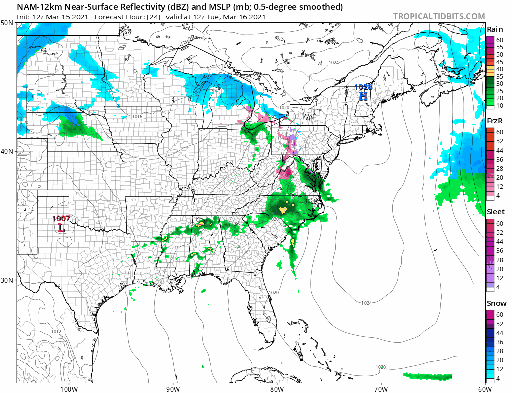
Attention Tuesday turns to the Colorado snow storm which is already weakening rapidly as it moves eastward. The strong upper trough to the east of us is suppressing this system as it moves east. Clouds will thicken up Tuesday. Some precipitation with this system does survive as it heads east. Also our cold air mass is going to hold on somewhat. Look for some rain or snow showers late Tuesday into Wednesday morning. This really shouldn’t amount to much. Some elevated areas in Northern New Jersey, Northeast Pennsylvania to the Catskills east to interior Southern New England could see a coating to an inch or so of accumulation.
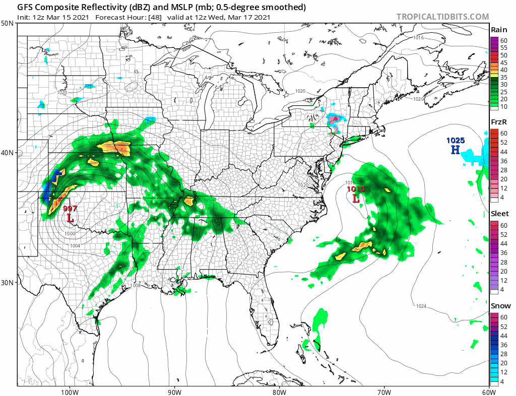
There is another stronger storm right behind the one for Tuesday. This one is likely to hold together as it moves east. This system will produce widespread severe weather across the Southern US from Texas to the Southeast US. Wednesday already shows an enhanced risk of severe weather across the Central Gulf States. Here we will see clouds hanging on Wednesday with highs in the mid 40s to lower 50s. Then we should see rain on Thursday. There is another shot of cold air with a high pushing southward from Eastern Canada. This could create a change to snow on the northern flank of the the precipitation shield Thursday night into Friday morning. Snow will favor elevated areas in Northern Pennsylvania, the Catskills. and the Southern Berkshires. Perhaps we could see a change to wet snow in elevated areas of Northern New Jersey as well. I don’t think this amounts to much from what I’m seeing at this stage of the game. Highs Thursday will be just in the 40s and then temperatures will fall late Thursday and Thursday night as cold air comes down from the north. This should push out to the southeast on Friday with improving weather conditions from north to south. The weekend looks dry and chilly but we could warm up for a couple of days early next week.
BE SURE TO DOWNLOAD THE FREE METEOROLOGIST JOE CIOFFI WEATHER APP &
ANGRY BEN’S FREE WEATHER APP “THE ANGRY WEATHERMAN!

MANY THANKS TO TROPICAL TIDBITS & F5 WEATHER FOR THE USE OF MAPS
Please note that with regards to any severe weather, tropical storms, or hurricanes, should a storm be threatening, please consult your local National Weather Service office or your local government officials about what action you should be taking to protect life and property.


