DOWNLOAD MY NEW FREE JOESTRADAMUS WEATHER APP FOR ALL DEVICES
THE APP IS ABSOLUTELY FREE TO ALL BUT CONSIDERING SUBSCRIBING TO PATREON FOR A WEATHER EXPERIENCE FREE OF ADS, EXCLUSIVE VIDEOS FOR MEMBERS ONLY AND MUCH MORE…STARTS AT $2 A MONTH..MESSAGE ME AT ANY TIME
Coastal Storm Makes It Close For Coast Dry Inland No Issues
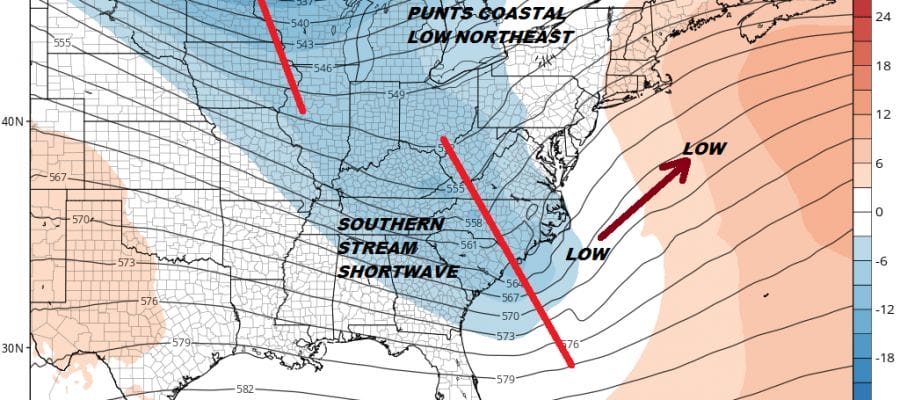
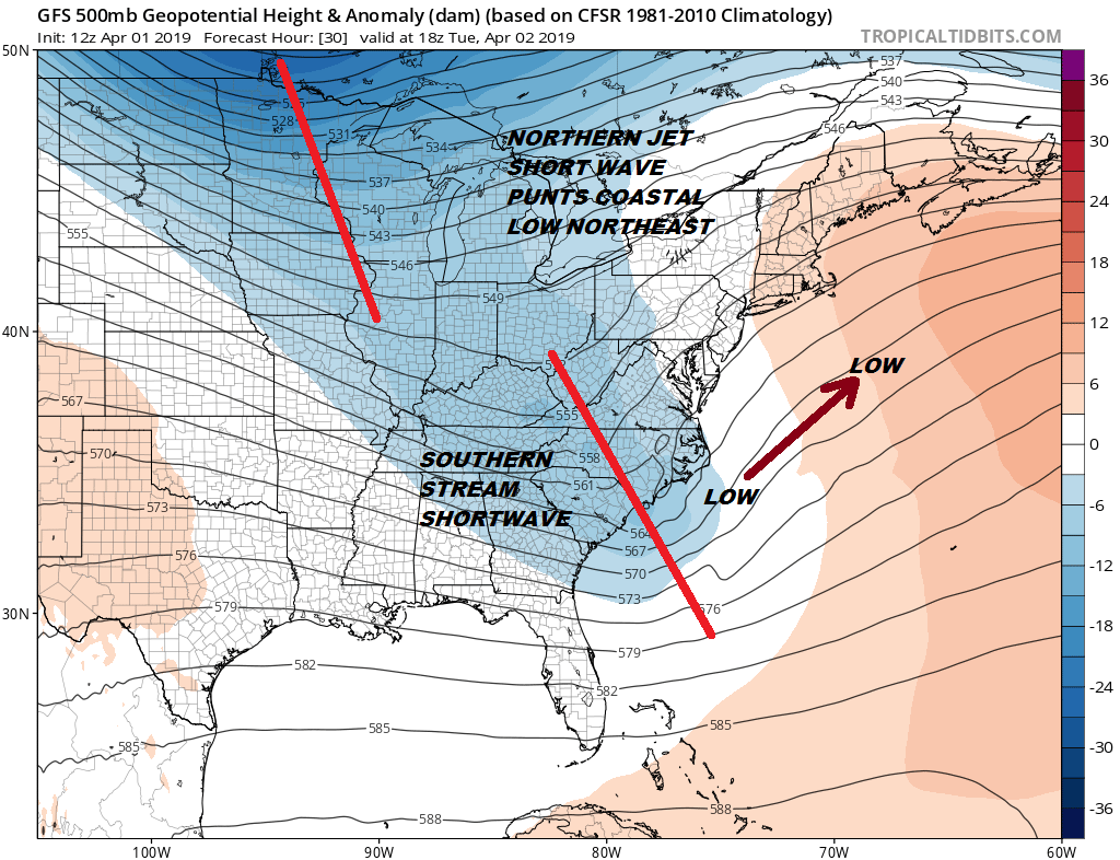
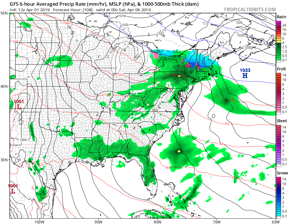
Across the Gulf of Mexico northeast to off the Southeast US Coast we see lots of clouds with a band of rain. From this area a storm will be born and low pressure will begin to develop along the coast of the Carolinas on Tuesday. Since last week the upper pattern appeared to be one where the northern part of the jet stream would remain more of a punter of the southern stream shortwave to the northeast and offshore. This remains the case today though the GFS model and and some others do make it a bit of a closer call for the immediate coast of New Jersey and Long Island. It still seems to me that this will be more offshore than onshore and the bulk of this system will stay to the south and east Tuesday night into Wednesday morning.
Areas that might see some rain from this low would be the New Jersey shore to NYC, Southern New England along the coast and Long Island. It will be a tight western edge. Areas just to the west of NYC will see very little rain Tuesday night for a few hours, while areas to the east will see a bit more rain and a gusty northeast wind will develop overnight. However this will NOT create noreaster conditions. We are talking about a 4 to 8 hour period of rain that should be all done before daybreak Wednesday if not just shortly afterwards.
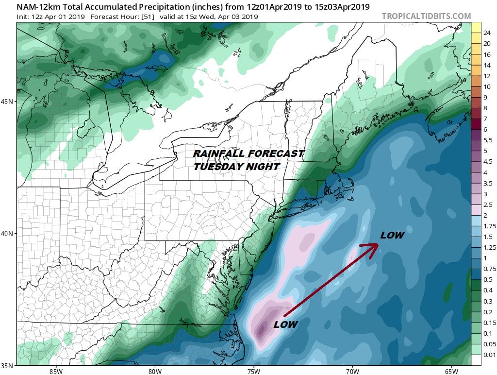
The aggressive Nam has the blue 1/2 inch or more rain area cutting Long Island in half and skimming the New Jersey coast with less than a tenth of an inch west of NYC. It will be a tight wall and Pennsylvania, Northwest New Jersey, much of the Hudson Valley and Southwest Connecticut will see little or nothing from this. A track a little flatter like some of the global model suggests would mean cut these amounts in half and shift the western edge further east.
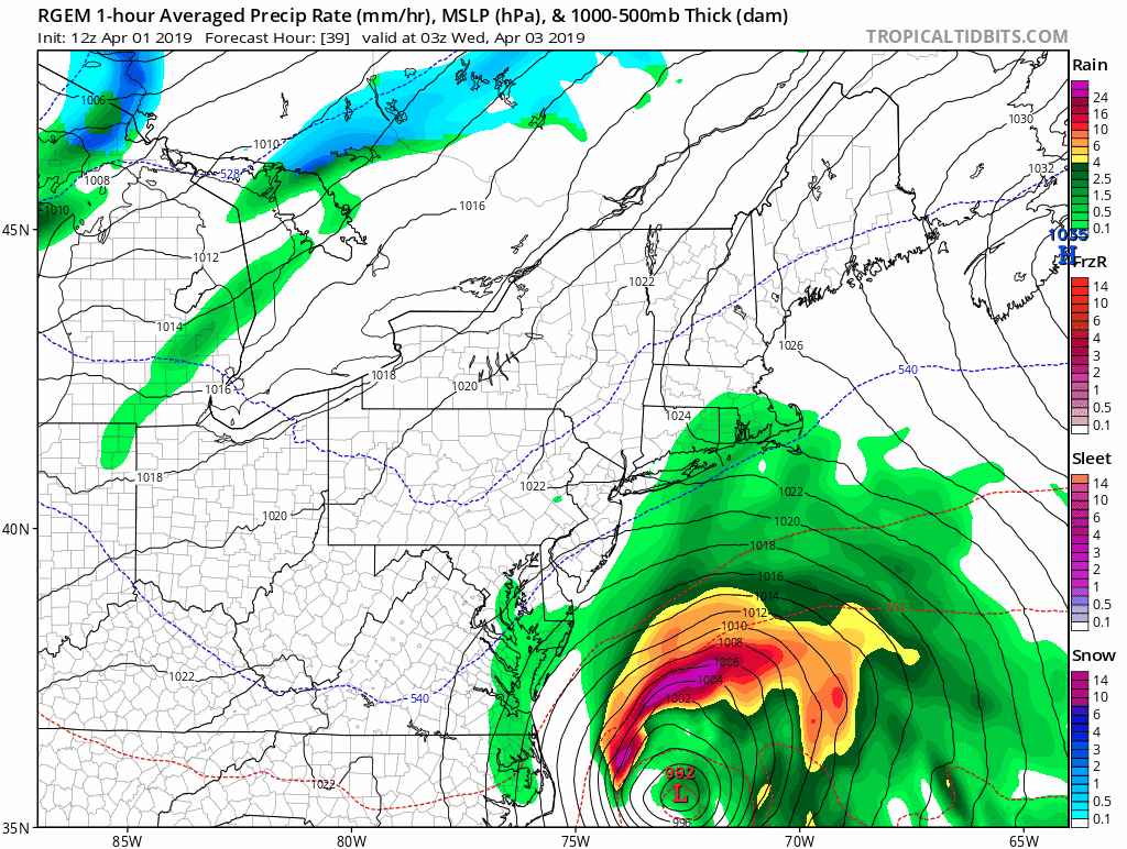
The flatter look of the RGEM model is on the other side of the tracking envelope with this storm. It pushes the low further east before lifting it northeast. This argues for less rain for most and shuts off most areas from any rain except over Long Island for a short time as well as Southeastern New England. This is the track I’ve been favoring for days and am sticking with it. Other than then NAM the other models are not far off from this idea.
SATELLITE

In the meantime there are no issue regarding tonight and the daytime Tuesday other than it is cold with clear skies tonight. At least the winds will diminish overnight and most lows will be in the 20s to lower 30s. Radars are quiet for the most part other than a few snow showers in upstate NY and those will disappear overnight.
REGIONAL RADAR

Lets jump now to the end of the week. Wednesday and Thursday look good with this storm pulling way Wednesday morning and lots of sunshine developing with highs in the upper 50s to lower 60s. Thursday look for sunshine giving way to late day arriving clouds and highs in the 50s. This is due to the next weather system arriving for Friday.
Friday with high pressure moving out to the east and building back temporarily to our north we set up for a chilly onshore fl;ow and a raw rainy Friday. Snow lovers in upstate NY and Central and Northern New England could see a little snow out of this. This is the system that transitions us over to a warmer and drier pattern for this coming weekend. How warm will depend on sunshine and wind direction. The wind will be more onshore Saturday as high pressure will be to our north but that high will eventually settle to the south of us later Sunday and Monday. 60s should be doable and with a little luck we could be pushing 70 or better in some places on Monday. As always in the spring, its complicated by so many factors. Most importantly the very cold ocean is always there to play spoiler. We will lean optimistically. At least once the Friday system exits early Saturday we should see dry weather into Monday of next week.
MANY THANKS TO TROPICAL TIDBITS FOR THE USE OF MAPS
Please note that with regards to any tropical storms or hurricanes, should a storm be threatening, please consult your local National Weather Service office or your local government officials about what action you should be taking to protect life and property.


