Coastal Rain Storm Possibility & Long Range Analysis
We are looking longer term first to next week with the split flow pattern that continues. The jet stream is becoming more active from a storm system perspective and models have been signalling the possibility of a coastal low and rain event for early next week. What is a bit of a standout here is that if this happens it would be a rain storm for everyone including inland areas (assuming it is far enough north and west on track) and not a snowflake or an ice pellet will be seen out of this.
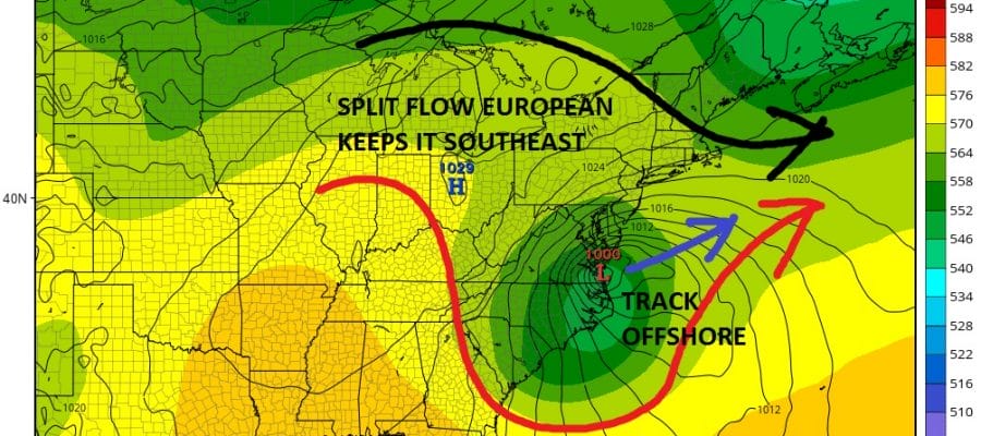
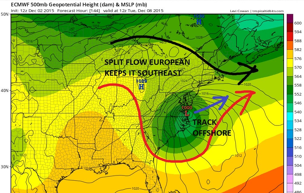
The question going forward with this is timing and whether the southern stream can lift the weather system far enough north. The European weather forecast model shows this quite well and would imply the track will be offshore with the northern jet not in position to allow for much northward lift.
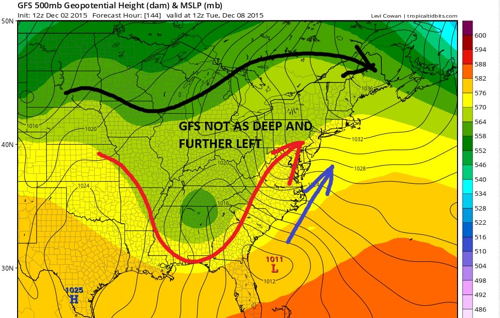
The GFS on the other hand is much slower and further left with the weaker upper feature and has a weaker coastal low at this time frame but there would be room for this to lift further northwest than the European, though it would be a day or two later.
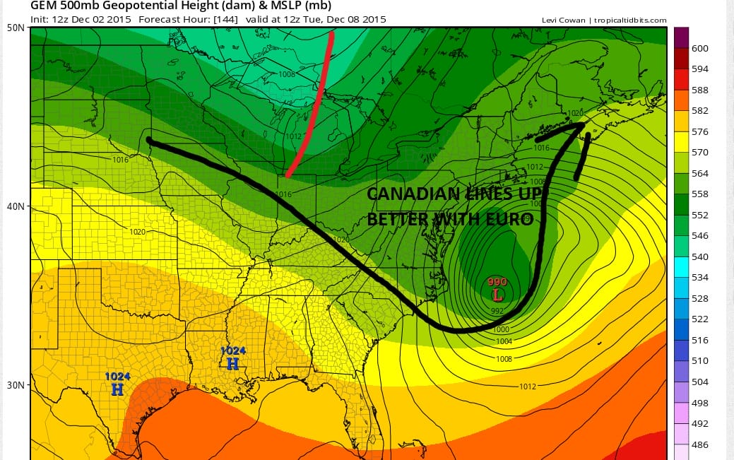
The Canadian lines up better with the European in terms of timing but because of what it shows upstream in Canada it would kick this out to sea as well. The Canadian seems to have an overdeveloped low at this point offshore
My feeling here is that the Canadian and European have the best idea on timng then the slower GFS. Now we have to see whether the models allow enough room for a more northward rather than a northeastward track.
Meanwhile JOESTRADAMUS took the GFS out to day 16 and does not like what he sees. It is another example of how this model continues to pick up on things in the longer term that don’t seem to be there yet in reality. The model maintains the vortex structure across the Arctic and does not break it down anytime soon although the implication of this run is a trend to more seasonal temperatures on average. Remember folks it is early to mid December and seasonal temps still means highs in at least the middle 40s.
LATE AFTERNOON UPDATE:
European and Canadian models do continue to show a weakening of the polar vortex complex as pressures begin to rise there. This is several runs in a row. Also the ensemble packages this afternoon also show this continuing beyond day 10. Let’s see if the late afternoon GFS model run catches on to this.
EL NINO HAS PEAKED BUT WHAT DOES THAT MEAN LONGER TERM?
CLIMATE MODELS WINTER FORECAST
JOESTRADAMUS VIDEO ANALYSIS FROM TUESDAY
JOESTRADAMUS LONG RANGE POST TUESDAY
JOESTRADAMUS LONG RANGE POST FROM MONDAY
JOESTRADAMUS WINTER FORECAST 2015-2016