Coastal Flood Watch Long Island Noreaster Friday Saturday
Coastal Flood Watch Long Island Noreaster Friday Saturday
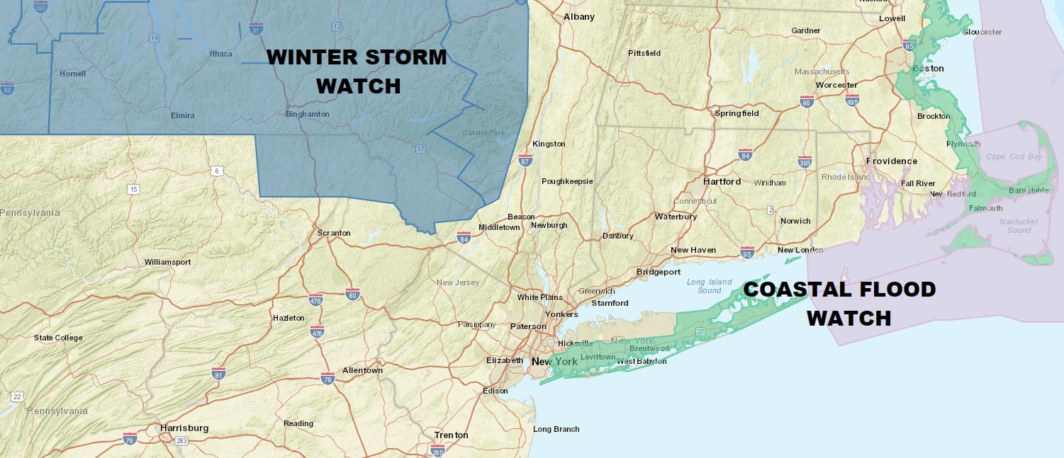
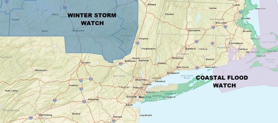
We are beginning to see the first watches going up and this is a Coastal Flood Watch which is up for the South Shore of Long Island as well as Northeast Suffolk County on the Long Island Sound side. Moderate coastal flooding is forecast for Friday and Saturday high tides. I would suspect some other Coastal Flood Watches will be going up as well. The first Winter Storm Watches are up for the Catskills westward as well as two counties in Northeastern Pennsylvania (Susquehanna & Northern Wayne). Obviously there are no serious issues today though we do have high clouds moving through ahead of a weak weather system to the northwest. It is basically a weakening cold front with strong high pressure to the north beginning to press southward. Overall today we are looking at sunshine through some high clouds with most highs in the 50s. South facing shore lines would likely see an ocean wind developing today which might keep temperatures a bit lower.
US SATELLITE

REGIONAL RADAR

Tonight look for clouds with most lows in the mid 30s to lower 40s as we begin to set up for the developing ocean storm. Low pressure will be moving east across the Ohio Valley & then redeveloping off the Delaware/New Jersey coast and intensifying rapidly. The low will like make its way to near Montauk or just east of there early Friday when it will stall out and then begin a slow drop southward. How this plays out here will be rain Thursday night into Friday. Once the low begins to move southward winds which will be picking up Thursday night will become more northeasterly over Long Island and Northerly over coastal New Jersey. This will likely lessen tidal impacts in New Jersey but the track is bizzare enough that we need to watch this. For Long Island and nearby NY Harbor, the higher tides may actually occur Friday night into Saturday morning when they could be 2 to 3 feet above normal.
As for a change to snow weather models have been all over the place with this as there is very little cold air to speak of other than what will be produced by the strong dynamics in the upper atmosphere. At the moment this would favor elevated areas north and west of the coast though speculating on amounts at this point is a rather useless exercise until we can feel more confident on the dynamic in the upper atmosphere and how they will play out. Precipitation is likely to continue Friday night and end early Saturday morning though winds are also likely to remain strong and gusty Saturday. This storm is going to become a major Atlantic Ocean storm as it eventually moves to the southeast and east and it will remain an impact on the ocean into early next week.
 GET JOE A CIGAR IF YOU LIKE

FiOS1 News Weather Forecast For Long Island
FiOS1 News Weather Forecast For New Jersey
FiOS1 News Weather Forecast For Hudson Valley


