Clouds Warmer Air Return Cooler Early Next Week
Clouds Warmer Air Return Cooler Early Next Week
Onshore winds and a cool dry New England air mass is giving us a cool start to the day. The high pressure cell responsible for this is now pushing out to the east of New England which opens the door for clouds to return from south to north. Temperatures won’t be going anywhere fast today with highs just in the 60s. Even though clouds will be coming back there does not appear to be anything to create widespread rain as we transition over to warmer and more humid conditions over the weekend. The radar is rather quiet today and should remain so.
SATELLITE LOOP

REGIONAL RADAR

Saturday we will see lots of clouds and there is the risk of a passing shower or some light rain or drizzle. In the middle of this skies might brighten up on spots but we may have to wait until Sunday to see a bit more of sunshine. Temperatures Saturday will be in the 70s.
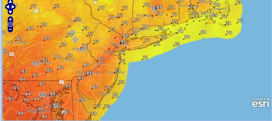
SUNDAY FORECAST HIGH TEMPERATURES
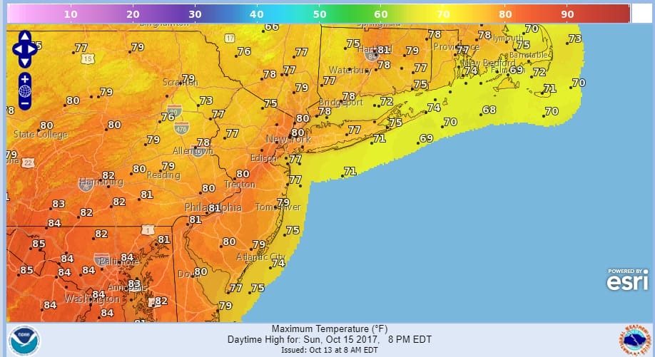
Sunday’s highs will reach the upper 70s and lower 80s ahead of a cold front. The front should hold off until Sunday night when there could be a few passing showers. Then another fast shot of cool air comes in for Monday and Tuesday of next week before the ridge in the east rebuilds later next week.
 GET JOE A CIGAR IF YOU LIKE

FiOS1 News Weather Forecast For Long Island
FiOS1 News Weather Forecast For New Jersey
FiOS1 News Weather Forecast For Hudson Valley


