
Clouds Sun Friday Saturday Mostly Dry Rain Sunday
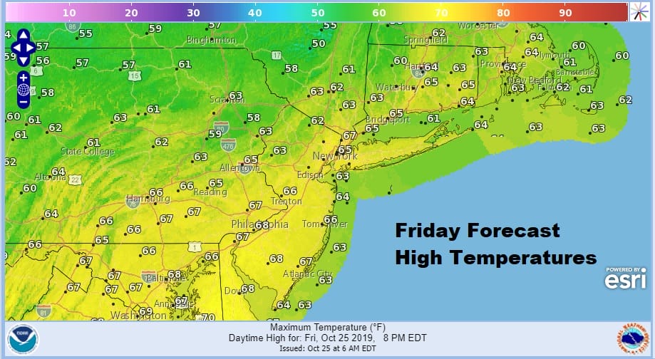
We have made it to the end of the work week after 2 beautiful autumn days with lots of sunshine. Today will be a bit different with some clouds dropping southeastward from upstate NY. We also have some high clouds streaming in from the southwest well ahead of low pressure now developing in East Texas as well as a tropical or subtropical low forming in the Western Gulf of Mexico. We don’t see it being any worse than a mix of sun and clouds today with highs mostly in the low to mid 60s. The clouds from the north are from a weak frontal boundary which will allow another high to build in for tonight and Saturday.
SATELLITE

REGIONAL RADAR

There are no radar issues today and we don’t expect any showers to deal with through much of Saturday. Skies will be partially clearing tonight with lows in the 40s. Then on Saturday clouds will be increasing. Low pressure coming out of the Gulf States will merge with the subtropical/tropical low creating a very moisture laden storm moving northeastward toward the lower Great Lakes. Some rain could move in Saturday afternoon from Pennsylvania west. Saturday’s highs will be in the upper 50s and lower 60s.

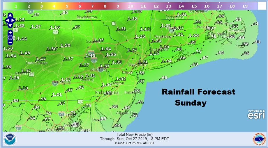
Late Saturday night and early Sunday rain moves in from southwest to northeast and we will see some heavier downpours during the day. Temperatures Sunday will be in the 60s. Rainfall amounts from this system will be on the order to an inch to an inch and a half in some areas. We should see the rain end late in the day or Sunday evening from west to east.
Next week brings about more volatility as we see the likelihood for 2 weather systems. One will come along late Wednesday or Thursday which is Halloween. Another system is possible over next weekend. In the meantime Monday and Tuesday of next week look to be dry with some sunshine both days. Highs will be into the 60s.
MANY THANKS TO TROPICAL TIDBITS FOR THE USE OF MAPS
Please note that with regards to any severe weather, tropical storms, or hurricanes, should a storm be threatening, please consult your local National Weather Service office or your local government officials about what action you should be taking to protect life and property.


