Cloud Issues Continue Into Midweek Dry Nice Late Week
It is hard enough to deal with the Coronavirus, social distancing, and being confined to our homes, but it might be nice to at least have some sunshine. One positive is that while most of the Northeast is in cloud cover, at least much of our area is dry and we the low clouds rain drizzle fog and thunderstorms of yesterday are gone. Southern Pennsylvania southward into Virginia is enjoying sunshine with the cloud line cutting across Southern Pennsylvania and Southern New Jersey. Temperatures in this zone have reached into the 60s at midday. North and east of here it is cloudy and raw with temperatures in the 40s and at best will break 50 in some places.
SATELLITE

REGIONAL RADAR

You can see that little dry slot on the satellite picture pushing into Southern Pennsylvania while the regional radars are showing ac cold rain in upstate NY, and snow up in Northern Maine. There is the risk for a passing shower or two later this afternoon and evening from Northern Pennsylvania to Northern New Jersey and Southern New England. Everyone else should be dry.
LOCAL RADAR NEW YORK CITY

LOCAL RADAR PHILADELPHIA


Low pressure over Southeastern Canada is only very slowly moving eastward so improvement here will be slow. Clouds will be around tonight with most lows in the upper 30s to mid 40s. Tuesday look for clouds around. Perhaps there is a better chance for a few breaks of sun. Highs should reach into the 50s.
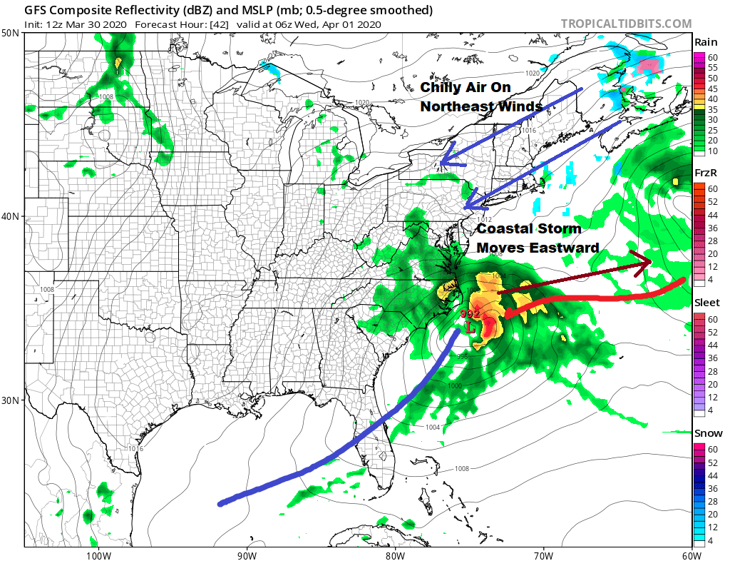
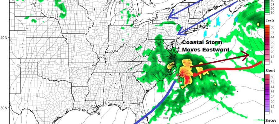
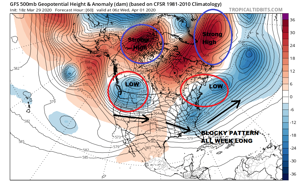
Low pressure from the Southern Plains will be heading eastward Tuesday and passing to our south Wednesday. It will not be able to turn northward up the East Coast due to a strong blocking pattern across the North Atlantic that is slowing systems down and forcing them to move further south.
Wednesday we will see lots of clouds around with highs in the 40s to near 50. I expect any rain from the Southern Plains system to reach as far north as perhaps Northern Virginia but no further north than that. Finally Thursday and Friday we should see some sunshine both days which should allow temperatures to respond a bit. Highs both days will be in the 50s.

With everything slowly down in the atmosphere and a major ocean storm well to the east, we could be in a bit of a dry sweet spot late this week and this weekend. I’m guardedly optimistic that we could make it through Sunday with decent weather and not a drop of rain.
BE SURE TO DOWNLOAD THE FREE METEOROLOGIST JOE CIOFFI WEATHER APP &
ANGRY BEN’S FREE WEATHER APP “THE ANGRY WEATHERMAN!
MANY THANKS TO TROPICAL TIDBITS FOR THE USE OF MAPS
Please note that with regards to any severe weather, tropical storms, or hurricanes, should a storm be threatening, please consult your local National Weather Service office or your local government officials about what action you should be taking to protect life and property.


