DOWNLOAD MY NEW FREE JOESTRADAMUS WEATHER APP FOR ALL DEVICES
THE APP IS ABSOLUTELY FREE TO ALL BUT CONSIDERING SUBSCRIBING TO PATREON FOR A WEATHER EXPERIENCE FREE OF ADS, EXCLUSIVE VIDEOS FOR MEMBERS ONLY AND MUCH MORE…STARTS AT $2 A MONTH..MESSAGE ME AT ANY TIME
Chilly Week Begins Should End Milder No Major Storms
The new week begins with clouds this morning as a weak weather front moves through and a wave on the front will follow later today. The system has very little support with it and we will spend the day ahead with lots of clouds. This morning we can see clouds overhead and more clouds to the west and south with the wave. Temperatures today will reach into the 50s.
SATELLITE

REGIONAL RADAR

The front itself is producing very little in terms of precipitation and we do see some patches showing up on the regional and local radars. The precipitation is mainly aloft and not reaching the ground. Later today some light rain will pass across Southern New Jersey and Southern Pennsylvania. There will likely be some wet snow mixed in when that area move by tonight. The northern extent of the precipitation will cut off across Southern New Jersey and for most everyone else tonight will be cloudy with most lows in the 30s.
LOCAL RADAR NEW YORK CITY

LOCAL RADAR PHILADELPHIA


Tuesday and Wednesday will be chilly days with some sunshine and highs in the 40s Tuesday night will be clear with lows in the 20s except lower 30s in warmer urban centers. Two nice days but they will be on the chilly side.
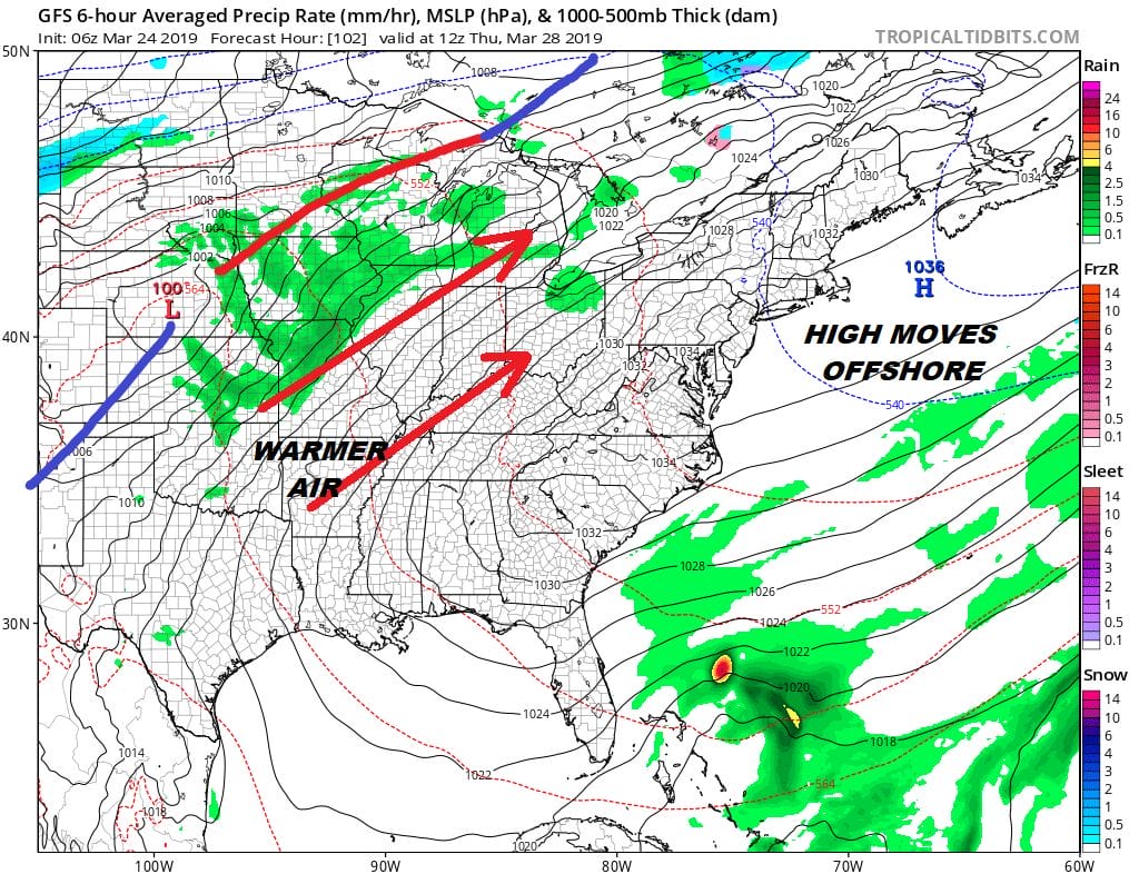
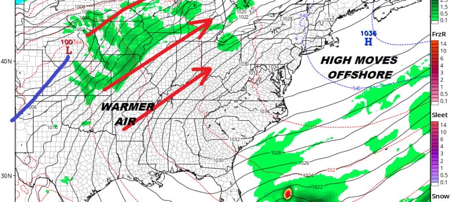
Starting Thursday with the high moving offshore we should start to warm things up a bit but it does get a bit tricky depending on the position of the high offshore. Wind direction is key. South verses a southwest can impact temperatures by 10 to 15 degrees or more especially during the day. We are thinking that Thursday and Friday we will see some sunshine. Most highs Thursday will be in the 50s. Friday’s highs will reach into the 60s but look for cooler conditions along the immediate coast. No storms or cold fronts are on the horizon until the weekend.
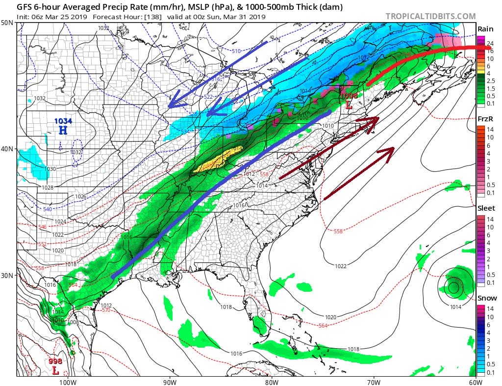
The upper high in the east means relatively warm conditions and as long as that front stays to our north it should be a decent Saturday with some sunshine and highs into the 60s. Whether the front sinks southward on Sunday or not is key to the Sunday forecast where we squeeze out one more decent day or do we see clouds showers and eventually cooler conditions prevail? Either way, March is winding down to its last few days. It is going out like a lamb. No major storms are on the horizon, Spring is gradually gaining some footing in the East and we are not going to see a late winter extension this year.
MANY THANKS TO TROPICAL TIDBITS FOR THE USE OF MAPS
Please note that with regards to any tropical storms or hurricanes, should a storm be threatening, please consult your local National Weather Service office or your local government officials about what action you should be taking to protect life and property.


