Chilly Thursday Up Down Pattern Continues
SHOP THE JOESTRADAMUS STORE
Chilly Thursday Up Down Pattern Continues
After a day of mainly sunny skies and temperatures that reached into the 60s we are seeing another change and another short trip down though nothing to any extreme length. Winds have turned to the north and colder air is bleeding southward. This puts us back in a cooler air mass for Thursday with temperatures close to average as most highs will be in the 40s to around 50. Thursday will see sunshine with some late day arriving clouds as a cold front approaches. The satellite loop shows clouds with that front moving through the Great Lakes and heading east with some showers.
SATELLITE LOOP

REGIONAL RADAR

Thursday night into Friday morning we could see some showers though they will be scattered in nature for the most part and they should not amount to much. Then another cool air mass arrives for later Friday when will be in the 50s. Then it is back to the 40s to near 50 over the weekend. Both weekend days look dry.
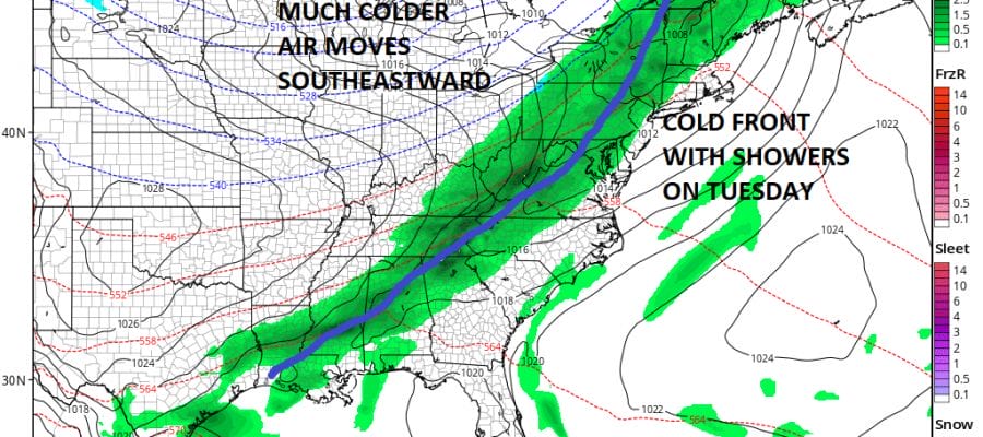
GFS WEATHER MODEL TUESDAY DECEMBER 5
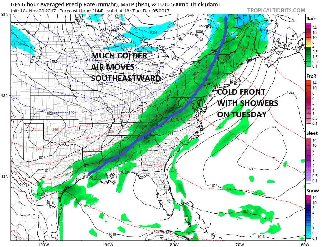
The next important cold front arrives later next Tuesday with a good chance for showers. Temperatures will warm ahead of it but behind the front much colder air will be dropping out of Canada and heading to the East Coast. Once this front passes we will look to begin what could be an extended stretch of colder than average temperatures as an early winter pattern begins to set up across North America and the Eastern US.
JOESTRADAMUS has more on this in his long range post.
 GET JOE A CIGAR IF YOU LIKE

FiOS1 News Weather Forecast For Long Island
FiOS1 News Weather Forecast For New Jersey
FiOS1 News Weather Forecast For Hudson Valley