CHILLY THURSDAY FRIDAY RAW WET SATURDAY
COASTAL LOW MOVES UP THE COAST SATURDAY
DRYING OUT SUNDAY
We are seeing clouds from two sources. Low pressure in the Gulf of Maine is producing a lot of clouds across New England with snow in Maine on the order of 4 to 8 inches. To the west and north we are seeing instability clouds moving southward. We should see the clouds clear out this evening and skies should be mostly clear. Temperatures overnight will drop down in the 30s everywhere with inland areas falling below freezing.
EASTERN SATELLITE

Radars nearby are inactive for the most part. We are seeing some showers in Southeastern New England while snow is continuing in Eastern Maine and that snow is tapering off as the low in the Gulf of Maine moves to the east.
REGIONAL RADAR

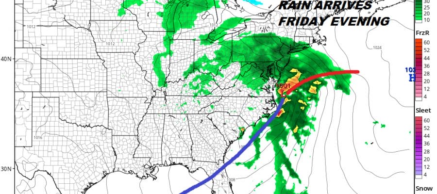
Thursday will be a sunny chilly day with just a few passing clouds and highs just into the 50s with areas inland north and west of the coast not getting out of the 40s. Friday starts with sunshine but low pressure from the Gulf States will spread clouds our way and they will be increasing. Rain is likely to arrive Friday evening between 7 & 11pm. The weather system is moving faster and that means the sooner it gets in the sooner it gets out.
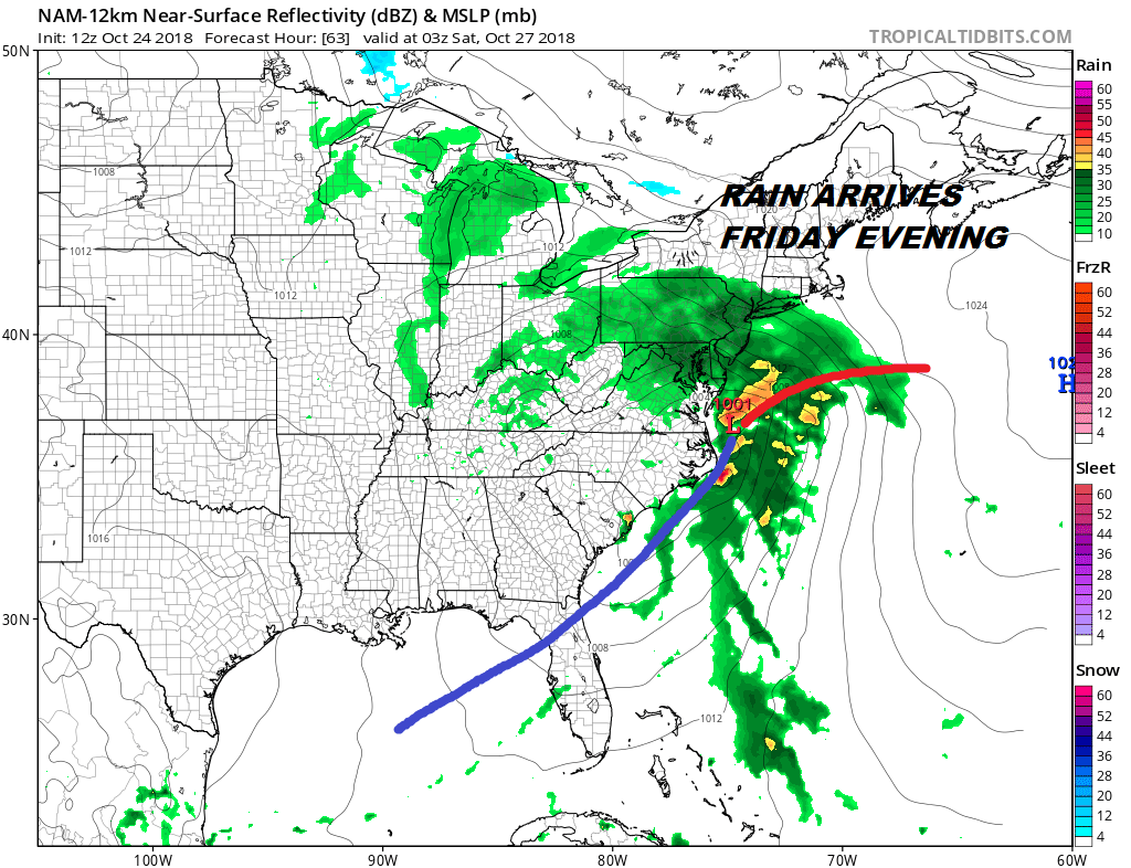
Saturday coastal low moves northeastward up the coast with rain of 1 to 2 inches likely. Winds will reach gale force along the coast overnight into Saturday morning. With regards to coastal flooding, there will likely be one high tide cycle to worry about and that is overnight into Saturday morning. This tide will be the highest as it is closest to tonight’s full moon. Tides will be high during Saturday afternoon but they should be lower than the overnight tide. Hopefully this keeps coastal flooding to a minimum. After the low goes by to the north, winds should shift to northwest Saturday night. While the dry air push behind the low isn’t strong, we should at least be rain free on Sunday even though clouds will be a bit stubborn. Some sun might try and poke through. Temperatures Saturday will be in the 40s making for a raw day indeed. Highs Sunday should be in the 50s to near 60.
NEXT SYSTEM FOR LATER MONDAY
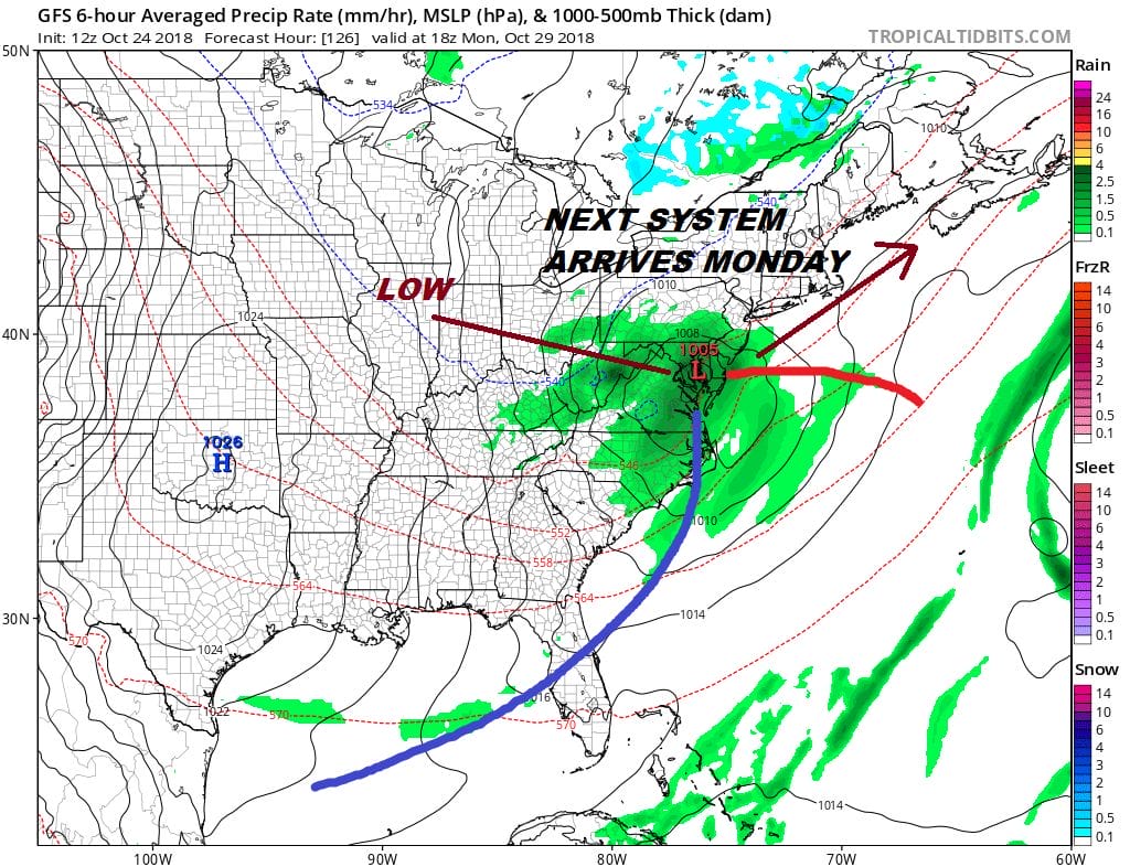
Monday brings the next upper trough and low pressure area from the Ohio Valley that heads to the Delaware coast Monday night so look for another round of rain Monday afternoon into Monday night. This could be another 1/2 to 3/4 inch rain producer before it moves out by daybreak Tuesday and weather conditions will improve after that with developing sunshine and temperatures in the 50s.
SUBSCRIBE TO PATREON FOR A WEATHER EXPERIENCE FREE OF ADS, EXCLUSIVE VIDEOS FOR MEMBERS ONLY AND MUCH MORE…STARTS AT $2 A MONTH..MESSAGE ME AT ANY TIME

MANY THANKS TO TROPICAL TIDBITS FOR THE USE OF MAPS
Please note that with regards to any tropical storms or hurricanes, should a storm be threatening, please consult your local National Weather Service office or your local government officials about what action you should be taking to protect life and property.
LATEST JOESTRADAMUS ON THE LONG RANGE


