Chilly Dry Into Monday Rain Arrives Tuesday
Chilly Dry Sunday Monday
Rain Arrives Tuesday
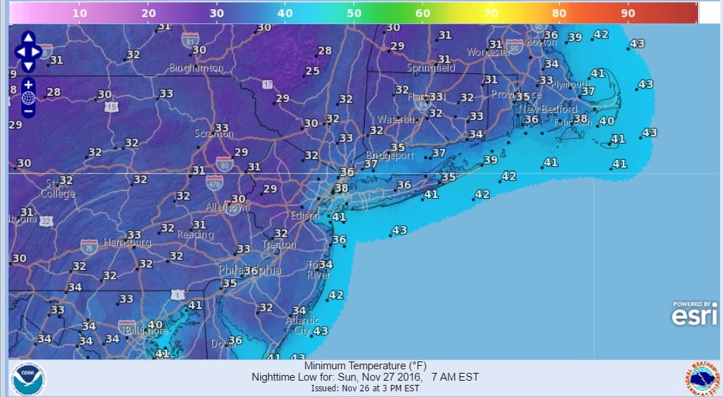
Dry and chilly air continues to move into the northeast and we have a cold night ahead away from urban and coastal areas as skies partially clear and temperatures fall into the 20s to near 30 inland and low to mid 30s in warmer urban areas and along the coast.
Sunday and Monday will be dry. We will see plenty of sunshine on Sunday and Monday we will have sunshine giving way to afternoon arriving high clouds. Highs both days will be in the upper 40s and lower 50s. The. satellite loop shows low pressure developing off the New England coast tonight but all the precipitation is well out to sea and over Maine


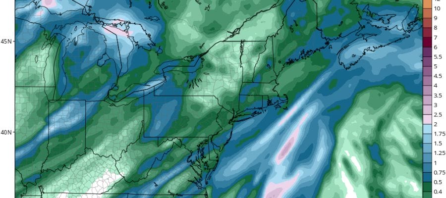
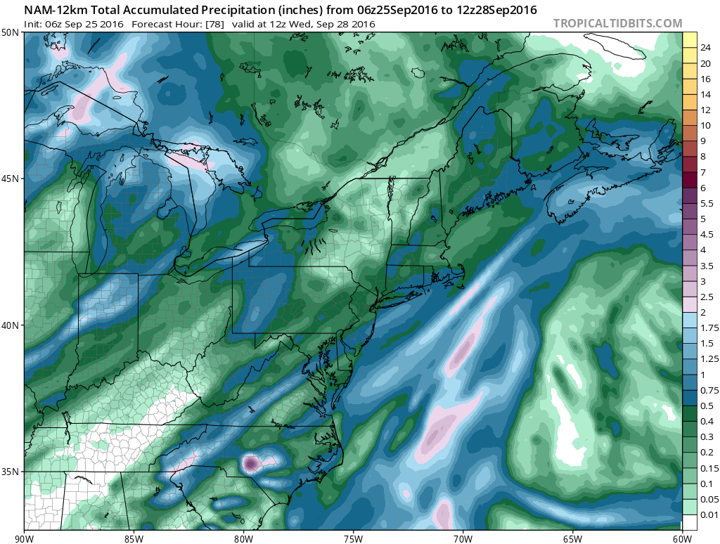
Tuesday we see the arrival of rain as several waves of low pressure move northeast. The first moves over the Great Lakes and pushes a front closer to the coast with some rain. The second on Wednesday edges the front even closer with another shot of rain while the third on Thursday moves northeast and intensifies bringing with it even more rain. This marks the first time in awhile where we may have measurable rainfall on three successive days. The late afternoon NAM model run produces a half inch to just over an inch of rain from the first shot on Tuesday into Tuesday night.
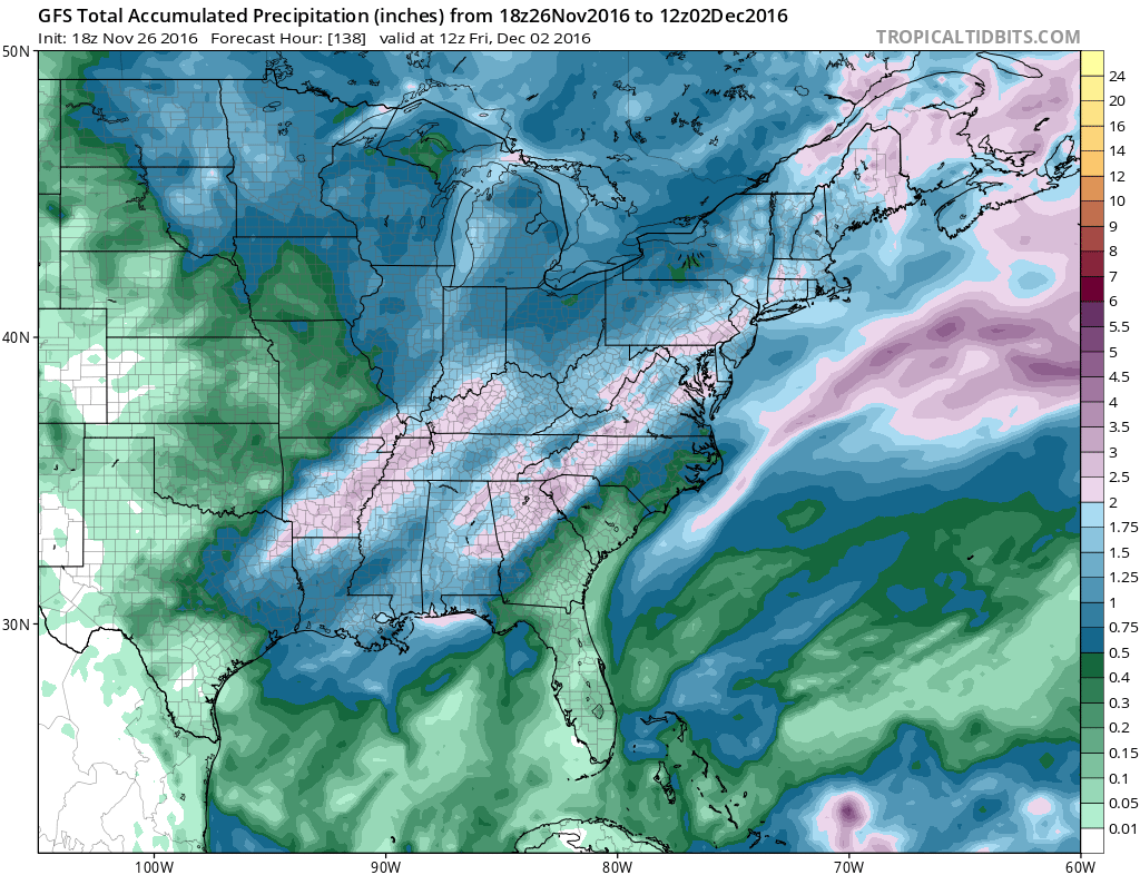
The latest GFS mid cycle run is pretty much in line with its prior runs showing 2 to 3 inches of total rainfall over the 3 day period. Fingers crossed.
SNOW REMOVAL COMPANIES FOR YOUR WINTER NEEDS
LONG ISLAND ROCKLAND COUNTY Connecticut

![]()

FiOS1 News Weather Forecast For Long Island
FiOS1 News Weather Forecast For New Jersey
FiOS1 News Weather Forecast For Hudson Valley
NATIONAL WEATHER SERVICE SNOW FORECASTS
LATEST JOESTRADAMUS ON THE LONG RANGE
Weather App

Don’t be without Meteorologist Joe Cioffi’s weather app. It is really a meteorologist app because you get my forecasts and my analysis and not some automated computer generated forecast based on the GFS model. This is why your app forecast changes every 6 hours. It is model driven with no human input at all. It gives you an icon, a temperature and no insight whatsoever.
It is a complete weather app to suit your forecast needs. All the weather information you need is right on your phone. Android or I-phone, use it to keep track of all the latest weather information and forecasts. This weather app is also free of advertising so you don’t have to worry about security issues with your device. An accurate forecast and no worries that your device is being compromised.
Use it in conjunction with my website and my facebook and twitter and you have complete weather coverage of all the latest weather and the long range outlook. The website has been redone and upgraded. Its easy to use and everything is archived so you can see how well Joe does or doesn’t do when it comes to forecasts and outlooks.
Just click on the google play button or the apple store button on the sidebar for my app which is on My Weather Concierge. Download the app for free. Subscribe to my forecasts on an ad free environment for just 99 cents a month.
Get my forecasts in the palm of your hand for less than the cost of a cup of Joe!


