Chance Showers Thunderstorms Into Thursday Dry Nice Into Sunday
After two fantastic days of sunshine we are seeing warmer and more humid air arriving today. Clouds are part of the process as are some passing showers which are around on the radars this morning. We also can see some breaks in the cloud cover to the southwest so once the warm front is through we should see skies go partly sunny later this morning into this afternoon. This will set off some daytime heating with highs reaching into the 80s in many locations (except the immediate coast).
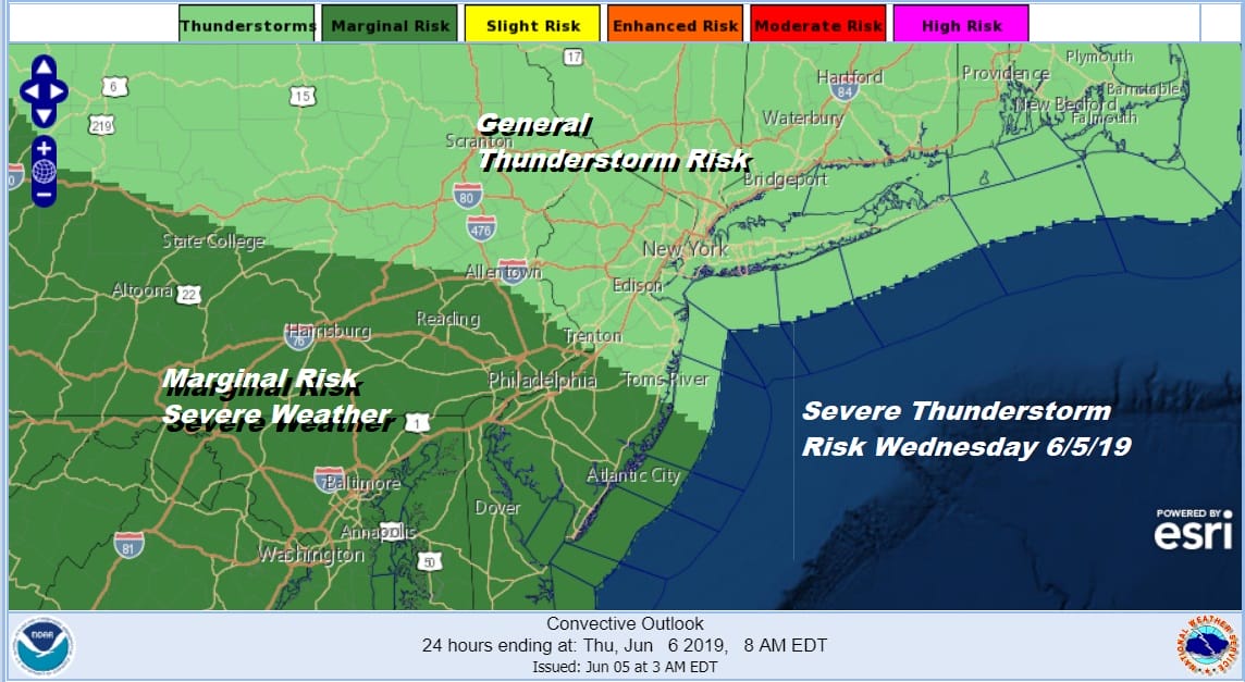
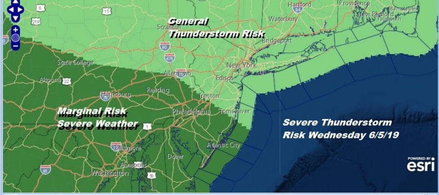
The Storm Prediction Center has scaled back the risk of severe weather but they did push the marginal risk area into New Jersey south of Route 195 and in Pennsylvania south of Route 78. I think we will see these thunderstorms be more along the lines of heavy rain producers rather than producing strong winds and hail though there will certainly be some stronger cells in the mix.
SATELLITE

REGIONAL RADAR

This morning the warm front is lying east west across Northern Pennsylvania to Southern New England as you see the band of mostly light showers moving from west to east. Local radars show that the vast majority of the area is not seeing much of anything this morning regarding showers. Look for them to become more numerous late this afternoon into tonight.
LOCAL RADAR NEW YORK CITY

LOCAL RADAR PHILADELPHIA


Tonight we will see some showers and thunderstorms in clusters with some locally heavy rain. The cold front will be slowly moving through late tonight and Thursday. Temperatures overnight will hold in the 60s. Thursday look for partly sunny skies with highs into the 80s. There is the chance for perhaps one more shower or thunderstorm later in the day. Then we watch dry air building south from Canada to take us into Friday and the weekend.

Yesterday we discussed the possibility of having dry and basically nice weather through the weekend and into Monday before low pressure in the south begins to lift to the northeast and bringing rain up the coast. We still think we are okay through Sunday as high pressure to the north will help to suppress moisture from Southern Virginia southward. Eventually that moisture has to move northward so the question is whether the upper ridge from the Middle Atlantic states to the Great Lakes holds longer or does it break down faster.
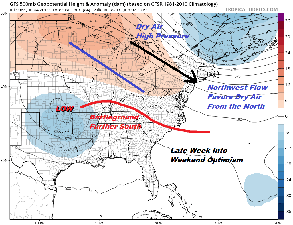
The upper high/ridge will certainly be able to protect the Northern Middle Atlantic to Southern New England into Sunday but models are breaking everything down a bit faster. This would bring some clouds coming up from the south later in the day on Sunday but no rain until Monday. The southern system will be pivoting northeast and northward as a strong trough swings east into the Great Lakes.
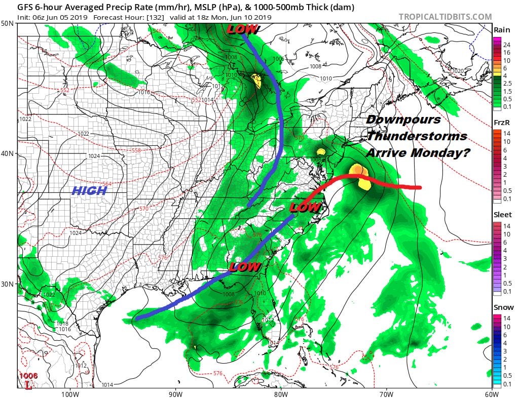
The bottom line is that Friday, Saturday, and possibly Sunday we will be okay with sunshine much of the time. Highs will likely be in the mid 70s along the coast and lower 80s inland. The high to the north keeps things from getting hot. We will see seasonal temperatures through the weekend. Rain should hold off until Monday. This next system could take a day or so to play through so we likely will have downpours and thunderstorms Monday night into at least part of Tuesday of next week before weather conditions genuinely improve.
MANY THANKS TO TROPICAL TIDBITS FOR THE USE OF MAPS
Please note that with regards to any tropical storms or hurricanes, should a storm be threatening, please consult your local National Weather Service office or your local government officials about what action you should be taking to protect life and property.


