Chance For Showers Thunderstorms Today More Rain On The Way
Changes are underway in the weather pattern across the US which opens the door for some rain chances. Ahead of a cold front today we are going to see warmer temperatures and probably some sunshine at least for awhile before we see the approaching front set off some showers and storms late this afternoon and into this evening. High temperatures will reach into the 80s though temperatures will be lower along south and east facing shorelines.
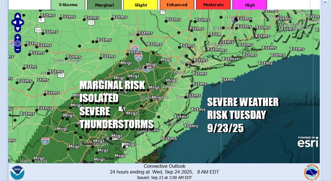
The Storm Prediction Center is indicating general thunderstorms and an area of severe weather risk covering much of Eastern Pennsylvania, Western New Jersey, southward into Maryland, Delaware, and Virginia. If any severe storms do develop they should be isolated in nature. At least with rising humidity today there is the risk for some locally heavy downpours and that at least will help to ease slightly the dry conditions.
SATELLITE WITH LIGHTNING STRIKES
WEATHER RADAR
Overnight showers and storms will weaken but Wednesday we will see clouds around and the risk for some showers. The old cold front becomes the new warm front to the south and we will see it start to move northward again bringing some rain Wednesday night as it goes. by Temperatures Wednesday will be in the 70s with an ocean wind.
Low pressure is forming in the Central Plains and this has a larger area of rain and thunderstorms. This low will track across the Ohio Valley and head to Lake Erie Thursday. The warm front will be in upstate New York and the cold front will approach during Thursday. Ahead of it look for warm and humid conditions with highs mostly in the 70s. This will result in showers and thunderstorms developing Thursday afternoon and evening.
Once again this opens the door for severe weather risk and the Storm Prediction Center is already indicating a marginal risk for isolated severe thunderstorms across the Northeast and Middle Atlantic states. Once the front passes we should see improving weather conditions Friday and a good weekend overall. Rainfall amounts over the next 3 days could total 1.5 to 2 inches or so with some locally higher amounts possible. Over the weekend we will be watching the area off the Southeast US coast where pressures will be below normal. There is the possibility of low pressure developing and this time of year we have to consider the possibility of tropical cyclone development. We will be monitoring this closely over the next several days.
BE SURE TO DOWNLOAD THE FREE METEOROLOGIST JOE CIOFFI WEATHER APP &
ANGRY BEN’S FREE WEATHER APP “THE ANGRY WEATHERMAN!
MANY THANKS TO TROPICAL TIDBITS FOR THE USE OF MAPS
Please note that with regards to any severe weather, tropical storms, or hurricanes, should a storm be threatening, please consult your local National Weather Service office or your local government officials about what action you should be taking to protect life and property.