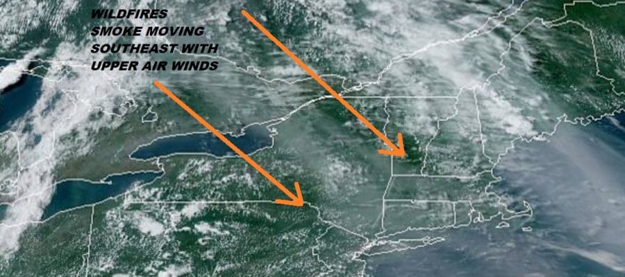
Canada Wild Fires Tropical System Severe Weather Risk
It was another day of very warm and humid conditions as the next cold front is getting ready to move across the area Thursday night with some showers and thunderstorms ahead of it. Meanwhile during today you may have noticed a smokey haze in the sky that was masking some of the sunshine . Wild fires across Ontario and Saskatchewan in Canada have been going on for quite some time (several weeks or more) and the upper air winds are bringing some of that smoke southeastward creating a hazy film in the sky that is easily visible as it cuts down the sunlight.
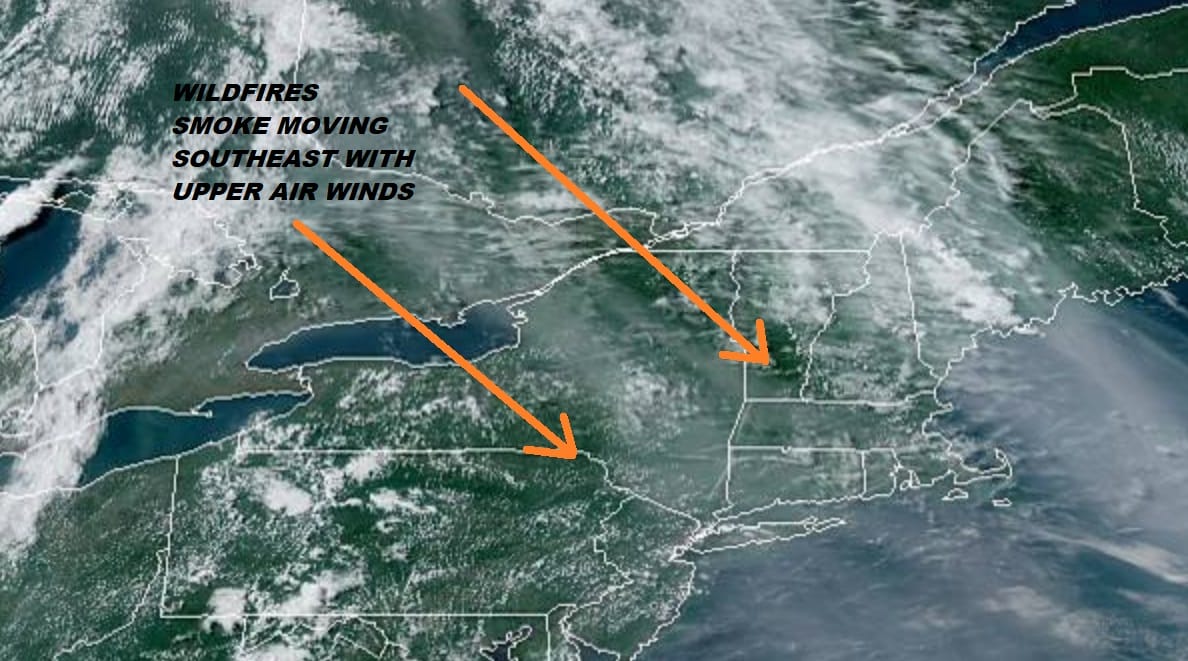
Those upper air winds are about to shift to the southwest and the next cold front brings with it some showers and thunderstorms here later Thursday and Thursday night. There are no issues tonight as we see nothing much happening on our visible satellite picture this evening with nothing more than some patchy clouds. The regional radar is free and clear of showers and thunderstorms with only a few scattered around in the Central Appalachians.
SATELLITE

REGIONAL RADAR

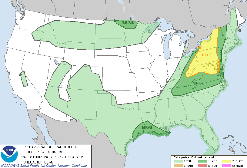
Overnight lows will be in the upper 60s and lower 70s with ever increasing humidity. Thursday brings a cold front and that chance for showers and thunderstorms. I believe that there is the risk for severe weather Thursday as this front passes. The Storm Prediction Center has most of the risk west of New Jersey through Pennsylvania south into the interior Mid Atlantic States. They have expanded the area of slight risk to cover much of the areas inland. I think we could see the marginal risk pushed further east on Thursday. Either way some thunderstorms seem likely as the front nears late in the day into Thursday evening. Highs Thursday will be in the 80s to near 90.
We should see improvement Friday with clouds and sun and perhaps a passing shower or isolated thunderstorm with highs in the 80s. As far as the weekend is concerned we will see some sunshine Saturday with perhaps a shower or thunderstorm at night with highs in the 80s. Sunday looks nice with slightly lower humidity and some sunshine with highs in the 80s. Next week will be hot and humid for at least a few days with the Bermuda high pumping away to the southeast. That means sunshine with the chance for an afternoon scattered thunderstorm mostly inland, and highs each day reaching the upper 80s to at least the lower 90s.
Potential Tropical Cyclone In Gulf of Mexico, Hurricane Watch for Southern Louisiana
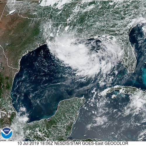
Satellite images this afternoon indicate that the low in the Northeast Gulf of Mexico is slowly organizing. This system has yet to develop a well defined circulation but it is on its way to doing so and should become a tropical storm in the next 24 hours or so. Conditions are favorable for strengthening and this low is far enough offshore that it could quickly become a hurricane so hurricane watches have been posted for the coast of Southern Louisiana. Right now the low center is moving west southwestward deeper into the Gulf of Mexico. There is model uncertainty with the future track as it will depend on the strength of the high to the north. A stronger high could force this system further west over time giving it more opportunity to strengthen and a bigger threat to the Texas Coast rather than Louisiana. We will cover this separately in a video and post later this evening.
MANY THANKS TO TROPICAL TIDBITS FOR THE USE OF MAPS
Please note that with regards to any tropical storms or hurricanes, should a storm be threatening, please consult your local National Weather Service office or your local government officials about what action you should be taking to protect life and property.


