
Brutally Hot Humid 95-100 Highs Being Reached
Brutally Hot Humid 95-100 Highs Being Reached
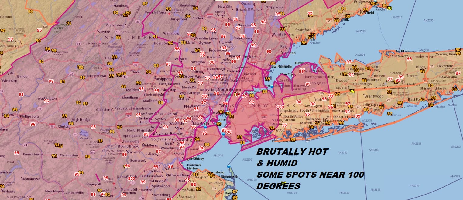
We are at the 4 o’clock hour and the highs of the day are being hit with many areas betwenn 95 & 100. This is happening even though we saw some clouds develop over New England this morning and created mostly cloudy conditions at times. Those close may have impacted the highs by a degree or two. Still this was a brutally hot humid day and there was hardly any relief to be found anywhere except maybe right on the beaches themselves.
EASTERN SATELLITE

REGIONAL RADAR

No pop up thunderstorms are anywhere close by and the won’t be an issue at least through Tuesday afternoon. Winds are going to turn a bit more southerly this week beginning Monday and this will probably ease temperatures back by 5 degrees or so inland and 5 to as much as 10 degrees for coastal areas. This will mean highs in the low to mid 90s inland and 80s to near 90 close to the coast. There are no changes in the weather outlook for the week ahead. Hot through Friday with the next cold front due late Friday with widespread thunderstorms. This will end the heatwave and bring some relief this weekend. Some pop scattered thunderstorms are possible Wednesday and Thursday but nothing that creates widespread issues.
The tropics are quiet and will remains so for the next 5 days. There are no systems in the Atlantic that pose a threat of developing into a tropical depression or tropical storm. Normally this is a quiet time in the Atlantic Basin and activity normally does not pick up until late in the month. Long range shows that we will see more frequent cold fronts bringing new fresh air masses from Canada every 3 days or so. This would prevent long duration heatwaves like this one from happening again while the jet stream from Canada comes back into play.
 GET JOE A CIGAR IF YOU LIKE

LATEST JOESTRADAMUS ON THE LONG RANGE