
Blowtorch Pattern Change Coming
![]()
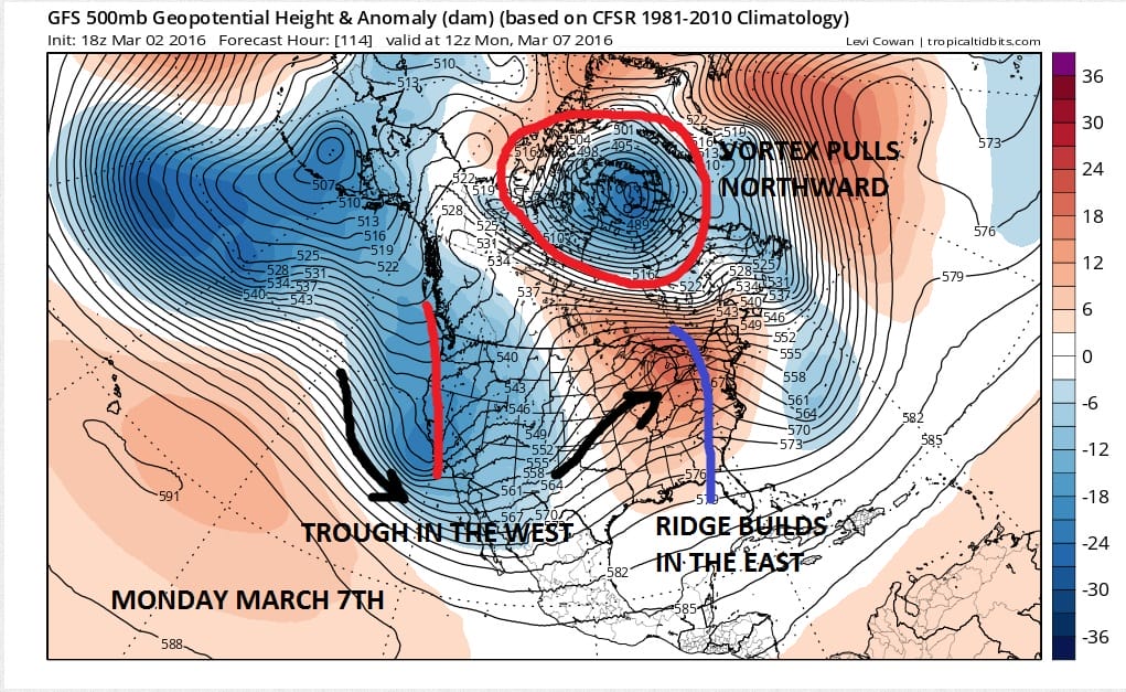
The next 4 days will probably be the last gasp of winter weather. We have another pattern change that is going to get underway once this major storm that develops off the coast heads out to the east.The polar vortex pulls up to Northern Canada. Meanwhile in the west a strong trough drops in. This forces the ridge to build in the Eastern United States. The pattern has the look of the setup we had back in December and we know how that month turned out.
Blowtorch Pattern Change Coming UPPER AIR PATTERN NEXT MONDAY
This look is only the beginning. The ridge in the east builds strongly all week long. This is going to produce a major warm up with no rain issues. We should see a few nice weather days out of all this. Other than clouds and local sea breezes, temperatures will be able to take off.
Blowtorch Pattern Change Coming UPPER AIR PATTERN NEXT THURSDAY
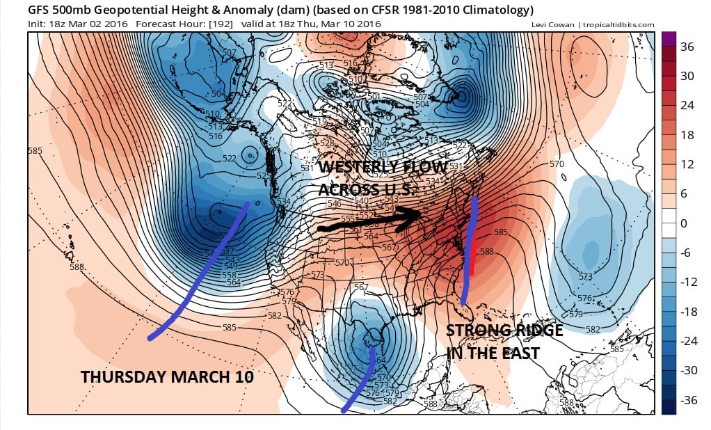
The cold air to the north is completely cut off from the United States. A westerly flow runs right across the country. One strong system drops down into South Texas and another deep trough sits along the west coast. That trough is ready to drop into the west next weekend. The bottom line is that it looks like this pattern is going to be in control until at least the third week of March.
Blowtorch Pattern Change Coming Forecast High Temperatures 3/9/2016 & 3/10/2016
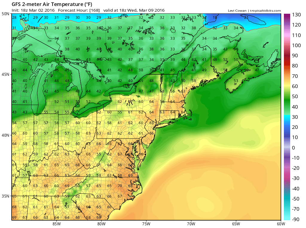

Take a look at the GFS model forecast surface temperatures for next Wednesday and Thursday. You can bet that these 2pm forecast temperatures are going to be 5 to 10 degrees too low! I think we could reach the 70s on both days. If we can get that with a fair amount of sunshine, it is going to put everyone into a real springtime mood. Beyond that we may have issues with back door cold fronts and the like. But at least through most of next week, no big storms are on the horizon. So prepare for the blowtorch!
FiOS1 News Weather Forecast For Long Island
FiOS1 News Weather Forecast For New Jersey
FiOS1 News Weather Forecast For Hudson Valley
NATIONAL WEATHER SERVICE SNOW FORECASTS
LATEST JOESTRADAMUS ON THE LONG RANGE
Weather App

Don’t be without Meteorologist Joe Cioffi’s weather app. It is really a meteorologist app because you get my forecasts and my analysis and not some automated computer generated forecast based on the GFS model. This is why your app forecast changes every 6 hours. It is model driven with no human input at all. It gives you an icon, a temperature and no insight whatsoever.
It is a complete weather app to suit your forecast needs. All the weather information you need is right on your phone. Android or I-phone, use it to keep track of all the latest weather information and forecasts. This weather app is also free of advertising so you don’t have to worry about security issues with your device. An accurate forecast and no worries that your device is being compromised.
Use it in conjunction with my website and my facebook and twitter and you have complete weather coverage of all the latest weather and the long range outlook. The website has been redone and upgraded. Its easy to use and everything is archived so you can see how well Joe does or doesn’t do when it comes to forecasts and outlooks.
Just click on the google play button or the apple store button on the sidebar for my app which is on My Weather Concierge. Download the app for free. Subscribe to my forecasts on an ad free environment for just 99 cents a month.
Get my forecasts in the palm of your hand for less than the cost of a cup of Joe!
![]()
