
Blow Torch Conditions Continue Through Christmas
The blow torch pattern shows no signs of relenting anytime soon as the overnight GFS weather forecast model and other weather models all pretty much have the same idea. There will be a minor interruption this coming weekend where temperatures will be close to normal for 2 days followed by a resumption of the primary pattern. The huge ridge in the east will build in Bermuda high fashion during next week and it is likely to continue right into New Years and the very beginning of January. Only a radical change in the upper air pattern could prevent this beyond the day 10 range.
What is truly amazing is how far north the blow torch extends. I was really take by the fact that the model takes ridge out to 60 west only to retrograde it back to 80 west on the first opportunity. It just doesn’t want to go away. 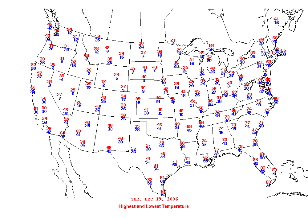
From the perspective of day to day highs and lows take a look at this map from 12/19/2006 where the pattern was similar. Thank you to David Tolleris of WxRISK for these. And below is high low map from 01/07/2007 were it pretty much shows the same thing. Even though it seems like this never happened before, in fact it has.

What has also happened is pattern flips. From mid January to mid March 2007 it produced the 3rd coldest 60 day period since 1900 for the United States. It did not however produce much snow here in this area. There are at best mixed messages longer term from a climate standpoint. Snow lovers are going to have to face the fact that they are going to require 2 pattern flips. The first of course is the flip to colder temperatures or at least cold enough when it matters. The second pattern flip is the long term dry pattern we have been in since last April. It is all fine and dandy to get the cold back however if the dry conditions persist it may be just cold and dry kiss it good bye. This makes the longer range especially challenging. It doesn’t help that rain events fall apart as they come east. Now that will change if the super strong ridge disappears.
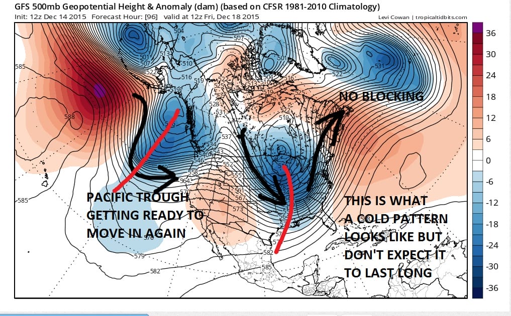
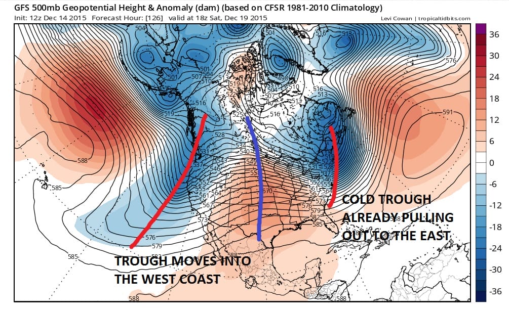
In case you were wondering what a cold pattern looks like, this is for the end of this week. You can see the jet stream is for a brief time coming out of Canada so that is where our air is coming from. The ridge is to the east for a change. However there is no block which means that system in the east pulls out and the next trough in the Pacfic dives right in. That means that the ridge in the east will fly up once again early next week and going into Christmas! Even by Saturday the process is underway with the cold trough in the east moving out.
SHORT RANGE FORECAST NEW JERSEY
SHORT RANGE FORECAST LONG ISLAND
SHORT RANGE FORECAST NEW YORK CITY
DOWNLOAD MY WEATHER..UPGRADE COMING SOON