Blocking Pattern Develops Thanksgiving Week
Blocking Pattern Develops Thanksgiving Week
Ever since the major storm of October 29th, the upper air pattern has been in an a massive upheaval. The first big change comes later tonight and into the weekend as we see a very cold Canadian air mass plunging into the East with widespread freezes and record lows. This air mass will be pulling out on Sunday which is no surprise. However in another week or so we may be seeing the strongest blocking signature in the upper air that we have seen in quite some time. The North Atlantic Oscillation has been somewhat absent for the last several years with only brief appearances. Now we may be seeing a blocking pattern that sets up and plans a lengthy stay.
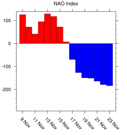
North Atlantic Oscillation Forecast
When the North Atlantic oscillation is negative as it is forecast to be beginning November 17th it means that pressures across the polar regions are higher than normal. This displaces the jet stream well to the south and creates conditions which favor colder average temperatures in the Eastern US. It also could influence the storm track so that any storm system tracks further south which opens the possibility for some early snows for some areas. The confidence level on this happening is rather high since all of the models are going in this direction though of course each one has some variation in how strong the blocking will be.
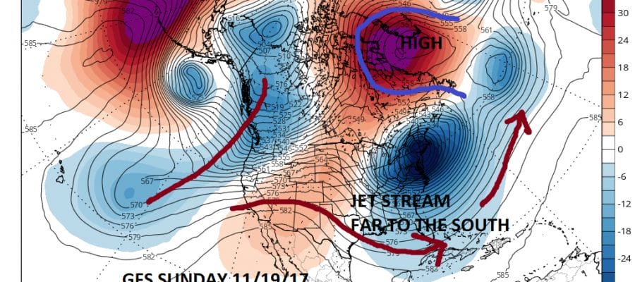
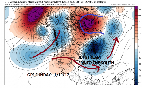
GFS UPPER AIR JET STREAM FORECAST SUNDAY 11/19/2017
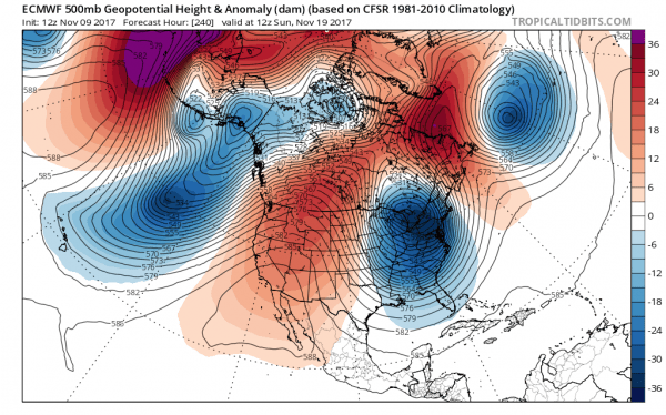
The blocking signature on the GFS model is EXTREMELY aggressive with a big upper high near Greenland & a strong upper vortex which develops over New England. You can see how the jet stream is forced well south of its normal position due to the blocking high. The European model is a bit less aggressive but does show a strong blocking signature developing as well.
EUROPEAN MODEL JET STREAM SUNDAY NOVEMBER 19TH
The longer range GFS holds the block strongly right through Thanksgiving week which gives us confidence that this pattern has some staying power. Whether any storm systems are going to be impacting us in the long range is a big question. There have been model signals for next weekend and again perhaps around Thanksgiving day but the storm question is always fraught with huge uncertainty this far out and it seems pointless to speculate on that angle at this point. However I will say that if something does come into the picture, this is the pattern winter level loves and snow lovers want to see.
MANY THANKS TO TROPICAL TIDBITS FOR THE WONDERFUL USE OF THE MAPS
GET JOE A CIGAR IF YOU LIKE!
FiOS1 News Weather Forecast For Long Island
FiOS1 News Weather Forecast For New Jersey
FiOS1 News Weather Forecast For Hudson Valley
NATIONAL WEATHER SERVICE SNOW FORECASTS
LATEST JOESTRADAMUS ON THE LONG RANGE
CHRISTMAS & HOLIDAY SHOPPING COUPONS

