
Better Sunday Rain Monday
Better Sunday Rain Monday
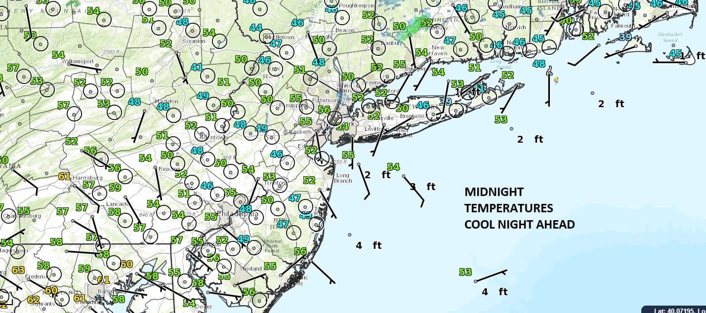
After a cool Saturday fighting clouds and even some light rain that popped up in a few spots, Sunday looks to be a bit better from the standpoint of cloud cover. There will be some clouds around but some sunshine as well. We are cooling off nicely overnight and highs Sunday in most places won’t be much out of the 60s and near the coast probably only in the low 60s thanks to an onshore wind. The next cold front stands obvious on the satellite loop tonight with some severe weather in the Southeast and Gulf States. Clouds will increase Sunday night with some rain Monday and a possible thunderstorm. However radars should remain peaceful on Sunday.
SATELLITE LOOP

REGIONAL RADAR

Once the cold front passes Monday the block will force the front to stall out to our south an a couple of low pressure systems will be in play Tuesday and Wednesday with the chance for some rain later Tuesday and again on Wednesday. Temperatures for much of the first part of the week are going to struggle with an onshore flow. Temperatures probably in the 60s at best and coastal areas likely to be in the 50s to near 60 much of the time. Rainfall amounts are a tough call since the lows are not that strong so track will determine whether we wind up with perhaps an inch or so of rain totals for the 3 day stretch or if it winds up being more than that. An early look at the Memorial Day weekend looks ok to start but there could be a weather system or two in play. More on this Sunday as we delve into the long range.
 GET JOE A CIGAR IF YOU LIKE

LANDSCAPE COMPANIES FOR YOUR NEEDS
LONG ISLAND ROCKLAND COUNTY Connecticut

![]()

ROCKLAND COUNTY TRI STATE SNOW REMOVAL JOHNSTOWN PA


FiOS1 News Weather Forecast For Long Island
FiOS1 News Weather Forecast For New Jersey
FiOS1 News Weather Forecast For Hudson Valley
NATIONAL WEATHER SERVICE SNOW FORECASTS
LATEST JOESTRADAMUS ON THE LONG RANGE
Weather App

Don’t be without Meteorologist Joe Cioffi’s weather app. It is really a meteorologist app because you get my forecasts and my analysis and not some automated computer generated forecast based on the GFS model. This is why your app forecast changes every 6 hours. It is model driven with no human input at all. It gives you an icon, a temperature and no insight whatsoever.
It is a complete weather app to suit your forecast needs. All the weather information you need is right on your phone. Android or I-phone, use it to keep track of all the latest weather information and forecasts. This weather app is also free of advertising so you don’t have to worry about security issues with your device. An accurate forecast and no worries that your device is being compromised.
Use it in conjunction with my website and my facebook and twitter and you have complete weather coverage of all the latest weather and the long range outlook. The website has been redone and upgraded. Its easy to use and everything is archived so you can see how well Joe does or doesn’t do when it comes to forecasts and outlooks.
Just click on the google play button or the apple store button on the sidebar for my app which is on My Weather Concierge. Download the app for free. Subscribe to my forecasts on an ad free environment for just 99 cents a month.
Get my forecasts in the palm of your hand for less than the cost of a cup of Joe!


