Beautiful Today Thursday Friday Questions
Humidity Returns Weekend Into Next Week

Weather in 5/Joe & Joe Weather Show Latest Podcast
Beautiful Today Thursday Friday Questions Humidity Returns Weekend Into Next Week
There was no need for air conditioning last night as temperatures this morning bottomed in the 50s even in the normally warmer urban settings. Cool spots north and west of the coast bottomed out in the 40s! Yesterday’s cold front is offshore and stalling out again but it is far enough east to allow this cool dry air mass to wedge into the Eastern US today. Dry air extends as far south as Georgia. We will see lots of sunshine all day long. Temperatures today will be cool as highs will be mostly in the low to mid 70s.
SATELLITE

Radars are on hiatus for awhile and we have a clear night ahead of us. Morning lows will be in the 50s to around 60s with a few 40s in cool spots. Thursday the dry air holds on with lots of sunshine. Highs will be in the upper 70s to around or just over 80 degrees with very low humidity.
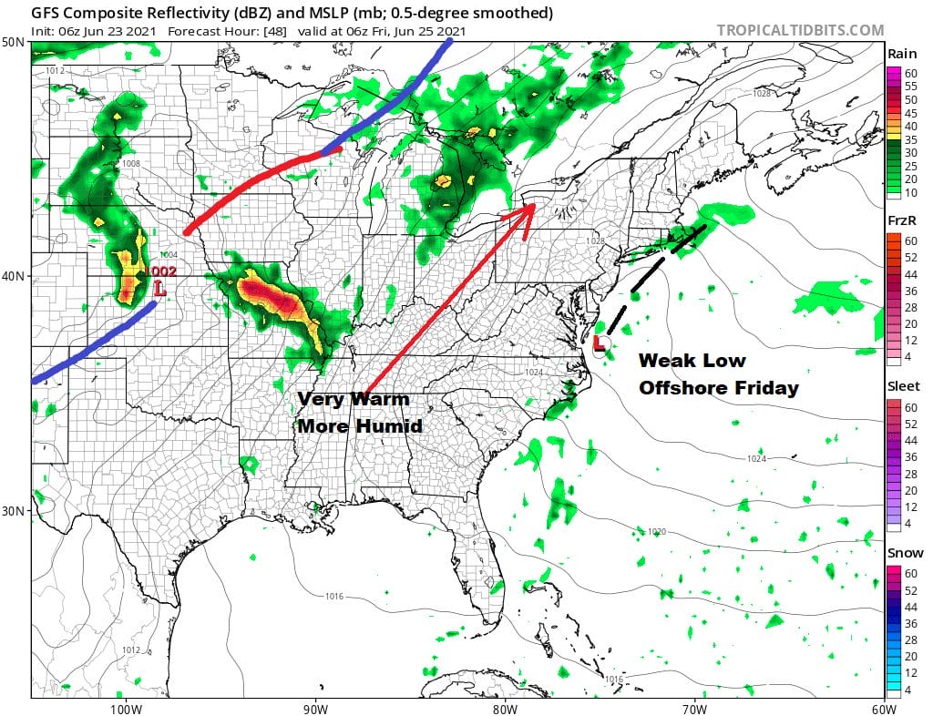
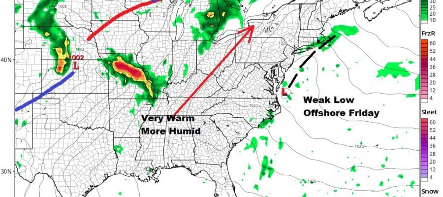
I’m going to be optimistic for Friday. A weak low off the Virginia coast forms underneath a strong high to the northeast. This will create what we call an inverted trough extending from the low to about Cape Cod. This will throw some clouds in the mix on Friday but I think we will see some sunshine. The onshore flow will likely keep temperatures in the 70s along the immediate coast but inland highs will reach the lower 80s.
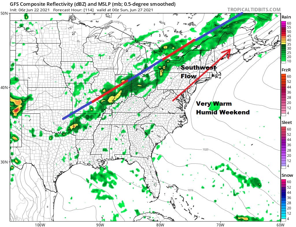
The weak low dissipates Friday night as high pressure to the northeast builds back westward. This will bring very warm and humid conditions for the weekend. Both Saturday and Sunday will feature sunshine. Highs will be in the mid to upper 80s both days. Temperatures will be cooler at the shore. We will throw in the chance of a shower or a thunderstorm in one or two spots mostly inland and they should be isolated in nature. Most of you won’t see a thing. The upper and surface high won’t be moving much which means the next cold front may not arrive until late next week. Very warm and humid conditions will continue for much of next week. Look for highs of 85 to near 90 by day and lows in the mid 60s to low 70s by night. Not much rain is forecast until the front to the west is allowed to move east.
BE SURE TO DOWNLOAD THE FREE METEOROLOGIST JOE CIOFFI WEATHER APP &
ANGRY BEN’S FREE WEATHER APP “THE ANGRY WEATHERMAN!

MANY THANKS TO TROPICAL TIDBITS & F5 WEATHER FOR THE USE OF MAPS
Please note that with regards to any severe weather, tropical storms, or hurricanes, should a storm be threatening, please consult your local National Weather Service office or your local government officials about what action you should be taking to protect life and property.


