DOWNLOAD MY NEW FREE JOESTRADAMUS WEATHER APP FOR ALL DEVICES
THE APP IS ABSOLUTELY FREE TO ALL BUT CONSIDERING SUBSCRIBING TO PATREON FOR A WEATHER EXPERIENCE FREE OF ADS, EXCLUSIVE VIDEOS FOR MEMBERS ONLY AND MUCH MORE…STARTS AT $2 A MONTH..MESSAGE ME AT ANY TIME
Backdoor Fronts, Front Door Fronts Onshore Flow April Chaos
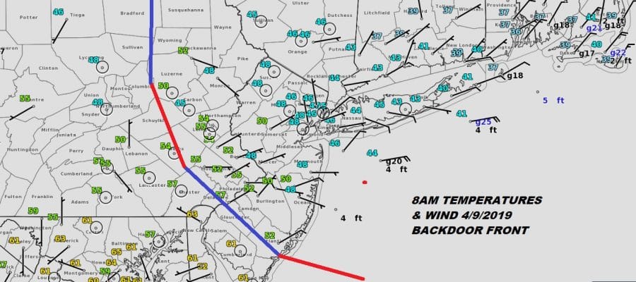
It is a rather gloomy morning with low clouds, northeast winds, patchy fog and even some drizzle. Yesterday’s warm front came back southwestward last evening and places that saw their temperatures literally soar in the afternoon the the 80 degree mark got sent right back down into the 40s and 50s overnight as winds went from northeast to west and then back to northeast. This morning we are sitting with the weak frontal boundary that has pushed back southwestward into Southern New Jersey and Southeastern Pennsylvania as of 8am.

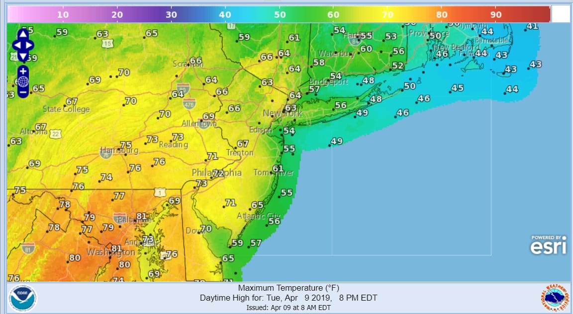
We will see this front push northeastward later today as a cold front swings in from the north. My thinking is that the front struggles to perhaps NYC and then come to a grinding halt. This means north and east of that boundary temperatures won’t get out of the 40s and 50s while to the southwest of the frontal boundary we should see 60s and 70s.
Now comes the question of whether we will see some showers and thunderstorms late this afternoon into this evening. We suspect that any thunderstorms will be restricted to areas west of the frontal boundary wherever that happens to be later today. i would just draw a straight line from the Hudson River south through NYC and down the New Jersey coast. From there west there is the risk for thunderstorms later today and some isolated cells could grow rather strong.
SATELLITE

REGIONAL RADAR

At the moment at least as of 8:45am the radars aren’t showing very much at all on land and all the showers and thunderstorms are out to the east. Look for some showers and thunderstorms to form this afternoon as the cold front swings southeastward from upstate NY and sweeps through this evening.
LOCAL RADAR NEW YORK CITY

LOCAL RADAR PHILADELPHIA


Once the front goes offshore skies will clear out tonight with lows by morning in the upper 30s to mid 40s. Wednesday looks nice with some sunshine but it will be chilly with highs just in the 50s in most areas. Thursday should also be an okay day with some sunshine and highs in the 50s to near 60. This brings us to Friday.
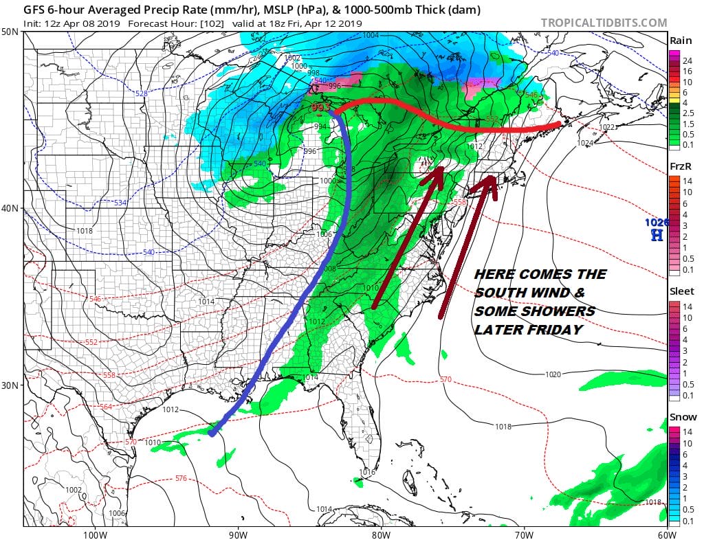
South winds will be picking up Friday as a storm heads to the Great Lakes. Look for arriving clouds Friday with highs in the 50s to lower 60s thanks to the south wind. Showers are likely Friday night but they should be gone by Saturday morning. Weather conditions will improve after that with some sunshine Saturday with highs in the 50s. Low pressure follows Sunday coming up from the south with a high to the north and a raw northeast wind developing. Look for clouds and maybe some rain late in the day on Sunday with highs just in the 50s.
MANY THANKS TO TROPICAL TIDBITS FOR THE USE OF MAPS
Please note that with regards to any tropical storms or hurricanes, should a storm be threatening, please consult your local National Weather Service office or your local government officials about what action you should be taking to protect life and property.


