
Models this afternoon are growing increasingly bullish over the idea that we could have 2 rain events and both could be soaking rains lasting 18 to 24 hours (with a little luck). The first will come Wednesday night with a cold front producing showers and thunderstorms with a stalling front. Then a short break before rain from a wave on that front moves over us Thursday and Thursday night, gone by Friday morning. The second and perhaps stronger system will swing out of the midwest and produce another front with another wave late Saturday into Sunday. 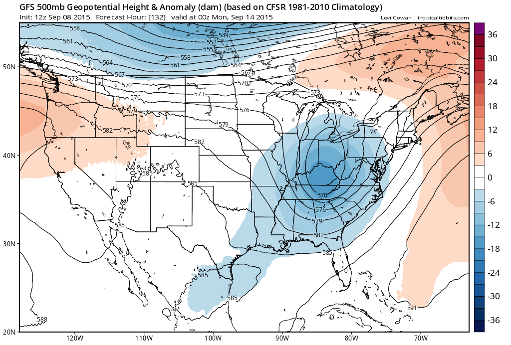
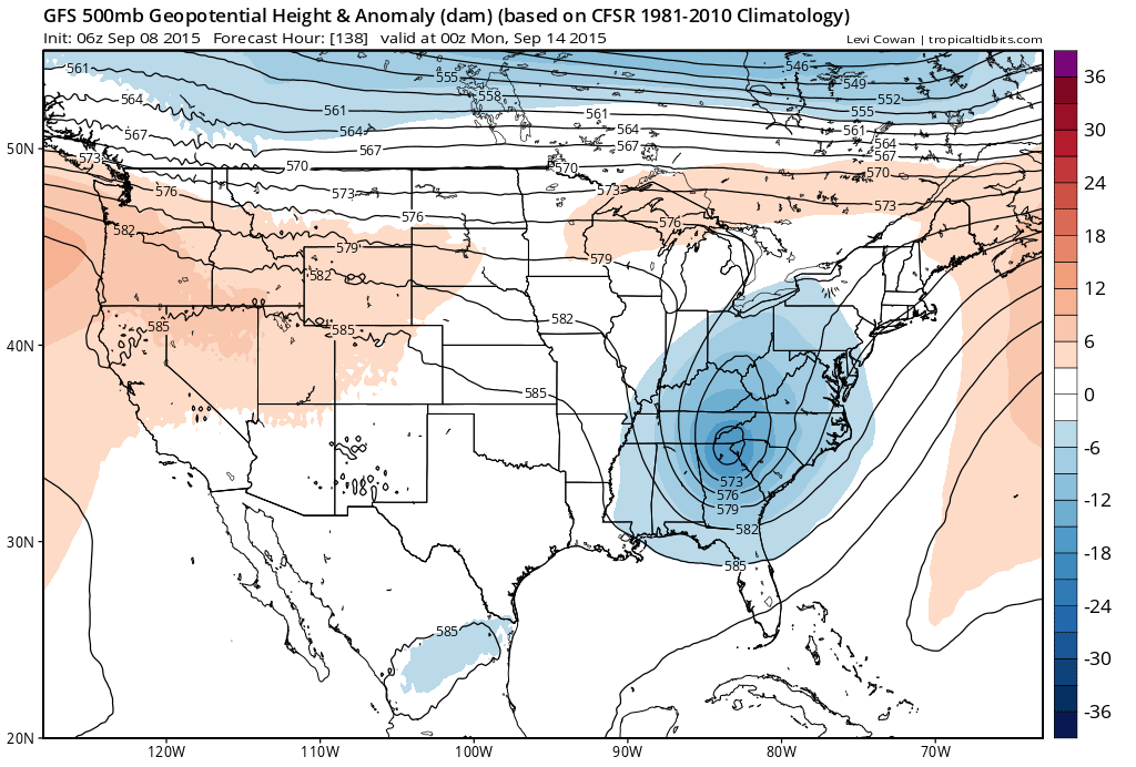 Above are the GFS from the last 2 runs for the same time. The top map is the most recent. This model has been the least bullish with regards to this trough coming out of the midwest. Each run has been deeper and further north with this feature and this is important because the southern track would weaken overtime and not produce very much. The more northern look of today’s run is in line with last night’s other models which were much deeper and more vigorous with this trough. Now let’s look at the Canadian run.

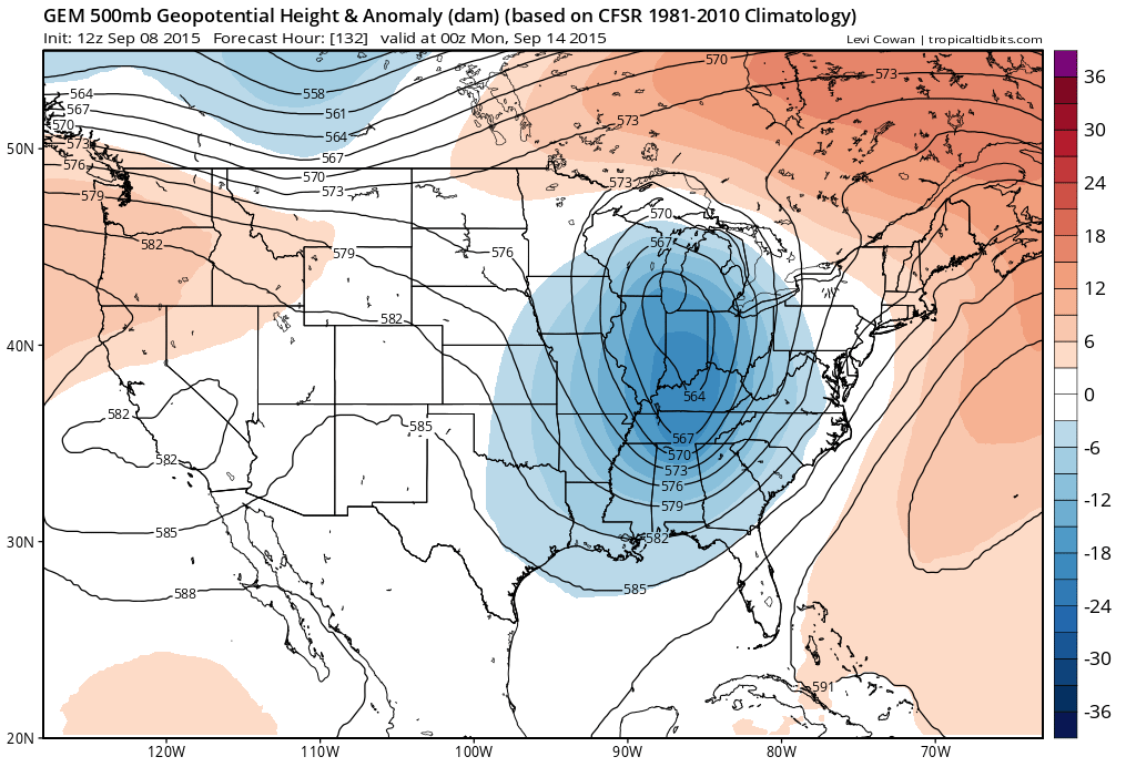
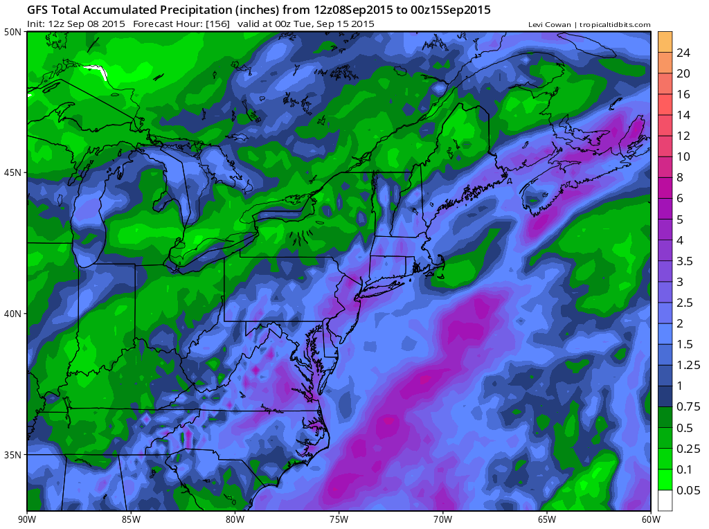
The Canadian today is slower and even a little deeper than the already deep overnight run. The models both produce ample rain fall of 3 to 6 inches between the 2 events. However I would caution here that it has been prudent to take model output of rainfall and cut it in half which says 2 to 3 inches. The reason I say this is that we are in a drought and models have consistently underperformed. Still even 1/2 of forecast is something substantial to cut the rainfall deficits that in some places are running 60 percent below normal for the last several months.
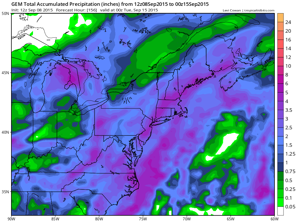
 One issue that could reduce rainfall would be an even deeper and even further left track of the upper system which would shift the axis of heavy rain westward and that needs to be considered. The European was left but trending a little east overnight. I will post an analysis of that model later today. Again this is about the second system here. I will also deal with the first with a separate post.


