
August Dog Days Sun Clouds Pop Up Downpours
Think back to yesterday and you can expect a repeat performance for today, Friday, and Saturday. We have a stalled frontal boundary just offshore. We have some dry air to our north that is trying to bleed southward and might make it briefly in the Hudson Valley to Connecticut and maybe for a few hours to about NYC. The atmosphere is unstable enough that we could see a few pop up scattered shower or thunderstorms like we saw yesterday. Who gets them and who doesn’t is just a matter of luck. Temperatures today will top out in the upper 70s to lower 80s thanks to a northeast wind which is keeping temperatures in check.
SATELLITE

REGIONAL RADAR

This morning the regional radar isn’t showing very much nor are we seeing any pop up showers at the moment. Local radars are quiet as well. Friday will be a wash rinse repeat of today. If I had to guess, I think the best chances for any pop up showers or thunderstorms will be well inland rather than along the coast. Friday’s highs will again be in the upper 70s and lower 80s in most places.
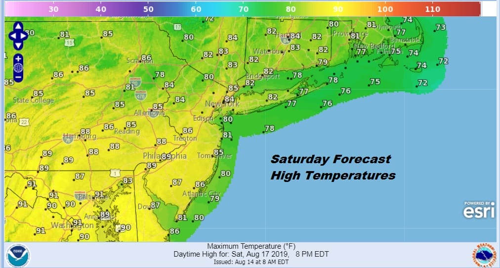
Saturday we will start to see the wind turn more southerly which will likely nudge up temperatures a bit. Look for clouds early (and some patchy fog along coastal areas) followed by some sunshine and the chance for a downpour or a thunderstorm. Highs will start pushing up into the middle to upper 80s with slightly lower temperatures along the coast.
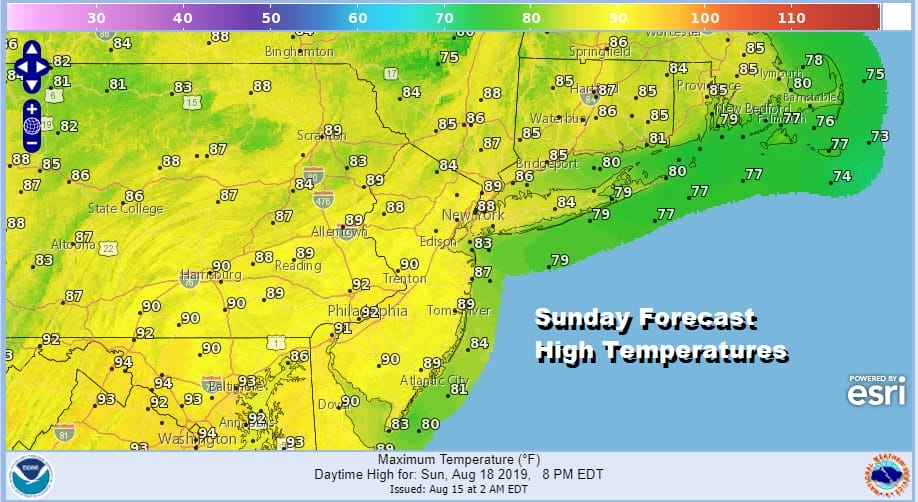
Sunday winds turn southwest which will allow temperatures to climb even higher. HIghs will reach upper 80s to near 90 with temperatures a little cooler along the shore with a sea breeze. Watch for scattered showers or a thunderstorm. Monday will be hot and humid and so will Tuesday with highs in the upper 80s and lower 90s. Late Tuesday brings the next cold front and the next chance for any kind of widespread shower or thunderstorm activity.
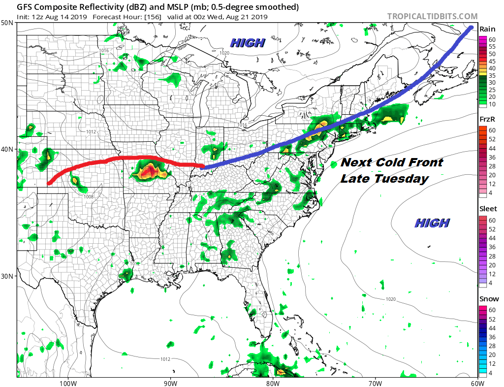
Guess what folks. This front is likely to stall out nearby which leaves in line for showers and thunderstorm chances for the middle of next week. Humidity relief from this front will be limited at best with the front stalling nearby. We may have to wait until late next week or next weekend for any kind of real humidity relief and that too may prove elusive.
MANY THANKS TO TROPICAL TIDBITS FOR THE USE OF MAPS
Please note that with regards to any tropical storms or hurricanes, should a storm be threatening, please consult your local National Weather Service office or your local government officials about what action you should be taking to protect life and property.


