DOWNLOAD MY NEW FREE JOESTRADAMUS WEATHER APP FOR ANDROID
THE APP IS ABSOLUTELY FREE TO ALL BUT CONSIDERING SUBSCRIBING TO PATREON FOR A WEATHER EXPERIENCE FREE OF ADS, EXCLUSIVE VIDEOS FOR MEMBERS ONLY AND MUCH MORE…STARTS AT $2 A MONTH..MESSAGE ME AT ANY TIME
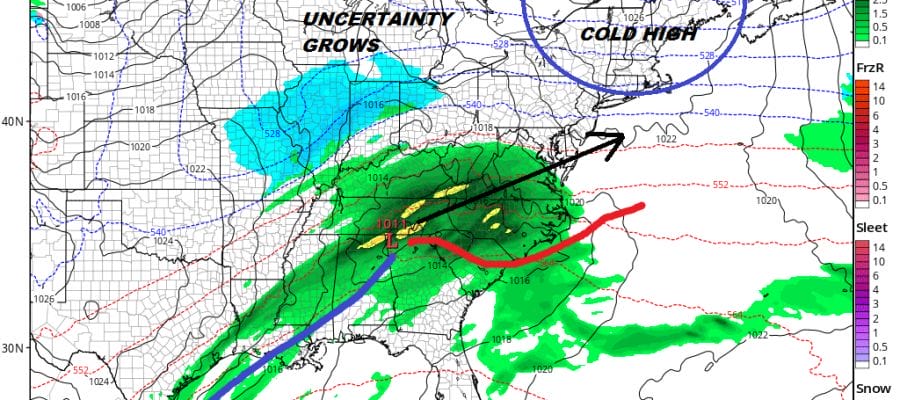
Winter Really Arrives Long Range Uncertainty Grows For Sunday
We are going to be talking about the part of the atmosphere where planes fly (6-7 miles up) and this is not my expertise. It has been a learning experience for me and I have been paying attention closely to the developments. We can thank Dr Judah Cohen for bringing this front and center. You can follow him on Twitter at @judahcohen for more information. Examining the long range outlook, everything that we have been discussing regarding a major pattern change remains on course. We are seeing a major warming event taking place in the stratosphere (where planes fly) which will be altering the weather patterns across the Northern Hemisphere for the next several weeks at least. At that level of the atmosphere there is one main driver and that is the polar vortex. That vortex however is being attacked by warm air moving through Siberia and penetrating the polar region. We can call this the attack of the polar vortex. The map below shows what it looked like 7 miles up in the atmosphere this past Sunday.
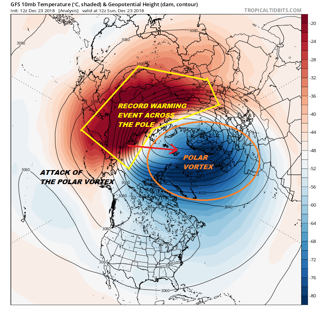
The warm air attack is so strong that it will cause the polar vortex to split into multiple pieces. We had a similar attack last February President’s Day weekend which then led to a splitting of the vortex. The outcome for the Northeast was 4 major noreasters in 2 1/2 weeks. We are not forecasting a repeat performance of this but the split is important as part of it goes back to Siberia and Northern Europe while the other half finds its way into Northeastern Canada.
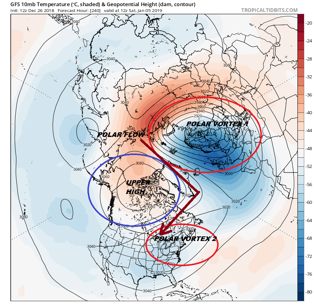
The implication of this split is that it creates a polar flow into the Eastern US bringing shots of cold air on a regular basis. Events at this level have a lag time effecting surface conditions of 10 days to 2 weeks. Since the split is beginning now the weather pattern will be making a big transition over the next few weeks. While all this is going on, whenever we have big changes happening, weather models tend to get very unstable and indecisive. Such is the case for Sunday. Friday’s rain event will play through and a cold front stalls out in the Gulf States. Another wave will be developing on the front. That is the easy part of this forecast since all the weather models have this.
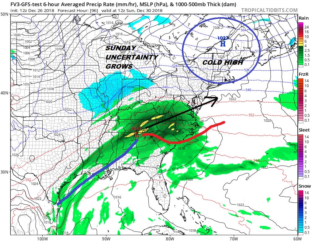
I’m using the new parallel GFS model which will soon become the standard GFS model in January as we try to get used to its errors. The wave moves northeast into a cold high developing in Northern New England (think back to November 15th). This model is very bullish for snow producing a swath of 3 to 6 inch snows for all of Pennsylvania to Central New Jersey, the Hudson Valley, Southern New England and Long Island.

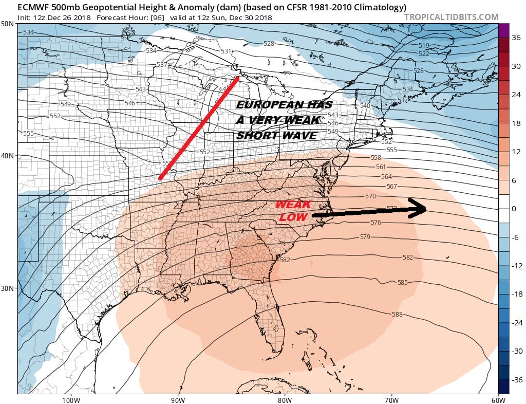
Would that this be so simple 5 days out. The problem is that we have a lot of energy running around in the upper atmosphere and each model is handling things so differently. For that we will look at the upper air where each model handles the upper reflection of this system differently. The European has a weak short wave trough which weakens further as it moves east leading to a weak surface low well offshore. We would see a little rain or snow from this at worst.
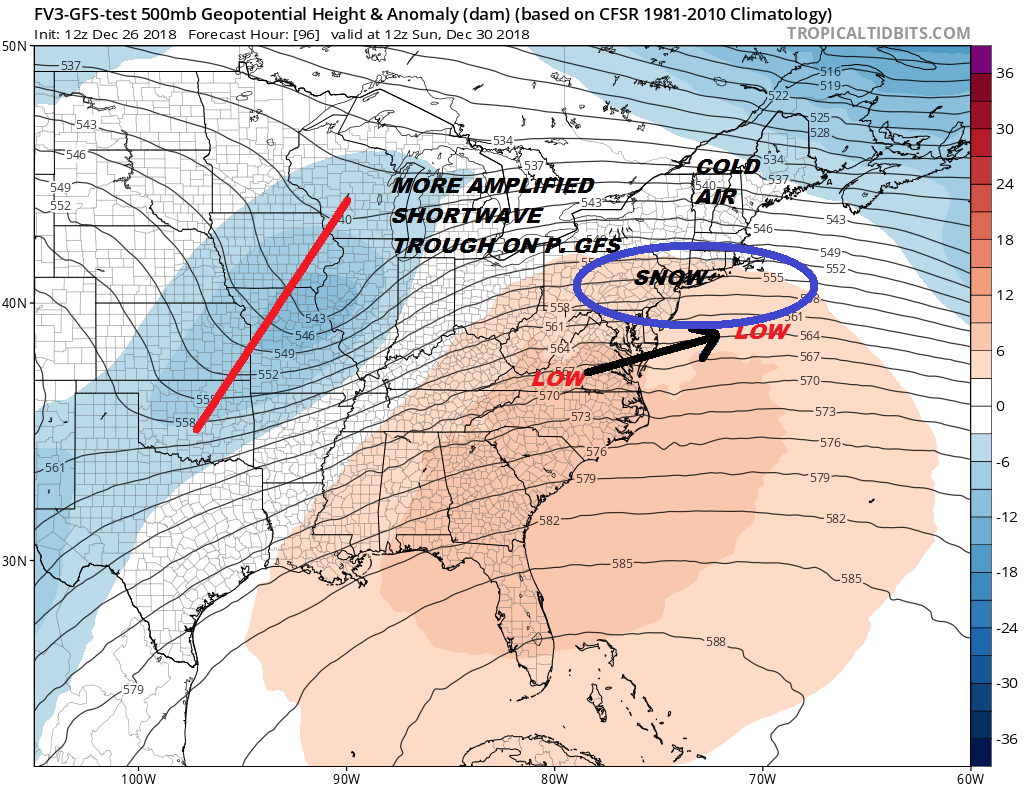
The Parallel GFS is completely on the other end of the spectrum with a strong short wave which actually gets even stronger as it nears the coast Sunday night into Monday morning. The outcome here is a solid area of precipitation and with cold air bleeding south from New England, snow could reach down into Maryland to the south and into New England on the northern flank.
Searching around for clues from other models was a fruitless exercise since they are all over the place with this. There is a bit of a ridge along the East Coast and the strength of this ridge could be key to all this. If models are overdoing it then we could see more room for the short wave trough to amplify. It all remains a forecast mess at the moment so we watch and wait for trends to develop.
MANY THANKS TO TROPICAL TIDBITS FOR THE USE OF MAPS
Please note that with regards to any tropical storms or hurricanes, should a storm be threatening, please consult your local National Weather Service office or your local government officials about what action you should be taking to protect life and property.