Arctic Air Snow Showers Snow Squalls Very Cold Into Saturday
No Major Storms Through Christmas
We are in recovery mode from the storm system of the last day and a half. Temperatures bottomed below freezing overnight making for a bit of a refreeze. Now we move ahead to an arctic front and some snow showers that will move through the area this afternoon and early evening. Most of you won’t see much. Some of you won’t see anything other than clouds. Others might see a few snow showers and a heavier snow squall is possible. In the meantime we will see some sunshine for a bit today before the front nears later this afternoon. it will be like a summer front with a line of heavy showers with it. Some of you get them..some of you won’t and temperatures will be mostly in the 30s for highs.
SATELLITE

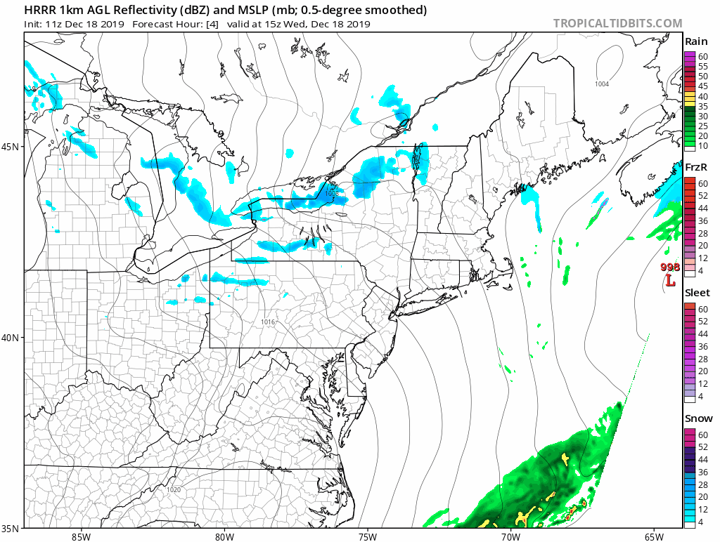
REGIONAL RADAR

The regional radar is picking up on some of the lake effect activity in response to the arctic front passing through Western NY & Northwest Pennsylvania. There isn’t much going on locally at the moment so certainly no weather issues into early afternoon. Then the front nears and we see those snow showers move through.
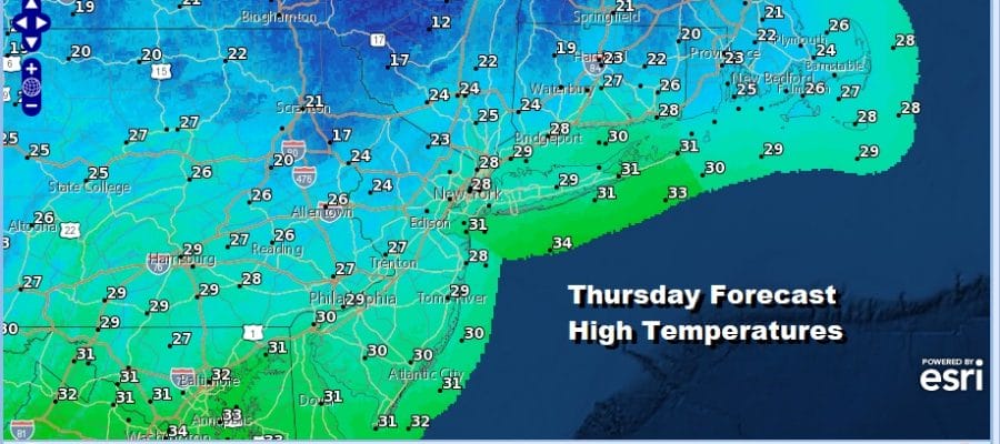
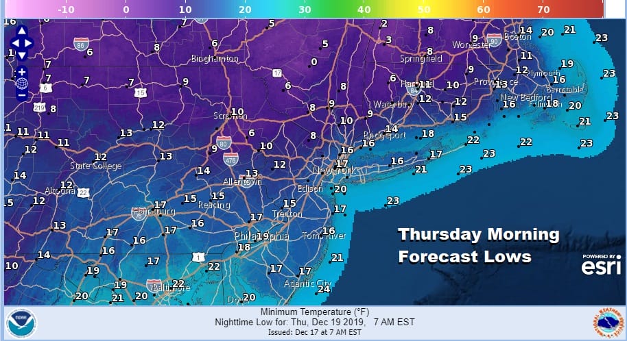
Bundle up tonight into Thursday because it will be very cold. By morning we will be in the single digits and lower teens and skies will be mostly clear The winds will be strong and gusty tonight into Thursday morning so wind chills will be down below zero at times. At least we will have a good deal of sunshine for Thursday but highs won’t be getting out of the 20s.
There doesn’t seem to be much for us to deal with other than this shot of cold air which will be pulling out over the weekend. After a clear very cold Thursday night, Friday we will see some sun with highs back into the 30s. Saturday we will go a little higher with highs in the 30s to near 40. Sunday with some sunshine highs will reach the 40s.
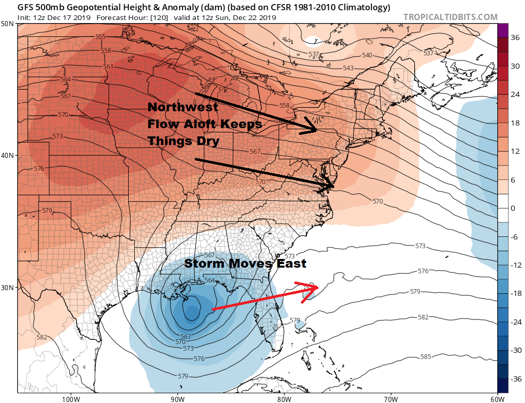
There will be a storm developing in the Gulf of Mexico late this week and it will be quite a gale center impacting the Gulf Coast, Florida, and the immediate coasts of Georgia and South Carolina. However the flow is split and the northern part of the jet stream shows a west to east flow this weekend. This means this storm cannot come up the coast. Also there is no cold air left so temperatures will be going a bit above average for the first part of next week and into Christmas. Also we don’t see any weather systems of importance at least through Christmas Day. It is a good time for the weather to calm down so that travel will come with no weather headaches.
BE SURE TO DOWNLOAD THE FREE METEOROLOGIST JOE CIOFFI WEATHER APP &
ANGRY BEN’S FREE WEATHER APP “THE ANGRY WEATHERMAN!
MANY THANKS TO TROPICAL TIDBITS FOR THE USE OF MAPS
Please note that with regards to any severe weather, tropical storms, or hurricanes, should a storm be threatening, please consult your local National Weather Service office or your local government officials about what action you should be taking to protect life and property.


