Arctic Air Arriving Teens Single Digits
ARCTIC AIR ARRIVING
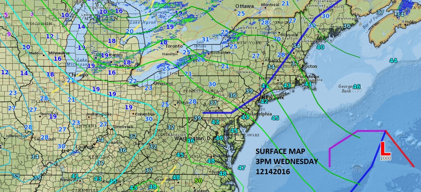
The first of two cold fronts are moving across the Northeast and Middle Atlantic States which is going take us from cold to colder to coldest. The mid afternoon surface map shows the first front moving through but the coldest air is still well to the north and that will arrive on Thursday with a few snow showers and perhaps a heavier snow squall. In the meantime tonight a little wave to the south could bring some light snow to Southern New Jersey with a little cheap thrill coating possible.
For now the radars are quiet but on the regional radar you can see some lake effect snows getting underway in Western and North Central New York.
Arctic Air Arriving Teens Single Digits Radar Loops


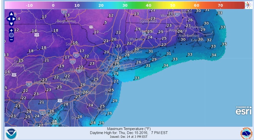
As far as the temperatures go we will see highs for Thursday and Friday not out of the 20s. I think the Friday highs are a little on the high side and they may not be reached until midnight as the snow begins to arrive.
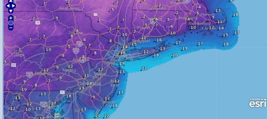
ARCTIC AIR THURSDAY HIGH TEMPERATURES WILL OCCUR EARLY IN THE DAY
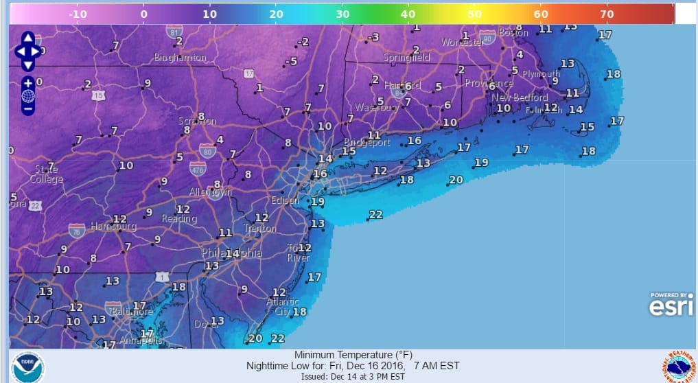
ARCTIC AIR FRIDAY MORNING LOWS
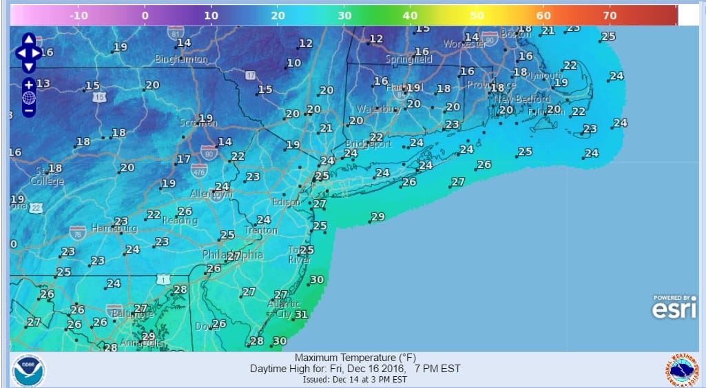
ARCTIC AIR FRIDAY HIGHS BY MIDNIGHT
In addition to the very low temperatures there will be strong gusty winds into Friday morning with wind chill values below zero. No doubt the coldest air of the very young almost winter season.
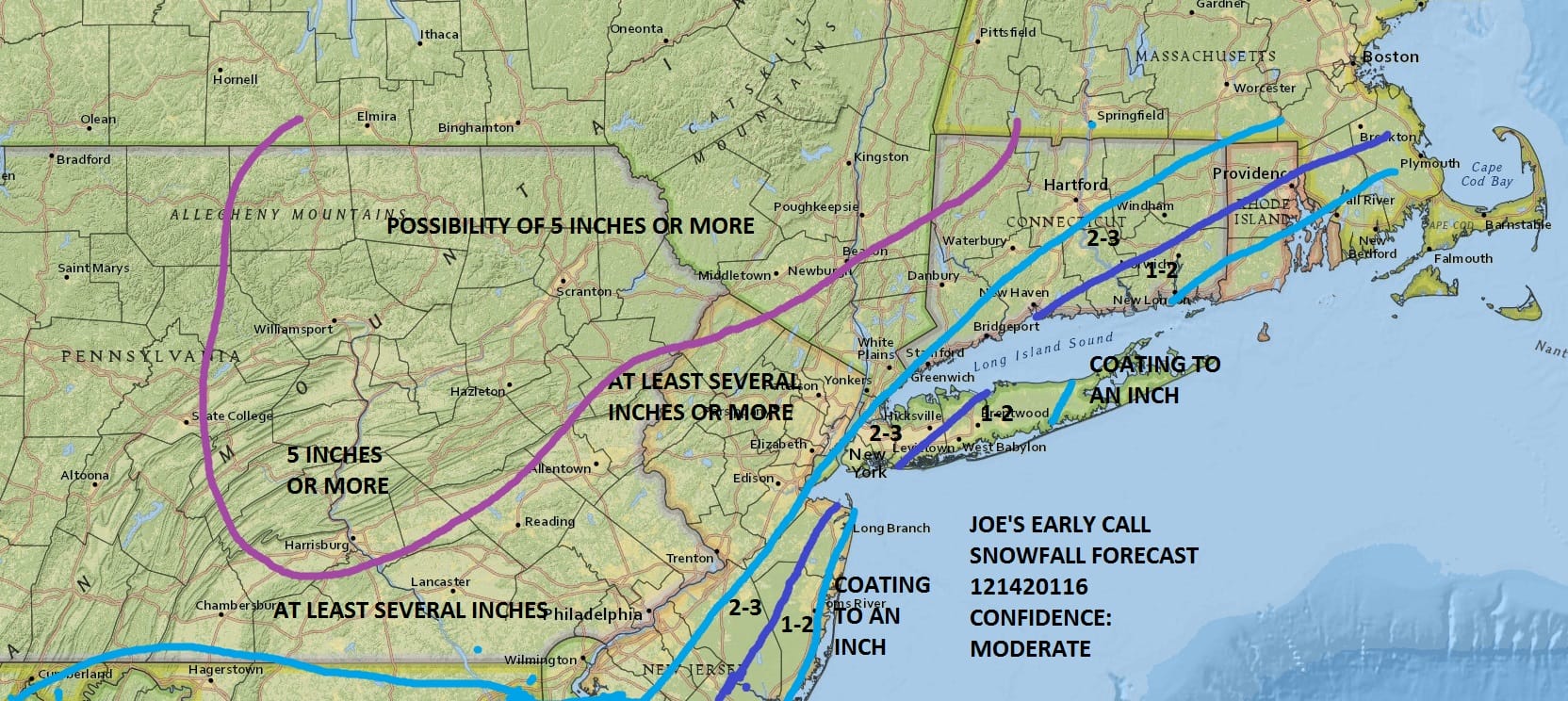
Of course we have snow in the forecast as we all know and I am making no changes at the moment. This is the kind of event where an extra hour of snow could mean an extra 2 to 3 inches for somebody. JOESTRADAMUS explains that in his latest post.
SNOW REMOVAL COMPANIES FOR YOUR WINTER NEEDS
LONG ISLAND ROCKLAND COUNTY Connecticut

![]()

FiOS1 News Weather Forecast For Long Island
FiOS1 News Weather Forecast For New Jersey
FiOS1 News Weather Forecast For Hudson Valley
NATIONAL WEATHER SERVICE SNOW FORECASTS
LATEST JOESTRADAMUS ON THE LONG RANGE
Weather App

Don’t be without Meteorologist Joe Cioffi’s weather app. It is really a meteorologist app because you get my forecasts and my analysis and not some automated computer generated forecast based on the GFS model. This is why your app forecast changes every 6 hours. It is model driven with no human input at all. It gives you an icon, a temperature and no insight whatsoever.
It is a complete weather app to suit your forecast needs. All the weather information you need is right on your phone. Android or I-phone, use it to keep track of all the latest weather information and forecasts. This weather app is also free of advertising so you don’t have to worry about security issues with your device. An accurate forecast and no worries that your device is being compromised.
Use it in conjunction with my website and my facebook and twitter and you have complete weather coverage of all the latest weather and the long range outlook. The website has been redone and upgraded. Its easy to use and everything is archived so you can see how well Joe does or doesn’t do when it comes to forecasts and outlooks.
Just click on the google play button or the apple store button on the sidebar for my app which is on My Weather Concierge. Download the app for free. Subscribe to my forecasts on an ad free environment for just 99 cents a month.
Get my forecasts in the palm of your hand for less than the cost of a cup of Joe!


