Another Warm Humid Night Severe Weather Risk Wednesday
We had a few scattered thunderstorms this afternoon which really only succeeded in making things even more tropical and more humid. Now we have a warm humid night ahead of us as thunderstorms and downpours die out. It will be another night were most temperatures don’t break below 70 and it will be even higher in the warmer urban centers which might not make it much below 75. It should be a quiet night as we wait for a cold front on Wednesday and the likelihood of thunderstorms later in the day.
SATELLITE
REGIONAL RADAR
Regional radar shows what is left of a dying line of thunderstorms that moved across Pennsylvania along with waning pop up isolated thunderstorms to the east. We don’t see anything happening overnight as the activity disappears.
LOCAL RADAR NEW YORK CITY
LOCAL RADAR PHILADELPHIA 
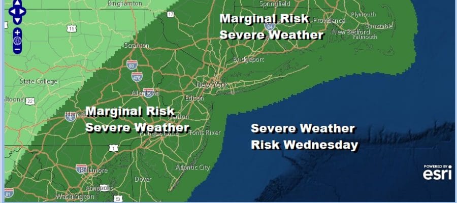
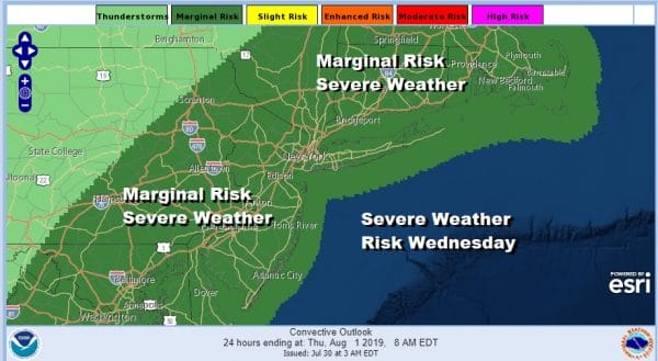
A cold front has been literally creeping across the Midwest and is now inching its way across Pennsylvania. It will arrive near the coast tomorrow evening. Wednesday will be a very warm and humid day with highs in the 80s to near 90. Look for sunshine in the morning to boost temperatures quickly before clouds develop with some renegade showers and thunderstorms scattered around in the early afternoon and a more formidable line of thunderstorms later in the afternoon and evening. The Storm Prediction Center maintains a marginal risk of severe weather but if the daytime heating gets out of hand, I would not be surprised if the Storm Prediction Center upgrades this to a slight risk.
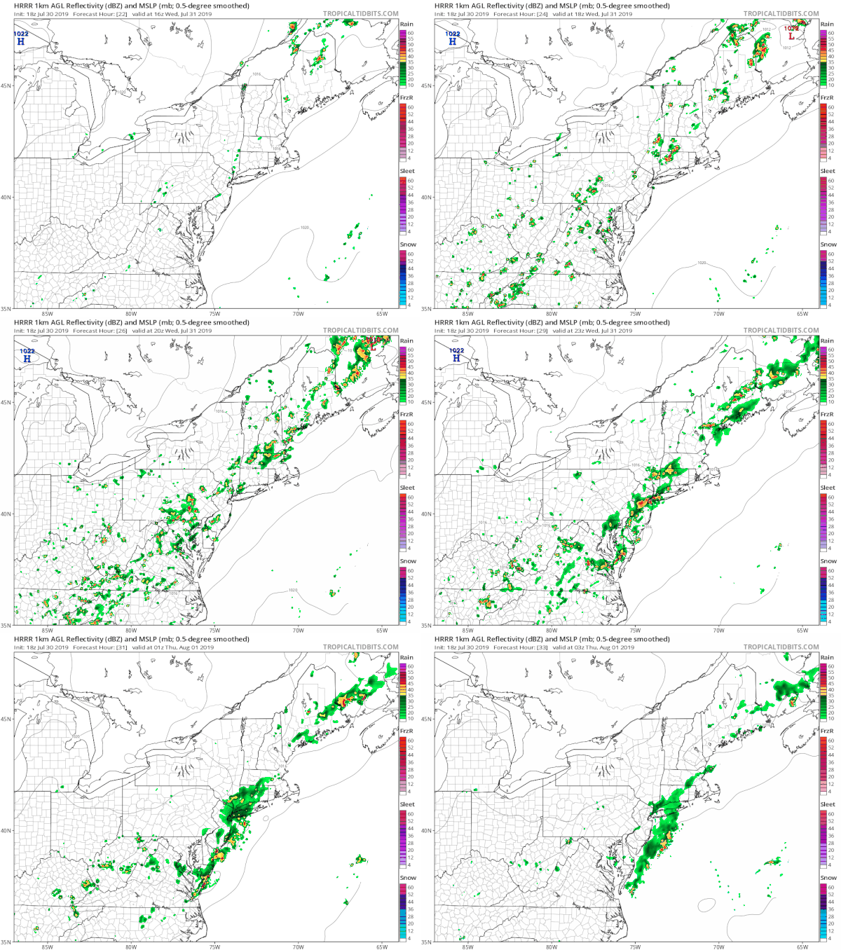
The HRRR model view is rather aggressive with the thunderstorms tomorrow afternoon. The loop takes you from noon until 11pm Wednesday showing the line impacting a large portion of Eastern Pennsylvania to Southern New England. We will let the radars tell us the story tomorrow as these thunderstorms develop.
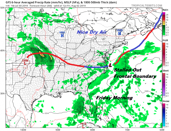
This front is going to stall out to the east and south as high pressure and slightly drier air tries to build in from the west so we are going to be close to boundary line Thursday into Saturday. Temperatures will definitely be lower after the front goes by so highs Thursday will be in the 80s with clouds and some sun. There might be some humidity relief north of NYC where dew points will drop into the 50s but areas in South Jersey and Southeast Pennsylvania will still be on the humid side with the chance for an afternoon downpour or a thunderstorm.
Friday a weak wave on the front will put us in more clouds than sun and there is the chance for some scattered downpours though the best chance would seem to be south and west of NYC. Friday’s highs will be in the lower 80s. Dry air across the Great Lakes will wedge into New England and again the southern boundary of the dry air probably bleeds down into Central New Jersey with more humid conditions to the south. Temperatures Friday will be in the upper 70s to some lower 80s so we do get temperature relief as well. I believe that for many most of the time it will be dry and some areas won’t see any rain at all.
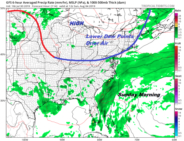
There is another front dropping southward out of Canada that should suppress this frontal boundary far enough south to not only remove the chance for showers but bring down some nice dry air for Sunday and for the first part of next week. This leaves us with Saturday with a mix of sun and clouds and the chance for a scattered downpour in a few spots. Again for most it should be a non event with temperatures in the 80s.
The front will pass through early Sunday which will lead to improving weather conditions Sunday with slowly lowering humidity and some sunshine with highs into the 80s. We might have to wait until Sunday night or early Monday for the real push to get in here but it will eventually get in here. The weather looks nice and reasonable for the first part of next week thanks to an active Canadian jet continuing to deliver occasional shots of drier cooler air.
MANY THANKS TO TROPICAL TIDBITS FOR THE USE OF MAPS
Please note that with regards to any tropical storms or hurricanes, should a storm be threatening, please consult your local National Weather Service office or your local government officials about what action you should be taking to protect life and property.

