Another Upper Trough Arrives Tuesday Wednesday Thursday Look Like Best Days This Week

Weather in 5/Joe & Joe Weather Show Latest Podcast
Another Upper Trough Arrives Tuesday Wednesday Thursday Look Like Best Days This Week
After another day of fighting lingering cloud cover, we are seeing clouds finally starting to break up on the satellite pictures this evening but there are still patches of cloud cover lingering over the Northeast. This will mean some partial clearing of skies tonight but some clouds will also hang around. That should at least help to hold temperatures up in our neck of the woods and most lows tonight will be in the 40s. Radars are quiet at the moment and we don’t see any issues through Tuesday morning.
SATELLITE

We should start Tuesday off with some sunshine but another upper trough to the northwest will be dropping southward during the day creating some clouds and there is the outside chance for a passing scattered shower. Temperatures Tuesday will be capped by the cloud cover and limited sun so highs should only reach the low and middle 60s.
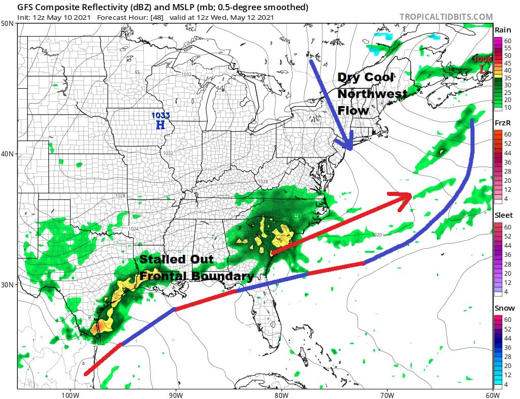
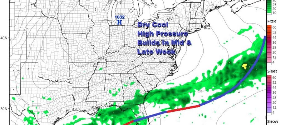
It gets better for Wednesday however as the upper trough moves out and we have a northwest flow of dry air. We should see a decent amount of sunshine Wednesday with a northwest breeze. Most highs will be in the low to mid 60s. Then we move on to Thursday which looks like the best day of the week. High pressure from the Midwest will continue to build into the Eastern US. We should see highs from the mid 60s to lower 70s. Skies should be mostly sunny from start to finish.

Friday through Sunday look okay though not perfect. The high weakens and we do have weak disturbances moving along in the flow that might produce some clouds and perhaps even the odd scattered inland shower Saturday and/or Sunday. Highs will be in the upper 60s and lower 70s Friday and Saturday and low to mid 70s on Sunday.

BE SURE TO DOWNLOAD THE FREE METEOROLOGIST JOE CIOFFI WEATHER APP &
ANGRY BEN’S FREE WEATHER APP “THE ANGRY WEATHERMAN!
MANY THANKS TO TROPICAL TIDBITS FOR THE USE OF MAPS
Please note that with regards to any severe weather, tropical storms, or hurricanes, should a storm be threatening, please consult your local National Weather Service office or your local government officials about what action you should be taking to protect life and property.


