
Another Good Day Overall Clouds Rain Stay South Very Warm Humid Weekend
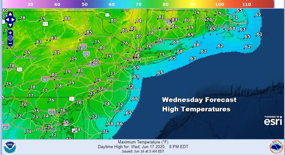
Today is going to be one of those upside down type of days temperature wise thanks to clouds and the time of year. This means the further north you go the warmer it will be with more sunshine while the reverse is true as you head south. Thank the stubborn upper low that is still sitting in the South Atlantic state and spinning up clouds and rain to about the Maryland/Pennsylvania/Southern New Jersey line. North and east of NYC highs will reach into the lower 80s with a good amount of sunshine. South and west of Philadelphia it will be partly sunny to cloudy with highs just in the lower 70s.
SATELLITE

REGIONAL RADAR

As far as the rain issue is concerned it is visible on the regional and it even shows up on the southern end of the local radars. As it lift northward however it loses support and weakens so we don’t think it gets much further north than where it has already reached (Maryland/Delmarva southward.
LOCAL RADAR NEW YORK CITY

LOCAL RADAR PHILADELPHIA


Finally the upper low breaks down and begins to get kicked away to the northeast tonight and Thursday. This opens the door to a warmer more humid air mass that will likely hang around through early next week. Thursday we will see sunshine and clouds and there is the risk for some pop up widely scattered showers or a thunderstorm. Highs will reach upper 70s and some lower 80s away from the coast.
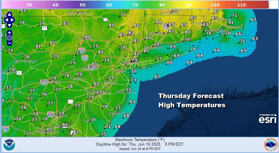
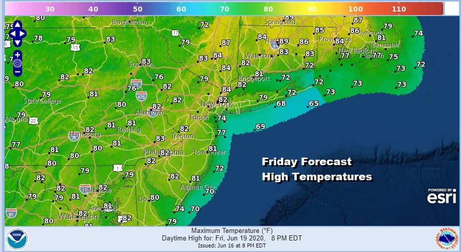
Again Thursday will be another one of those upside down type of days with warmer temperatures in New England than in the Middle Atlantic states. Friday will be a wash rinse repeat of Thursday with clouds and sun, warm humid conditions and probably a better chance for pop up showers and thunderstorms. The best chances for any pop ups will be well inland.
There are no changes to the outlook for the weekend and Father’s Day. Sunshine and clouds very warm and humid conditions will take over. Most highs will be in the 80s. Temperatures will be cooler both days near the ocean. Nights will be warm and humid with lows in the 60s inland and lower 70s in warmer urban areas.

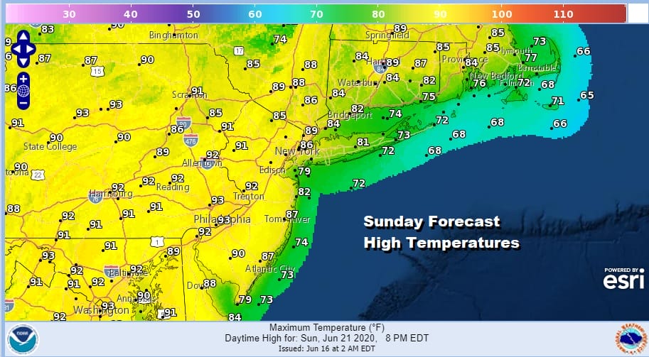
There is the chance for pop up scattered showers or thunderstorms mainly inland for both Saturday and Sunday the chances are probably a little higher on Saturday than they are on Sunday. The beach or the pool might be a good place to hang out this weekend.

Next week brings some changes in the upper air pattern as the fast flow from Canada strengthens again. This means several cold fronts will be moving through but it also means some shots of cooler air in between. The first such front approaches Tuesday with some showers and thunderstorms and another one probably next Thursday with some showers and thunderstorms. Shot of drier slightly cooler air will be coming in behind each front. Summer begins as do the final days of June!
BE SURE TO DOWNLOAD THE FREE METEOROLOGIST JOE CIOFFI WEATHER APP &
ANGRY BEN’S FREE WEATHER APP “THE ANGRY WEATHERMAN!
MANY THANKS TO TROPICAL TIDBITS FOR THE USE OF MAPS
Please note that with regards to any severe weather, tropical storms, or hurricanes, should a storm be threatening, please consult your local National Weather Service office or your local government officials about what action you should be taking to protect life and property.


