Alberto Strengthens Winds 65 MPH Moving Toward NW Florida
Alberto Strengthens Winds 65 MPH Moving Toward NW Florida
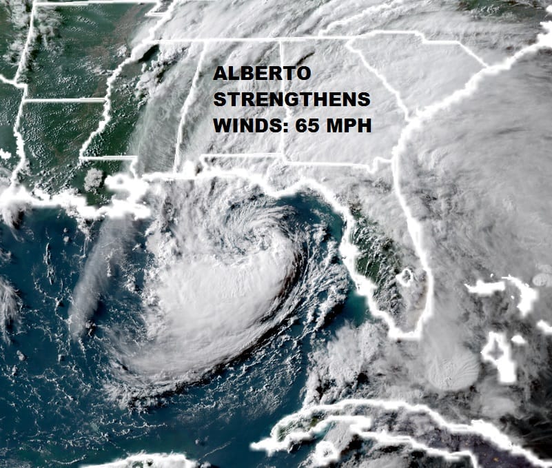
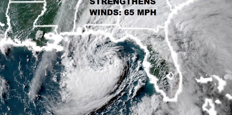
During the afternoon & evening hours satellite loops show that Alberto continues to organize and is beginning to look more like a tropical rather than a subtropical storm. Recent reports from an Air Force plane show that maximum winds are now 65 mph and the pressure has fallen to 991 millibars. Alberto is nearing the NW Coast of Florida but landfall will not happen until Monday afternoon at the earliest. The storm is responding to a cut off upper low that is developing in the North Central Gulf which may slow it down a bit. A light wind shear environment aloft could create an opportunity for further strengthening. There is a chance Alberto could become a minimal hurricane before landfall making it only the 5th such hurricane in May since 1851!
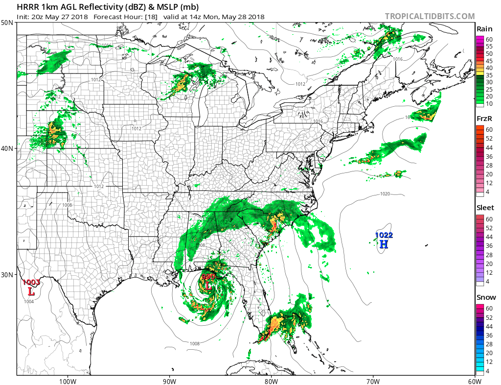
The way the short term models see this like the HRRR & the NAM, the storm at 10am Monday is still offshore with a radar presentation that appears like a well defined core of convection near the center. The northern most band of rain that has separated from the core reaches into the Carolina’s Monday morning. Also some rain is still showing up in Southeast Florida.

On the Southern Mississippi Valley regional radar you can see bands of rain in Northwest Florida but you can also begin to see a ring of echos offshore that represents the strengthening center. The National Hurricane Center which has been in a tough spot from the beginning with this system coming on a holiday weekend will be facing a dilemma regarding whether hurricane warnings may be required. For now they have left things alone as far as warnings are concerned.
BULLETIN
Subtropical Storm Alberto Special Advisory Number  11
NWS National Hurricane Center Miami FL       AL012018
730 PM CDT Sun May 27 2018

...ALBERTO STRONGER...


SUMMARY OF 730 PM CDT...0030 UTC...INFORMATION
----------------------------------------------
LOCATION...28.4N 85.7W
ABOUT 195 MI...315 KM W OF TAMPA FLORIDA
ABOUT 100 MI...160 KM SSW OF APALACHICOLA FLORIDA
MAXIMUM SUSTAINED WINDS...65 MPH...100 KM/H
PRESENT MOVEMENT...NW OR 325 DEGREES AT 10 MPH...17 KM/H
MINIMUM CENTRAL PRESSURE...991 MB...29.27 INCHES


WATCHES AND WARNINGS
--------------------
CHANGES WITH THIS ADVISORY:

None.

SUMMARY OF WATCHES AND WARNINGS IN EFFECT:

A Storm Surge Watch is in effect for...
* Crystal River to Navarre Florida

A Tropical Storm Warning is in effect for...
* Anclote River to the Mississippi/Alabama border

A Storm Surge Watch means there is a possibility of life-
threatening inundation, from rising water moving inland from the
coastline, in the indicated locations. For a depiction of areas at
risk, please see the National Weather Service Storm Surge
Watch/Warning Graphic, available at hurricanes.gov.

A Tropical Storm Warning means that tropical storm conditions are
expected somewhere within the warning area.

For storm information specific to your area, including possible
inland watches and warnings, please monitor products issued by your
local National Weather Service forecast office.


DISCUSSION AND OUTLOOK
----------------------
At 730 PM CDT (0030 UTC), the center of Subtropical Storm Alberto
was located near latitude 28.4 North, longitude 85.7 West.  The
storm is moving toward the northwest near 10 mph (17 km/h).   A
northwest to north-northwest motion with some decrease in forward
speed is expected overnight.  A north-northwestward to northward
motion is expected Monday through Wednesday.  On the forecast track,
the center of Alberto will move over the northern Gulf of Mexico
tonight and cross the northern Gulf Coast in the warning area on
Monday. Alberto is expected to move inland into the Tennessee Valley
on Tuesday and into the Ohio Valley on Wednesday.

Maximum sustained winds are near 65 mph (100 km/h) with higher
gusts.  Little additional strengthening is expected before Albert
reaches the northern Gulf Coast.  Steady weakening is expected after
landfall, and Alberto is forecast to become a tropical depression
Monday night or Tuesday.

Winds of 40 mph extend outward up to 115 miles (185 km) from the
center.

The minimum central pressure estimated from Air Force Hurricane
Hunter aircraft data is 991 mb (29.26 inches).
FiOS1 News Weather Forecast For Long Island
FiOS1 News Weather Forecast For New Jersey
FiOS1 News Weather Forecast For Hudson Valley