
After Relative Calm More Active Weather Pattern Lies Ahead
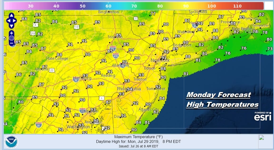
The last weekend of July certainly put an asterisk on the summer weekends with 99 percent of you seeing sunshine. Yes it was very warm to borderline hot and yes it did turn more humid but after all it is summer. A very few of you saw a couple of pop up downpours but that was the exception and not the rule. The weather has been relatively quiet since last Monday’s severe weather rout. This week starts off hot and humid but will also see an increasing chance for showers and thunderstorms beginning on Wednesday and probably lasting through the rest of the week. Today and Tuesday however will be hot and humid with today being the hottest day this week. Highs will reach 90 to 95 in most places. We will see sunshine and we will also leave in the chance for a few scattered thunderstorms developing late this afternoon and evening.
SATELLITE

REGIONAL RADAR

The satellite picture shows clear skies throughout much of the Eastern US. Nothing is on the radar and other than from scattered pop ups that might show up later today, there will be no issues. Tuesday is looking like a repeat performance with sunshine and highs in the upper 80s and lower 90s. There is a slightly better chance for showers and thunderstorms inland from Western New Jersey westward as a cold front starts its approach.
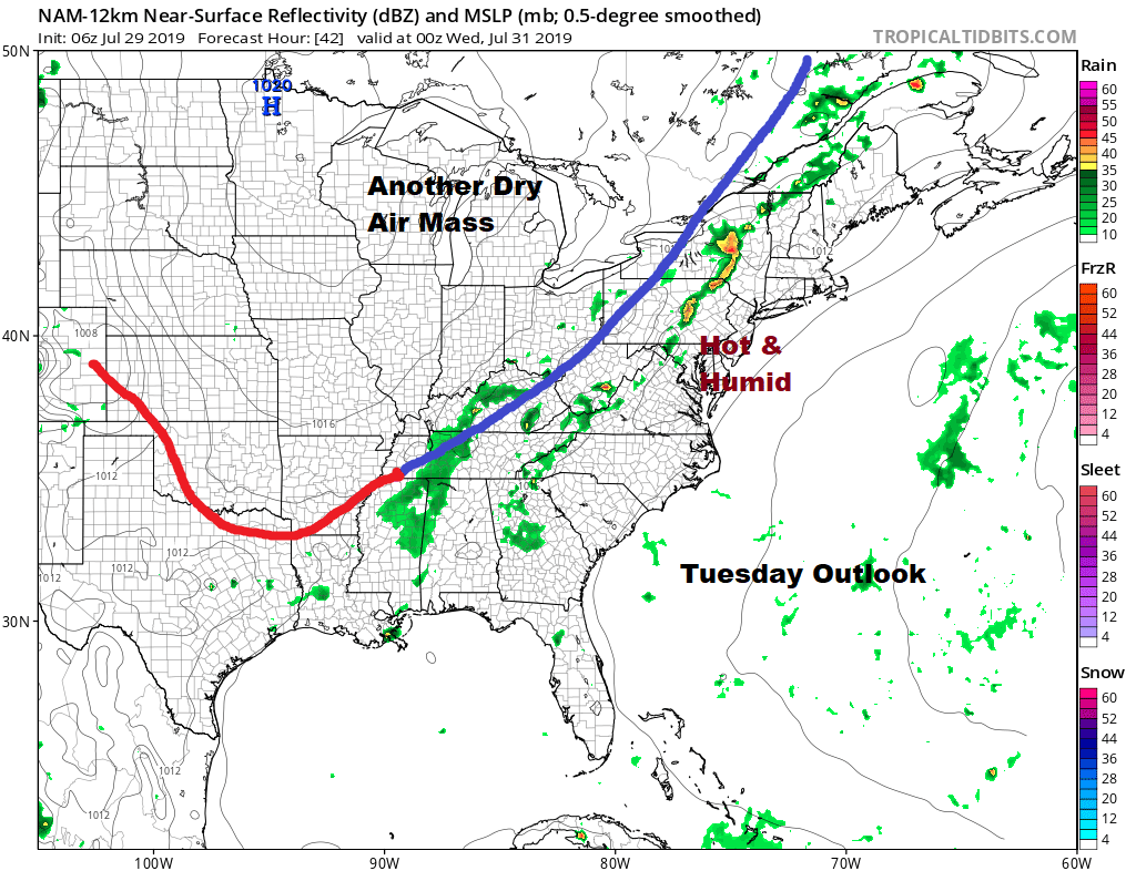 Wednesday brings a better chance for thunderstorms later in the day as the front nears the coast. Highs Wednesday will probably be shy of 90 degrees with more clouds and a southerly wind. Highs will be in the mid to upper 80s.

This front is going to stall out just offshore Wednesday night and it is going to hang around the coast Thursday and Friday putting us in line for the chance for showers and thunderstorms both Thursday and Friday with highs in the 80s both days. The frontal boundary will like close by into the weekend thanks to an upper trough in the Eastern US. This will keep the heat away but it might leave in the threat for a shower or thunderstorm into the weekend.
MANY THANKS TO TROPICAL TIDBITS FOR THE USE OF MAPS
Please note that with regards to any tropical storms or hurricanes, should a storm be threatening, please consult your local National Weather Service office or your local government officials about what action you should be taking to protect life and property.


