A Wet New Year Freezing Rain Friday Morning North of Route 84

Weather in 5/Joe & Joe Weather Show Latest Podcast
A Wet New Year Freezing Rain Friday Morning North of Route 84
A cold front is pushing through the Northeast this evening after what turned out to be a mostly okay kind of day. This front will pass with through with not much weather with it and only just some clouds. It will leave behind some snow showers in Western Pennsylvania and upstate NY with a little lake effect action. Overall though it should be a quiet night with clearing skies. Most lows Tuesday morning will be in the upper 20s and lower 30s.
SATELLITE

We don’t see much change in the outlook for Tuesday and Wednesday. Both days will feature sunshine. Tuesday highs will be in the low to mid 30s. Wednesday’s highs will be in the upper 30s to around 40 or so.
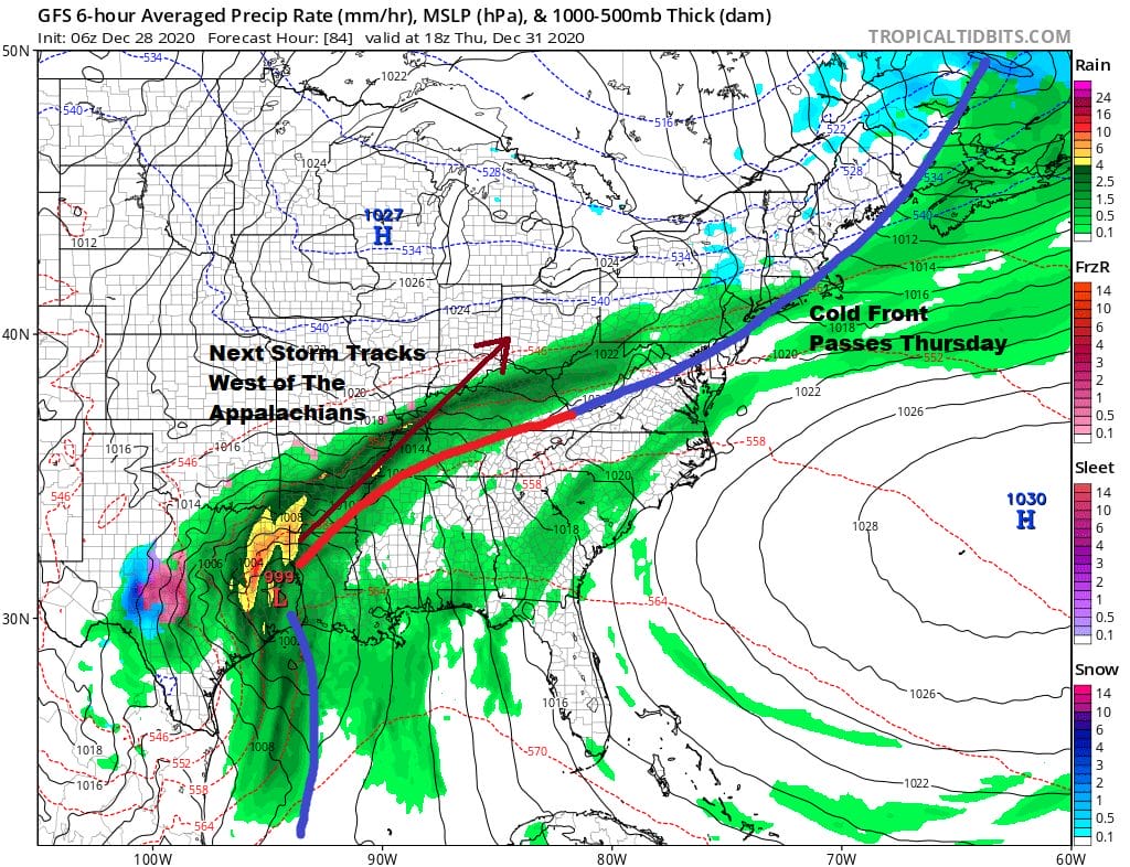
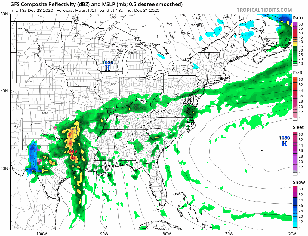
Thursday sets in motion the next cold front that moves through Thursday morning and then stalls to the south with high pressure building to our north. Cold air from that high will bleed southward leaving us in clouds and temperatures will ease Thursday and Thursday night leaving areas just inland of the coast at or below freezing.
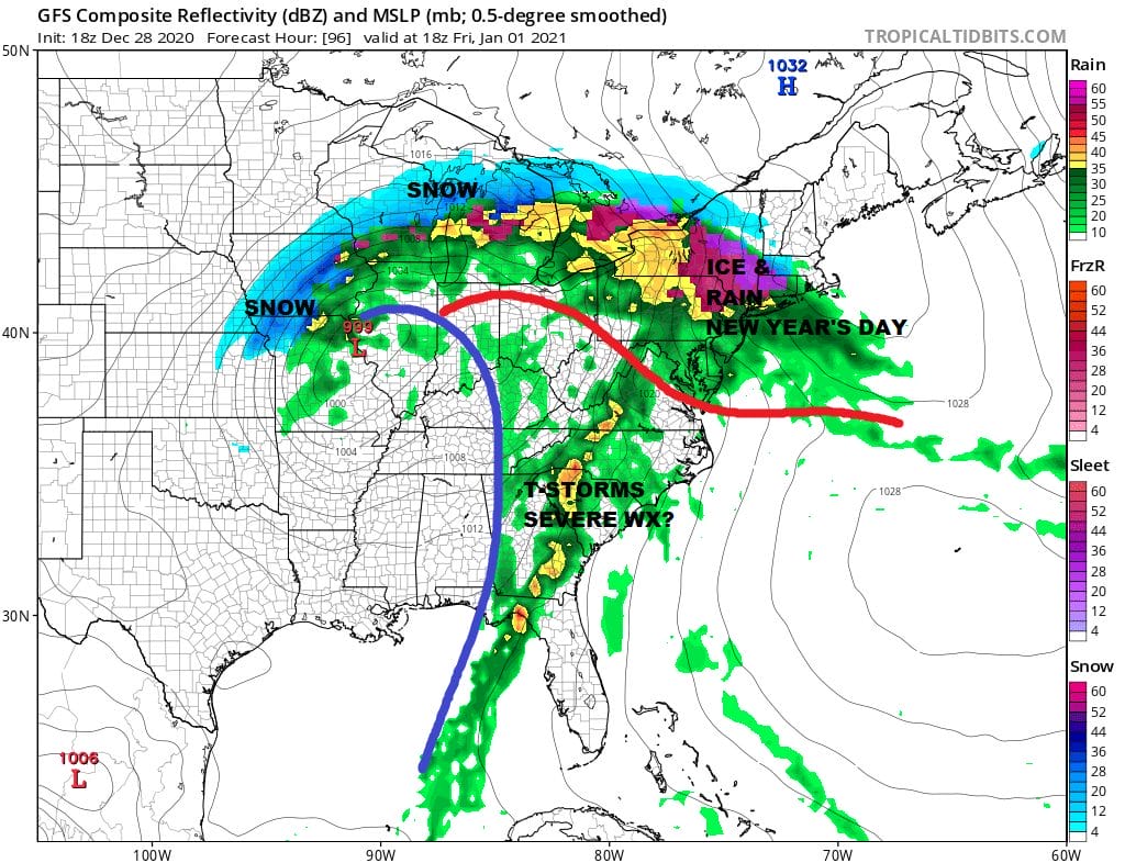
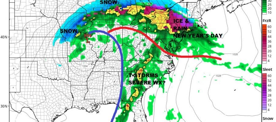
Low pressure remains on course to head from the Gulf States north northeast and well to our west. This will pin the cold front down across the Mid Atlantic states and then it will be a matter of whether that front can make it into Southern New England and the Hudson Valley Friday as the low moves east. This likely leaves us rain free other than a shower early New Years Eve and that we will see precipitation develop from south to north during the morning hours on Friday.
The GFS is somewhat aggressive with the area of freezing rain and for that matter so is the European model on today’s run. This would suggest a tenth to a quarter of an inch of ice accretion at this early stage for Friday. Again this will be for areas mainly north of Route 84 in Pennsylvania New York State and New England. We will have a better handle on this tomorrow and Wednesday. In the meantime it is rain for everyone else down to the Middle Atlantic States and it could be another 1 to 2 inch rain producer on New Years Day. The weekend appears to be dry and chilly. Another low develops off the Southeast Coast of the US and for now at least it seems this low should pass to our south and east, though some models do make it a close call for Sunday night into Monday morning.
BE SURE TO DOWNLOAD THE FREE METEOROLOGIST JOE CIOFFI WEATHER APP &
ANGRY BEN’S FREE WEATHER APP “THE ANGRY WEATHERMAN!
MANY THANKS TO TROPICAL TIDBITS FOR THE USE OF MAPS
Please note that with regards to any severe weather, tropical storms, or hurricanes, should a storm be threatening, please consult your local National Weather Service office or your local government officials about what action you should be taking to protect life and property.


