USE THE COUPON CODE “summer2026” AND GET 10 PERCENT OFF ON ANY PURCHASE
A Slight Humidity Break But It Returns Tomorrow
Drier Air Late Friday & The Weekend
If you are in Northern New Jersey and New York City north and northeast you are going to catch a bit of a break in the humidity today. Even in areas to the south, dew points will be a shade lower but it is in northern areas where it will be more noticeable. Also temperatures will be a shade lower with highs mostly in the middle to upper 80s. Also another break as there will be low chance for a shower thunderstorm risk for today. You can thank a weak high building in from New England. However the next round of changes will be getting underway Thursday as the next weather system heads our way. No issues tonight with mainly clear skies and lows will be in the 60s to near 70 in most places.
SATELLITE WITH LIGHTNING STRIKES
WEATHER RADAR
Humidity levels will be slowly rising as we move through day and it should be no worse than partly sunny. While there is the chance for some isolated late day showers or a thunderstorm, the chances are very low. We do have a cold front that is approaching but it is not likely to move through until late Thursday night. Highs Thursday will be in the mid to upper 80s.
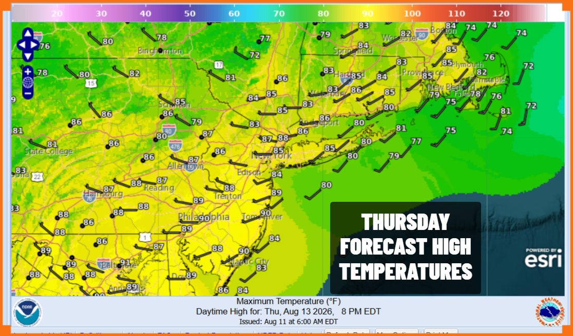
A cold front moves through Thursday overnight and there could be a shower or thunderstorm when the front goes by though the chances seem low. Then Friday the front will temporarily get hung up across the Mid Atlantic states. The day across Eastern Pennsylvania to Southern New England will probably start cloudy and on the humid side but we will gradually see increasing sunshine from north to south. More importantly humidity levels will start to drop as dew points plunge into the 50s.
Most highs Friday will be in the low 80s and Friday night into Saturday morning we will see temperatures drop to the low and middle 60s including warmer urban areas and the coast. We will see dry comfortable conditions through the dayside Sunday. Saturday we will have sunshine. Sunday we will see sunshine giving way to arriving clouds. Humidity levels will start to climb later in the day Sunday into Sunday evening but we are leaving showers and thunderstorms out of the forecast for both weekend days. Highs both days will be in the lower 80s.
MANY THANKS TO TROPICAL TIDBITS FOR THE USE OF MAPS
Please note that with regards to any severe weather, tropical storms, or hurricanes, should a storm be threatening, please consult your local National Weather Service office or your local government officials about what action you should be taking to protect life and property.