A Near Average Temperature Day Before
It Turns Colder But Not Extreme
In some respects, this is going to feel like a warm spring day compared to where we have been. A cold front has passed and there is colder air waiting to come back southward but that will wait until this evening and tonight. It is not arctic cold so yes we will see below average temperatures over the next few days but not by much and by no means will it be anything extreme. Skies today should be no worse than partly sunny though there is an upper trough that has to move through, producing clouds from time to time. Highs today will be in the upper 30s to lower 40s just about everywhere.
SATELLITE WITH LIGHTNING STRIKES
WEATHER RADAR
There is some snow on the radar in upstate New York and I suppose it is always possible that somebody sees a snow shower. Otherwise we should be precipitation free, Skies will clear tonight and it will be breezy with Thursday morning lows mostly in the 20s. Thursday dayside should be no worse than partly sunny but it will be on the cold side with most highs in the low to middle 30s.
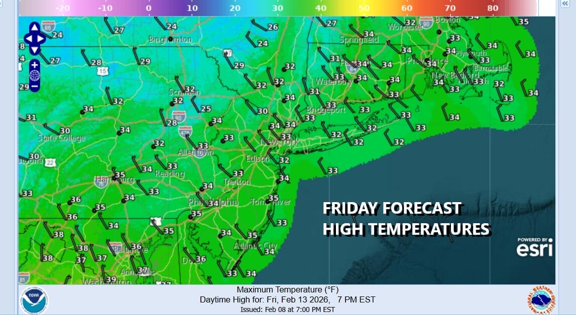
The coldest air of this next air mass will move in Thursday night into Friday. Skies Thursday night will be mostly clear with morning lows Friday in the teens just about everywhere. Friday dayside will be partly to mostly sunny and afternoon highs should reach the low and middle 30s in most places.
We have a three day holiday weekend coming up and we can say that Saturday looks fine as does the dayside Sunday. However attention turns to another storm system. This one develops in Texas and heads eastward through the Lower Ohio Valley and Deep South. The the question becomes whether it makes the turn northward up the East Coast. Models remain usually wide in their ideas ranging from benign to extreme. For now we are thinking this is going to be another one of these storm systems that models will try to bring it northward only to have it follow the primary trend this winter, which is to keep it to the south and east with little consequence. Another day or two of model waffling is ahead of us until we can put this to bed one way or the other.
BE SURE TO DOWNLOAD THE FREE METEOROLOGIST JOE CIOFFI WEATHER APP &
ANGRY BEN’S FREE WEATHER APP “THE ANGRY WEATHERMAN!
MANY THANKS TO TROPICAL TIDBITS FOR THE USE OF MAPS
Please note that with regards to any severe weather, tropical storms, or hurricanes, should a storm be threatening, please consult your local National Weather Service office or your local government officials about what action you should be taking to protect life and property.