A Major Pattern Change Thanksgiving Week
to a colder stormier one for the US thanks to weak El Nino

A Major Pattern Change Thanksgiving Week
to a colder stormier one for the US thanks to weak El Nino
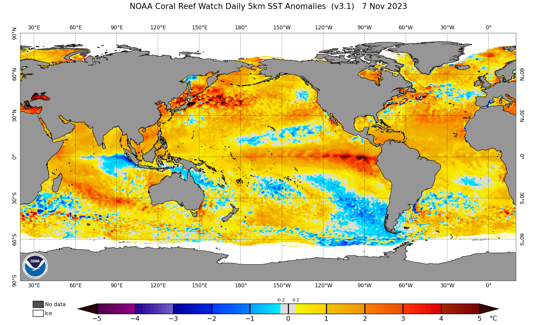
A couple of things to note on today’s long range. First is the warmer than normal temperatuers in the Atlantic with a couple of cold pools of water in the Cetnral Atlantic. It is hard to say what the implication for the winter is with the warm Atlantic as the correlations are less understood in general than what happens in the Pacific. In the Pacific we have the EL Nino which hasn’t really changed much in the last few weeks nor has the cold pool of water near and south of Hawaii that extends eastward to off the coast of Baja California. This cold pool seems to be keeping the EL Nino in check at least for now. That could be important regarding the long term pattern. So is the fact that much of the Pacific is seeing above normal ocean water temps which could be supportive of ridging developing in the Northeast Pacific and Northwest Canada.

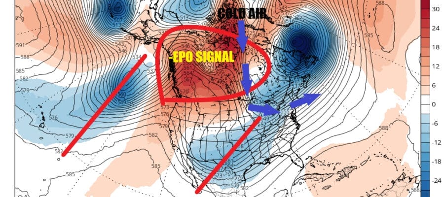
In the meantime we are in this up and down dry pattern and that will last into next week. However late next week if models are correct we being to see a change in the upper air pattern. The change in the Pacific favors a negative East Pacific Oscillation signal and that is a teleconnection that I have always believed is the most important when it comes to winter weather in the US and in the Eastern US. The ridging in Northwest Canada and the Northeast Pacific strengthens and this creates a flow of cold air from Canada into much of the eastern half of the US. Look for this new pattern to take hold Thanksgiving week.

The pattern also favors a split flow from the Pacific into the US and that opens the door for a more active storm pattern. This should put an end to the dry spell that dominates much of the Eastern US and in particular the Southern US and Gulf States where we are in a state of drought. All the indictors seem to point to this pattern shift beginning in 10 days. This would be a pattern that favors below average temperatures and near to above average precipitation. If this pattern holds for the longer term it would mean an early start to winter weather in the Northeast and Mid Atlantic states.
BE SURE TO DOWNLOAD THE FREE METEOROLOGIST JOE CIOFFI WEATHER APP &
ANGRY BEN’S FREE WEATHER APP “THE ANGRY WEATHERMAN!
MANY THANKS TO TROPICAL TIDBITS FOR THE USE OF MAPS
Please note that with regards to any severe weather, tropical storms, or hurricanes, should a storm be threatening, please consult your local National Weather Service office or your local government officials about what action you should be taking to protect life and property.
(Amazon is an affilate of Meteorologist Joe Cioffi & earns commissions on sales.)


