A Little Colder But Bearable Into the Weekend
Storm System To Stay South Sunday & Monday
Colder air has returned after a day of temperatures that reached 40 degrees in many places. Gusty winds and sunshine will rule the day here as the next cold air mass builds in. We will see below average temperatures but nothing extreme. Highs today will reach the low and middle 30s in most places. Winds gusting to 20 to 30 mph will make it feel about 10 degrees colder. Overall not a bad day temperature wise especially when compared to the bitter cold weather we just went through. A disturbance moving southeast is producing some clouds and there is some snow on the radars in Upstate New York but that should gradually weaken as we go through the day.
SATELLITE WITH LIGHTNING STRIKES
WEATHER RADAR
Most lows tonight will be in the teens to around 20 degrees under mainly clear skies and winds should ease. Friday we will finish off the week with sunshine. Highs again will be mostly in the low to middle 30s. This is getaway day for the holiday weekend and we do not see any weather related travel issues no matter which direction you may be headed in.
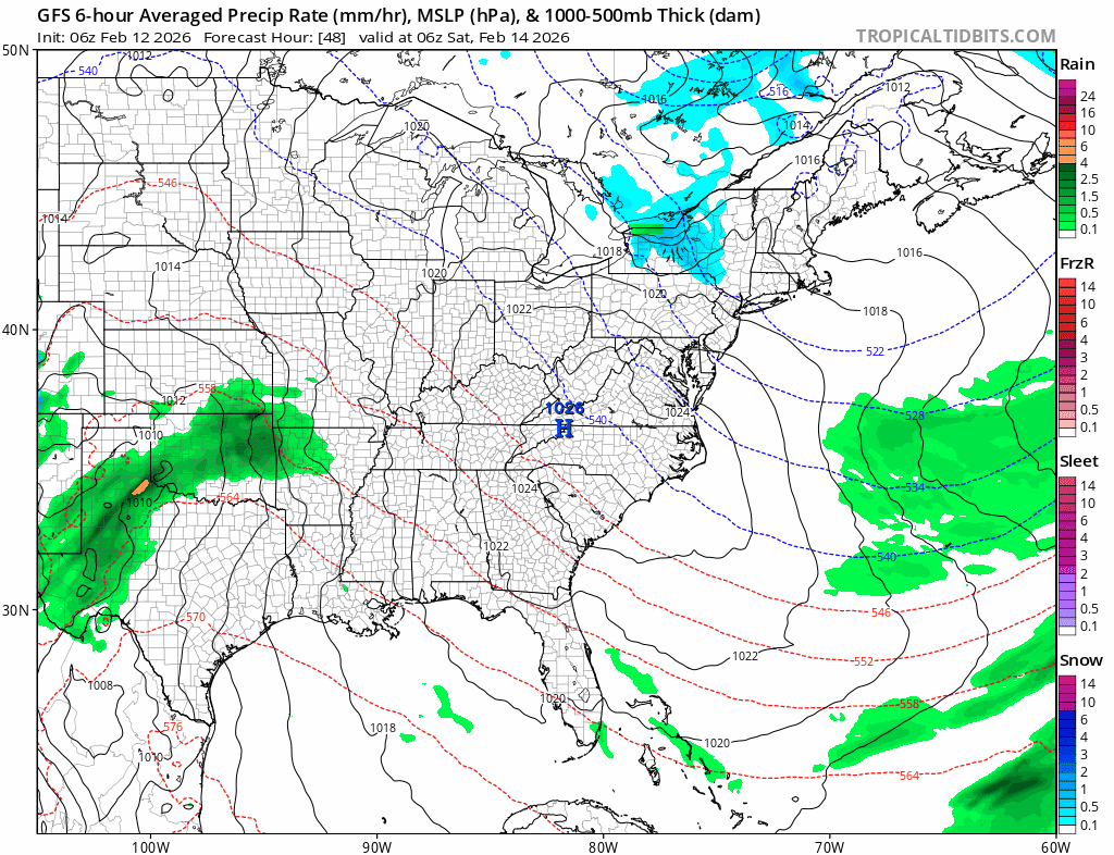
Friday night we will begin to see low pressure developing in Texas and that low is going to be moving eastward across the Lower Tennessee Valley later Saturday and Sunday, eventually moving off the coast of the Carolinas. There is no system in the northern stream that will turn this low northward up the coast. Northwest winds in the upper atmosphere in the Northeast into the Mid Atlantic will act as a shield keeping precipitation from advancing too far north.
u
BE SURE TO DOWNLOAD THE FREE METEOROLOGIST JOE CIOFFI WEATHER APP &
ANGRY BEN’S FREE WEATHER APP “THE ANGRY WEATHERMAN!
MANY THANKS TO TROPICAL TIDBITS FOR THE USE OF MAPS
Please note that with regards to any severe weather, tropical storms, or hurricanes, should a storm be threatening, please consult your local National Weather Service office or your local government officials about what action you should be taking to protect life and property.