
A Few Snow Showers Mainly North Tonight
Otherwise Quiet Colder Into Late Week No Clairty On Weekend Storm

Weather in 5/Joe & Joe Weather Show Latest Podcast
A Few Snow Showers Mainly North Tonight
Otherwise Quiet Colder Into Late Week No Clairty On Weekend Storm

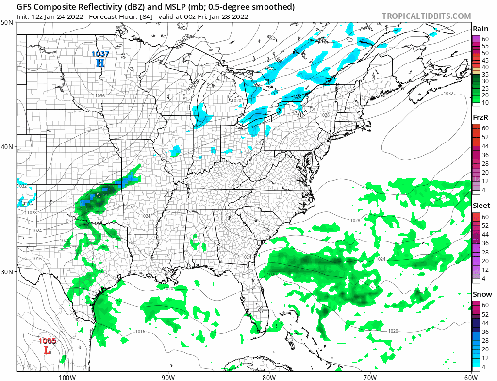
We have a warm front heading our way from the southwest and it is producing clouds and there are snow showers on the radar again this evening across Pennsylvania into New York State. Some of the lead echos are making it to the coast and there could be a snow shower or two running around this evening. Like last night they were light and a few places got the ground whitened up but the best chances for that will be north of NYC where a coating to at most an inch could accumulate. Otherwise it will be cloudy tonight with temperatures not going very far. Most lows will be in the 20s to around 30. Tuesday will be the one mild day this week until another arctic front passes. Look for clouds and some sun in the mix. I would throw in the chance for a brief rain or snow shower (inland) when the front passes but that chance is very low. Highs will reach the low and middle 40s.
SATELLITE

WEATHER RADAR

Cold weather returns Wednesday and lasts into Friday. Wednesday morning we will start out in the teens and low 20s. Sunshine should be with us for Wednesday and Thursday but highs both days will be just in the 20s. Wednesday night into Thursday morning will be another round of very cold low in the low teens and single digits.
Friday starts the process of low pressure developing off the Southeast US coast and then it heads northeastward. There is still no clarity on what is going to happen or if this is going to happen. We still have issues to resolve regarding the strength and position of the upper trough which will be driving development of this storm
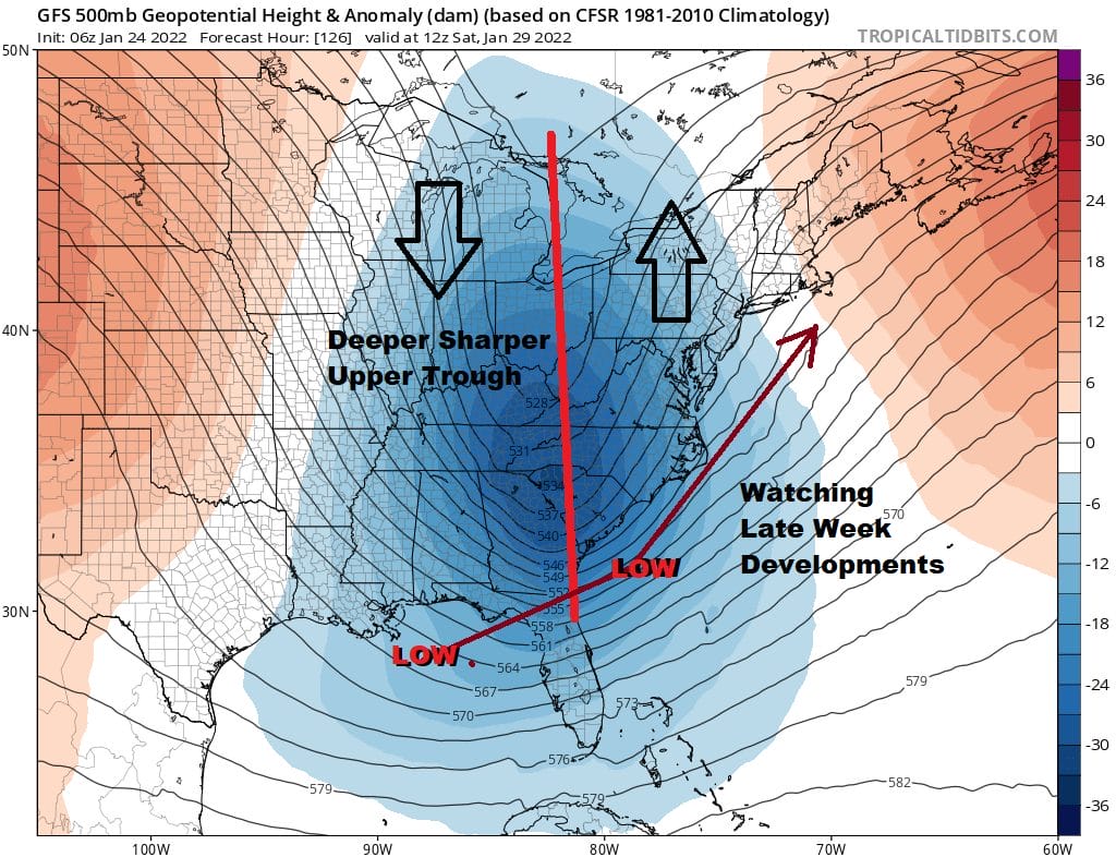
Today’s model runs were all on the dynamic side with a sharp upper trough as shown above an a strong south southwest flow that would take a low up the coast. However and this is big however, the trough is going to be there, and models have been struggling on whether this is going to be a strong upper system or one that is much weaker and “progressive” In other words instead of lifting the storm up the coast it pushes it to the east and we wind up with less, or even nothing if it goes well to the east. We will not have clarity until we see just how sharp this trough is as it nears the coast. It will probably be another two days until we get clarity on that and it won’t be until late Wednesday at the earliest where an early call snow forecast would be issued. Until then the speculation continues on the outcome.
BE SURE TO DOWNLOAD THE FREE METEOROLOGIST JOE CIOFFI WEATHER APP &
ANGRY BEN’S FREE WEATHER APP “THE ANGRY WEATHERMAN!
MANY THANKS TO TROPICAL TIDBITS & F5 WEATHER FOR THE USE OF MAPS
Please note that with regards to any severe weather, tropical storms, or hurricanes, should a storm be threatening, please consult your local National Weather Service office or your local government officials about what action you should be taking to protect life and property.