A Cold Morning But A Thanksgiving Warmup Next Front Friday Brings Cold Watching Weak Storm For Sunday

Weather in 5/Joe & Joe Weather Show Latest Podcast
A Cold Morning But A Thanksgiving Warmup Next Front Friday Brings Cold Watching Weak Storm For Sunday
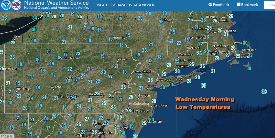
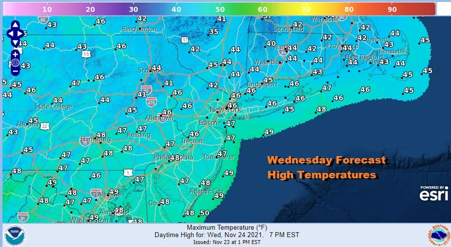
No doubt about it this was the coldest morning of the Autumn season so far as we bottomed in many areas in the 20s and the warmest urban locations also bottomed under 32. If there are any spots that had not been to 32 yet, this morning took care of that. We are in the middle of high pressure not aligned along the coast. The satellite shot shows us mostly free of clouds so it should be a mainly sunny day. Temperatures this afternoon will top in the middle to upper 40s.
High pressure moves off the coast tonight and winds go southwest which means the overnight lows into Thursday morning won’t be as cold as they were this morning. Tonight should be mostly clear with lows in the 20s to near 30 inland and low to mid 30s warmer urban centers and coast. Radars are nice and quiet today and they won’t be an issue through Thursday.
SATELLITE

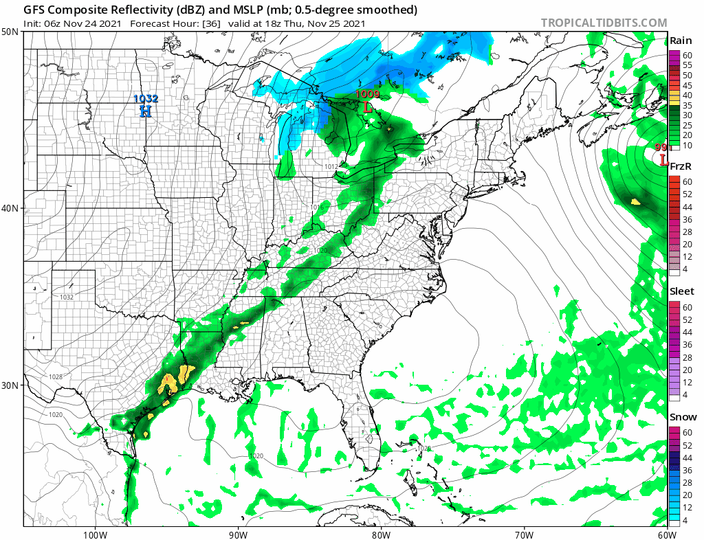
WEATHER RADAR

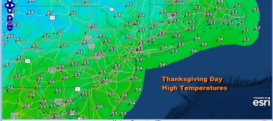
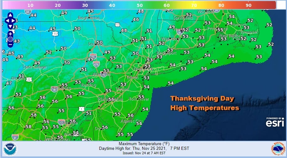
Thanksgiving Day is going to be a great day of sunshine and temperatures are going to bounce higher. Even with a cold front approaching, the timing will be good where clouds will wait until later in the afternoon to arriving from west to east and no showers are forecast until sometime later Thursday night. Highs Thanksgiving day will be in the low to mid 50s.
Thursday night into Friday morning we will see some showers and another cold front passes. After the front goes by temperatures will drop from the 50s into the 40s Friday as clouds give way to some afternoon sun from west to east along with the a gust windy. This is pretty much a repeat performance of what happened at the beginning of the week.
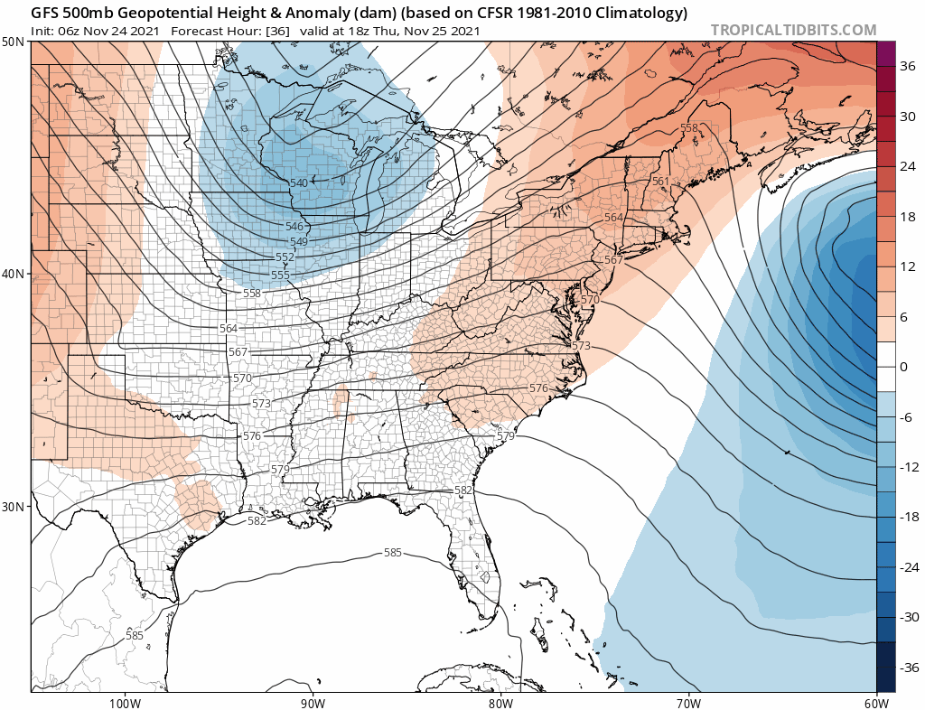
We continue to see upper troughs moving through the east and each one has a shot of cold air behind it. This time around however you will notice that the upper trough coming through on Friday is being followed up by another one for Sunday. While the initial idea out of this was for a storm to develop offshore and be of no issue, we are seeing that next system a little stronger and sharper as it drops southeastward.
As far as the weekend is concerned Saturday is just going to be cold with sunshine and highs just into the 40s. For now we will call for arriving clouds on Sunday and make a mention for a chance for a period of rain or snow later in the day or Sunday night. We would like to see weather models show more consistency so we will look to see if models continue to carry it forward today. In the meantime, enjoy your Wednesday. There are no weather related delays to worry about if you are travelling as the weather across much of the country is quiet. Happy Thanksgiving to you and your family. I will be around and posting while my turkey is cooking!
BE SURE TO DOWNLOAD THE FREE METEOROLOGIST JOE CIOFFI WEATHER APP &
ANGRY BEN’S FREE WEATHER APP “THE ANGRY WEATHERMAN!

MANY THANKS TO TROPICAL TIDBITS & F5 WEATHER FOR THE USE OF MAPS
Please note that with regards to any severe weather, tropical storms, or hurricanes, should a storm be threatening, please consult your local National Weather Service office or your local government officials about what action you should be taking to protect life and property.


