90 Degree Temperatures Mid Afternoon 100 Possible Sunday
90 Degree Temperatures Mid Afternoon 100 Possible Sunday
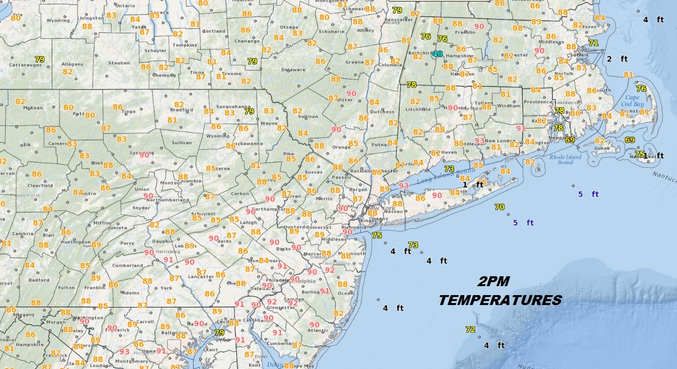
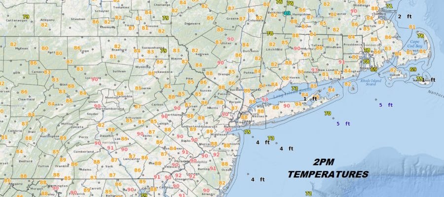
Mid Afternoon temperatures are touching the 90 degree mark and this hot but not very humid day. Winds are mostly northwest which means even the beaches are experiencing temperatures in the mid to upper 80s. The dew points are in the upper 50s and lower 60s which makes it reasonably comfortable out there. Other than a few passing clouds dry air covers the Northeast and Middle Atlantic. The radars are silent and will remain so into next week. The focus over the next week will be temperatures as far as how high we get and whether the ocean wind will occasionally kick in tempering the heat ever so slightly.
EASTERN SATELLITE

REGIONAL RADAR

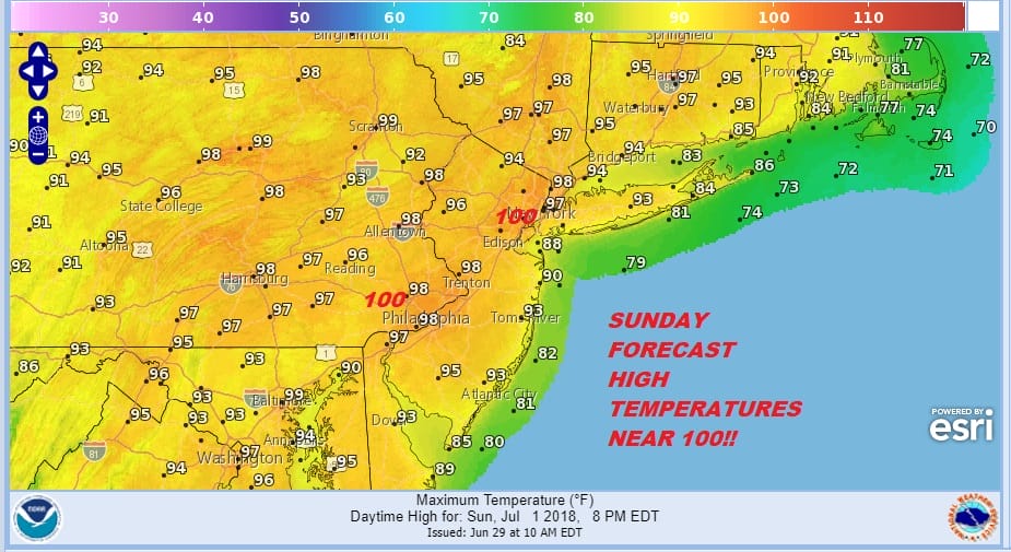
Saturday will be a repeat of today with temperatures a little higher as we reach the low and middle 90s but cooler at the beaches. Sunday remains on course as the hottest day of the next 7 with highs close to 100 in some places.
SUNDAY FORECAST HIGH TEMPERATURES
The only chance for any pop up storms is a tiny chance on Tuesday and perhaps a slightly higher risk on Wednesday the 4th of July but other than that, this is an almost perfect stretch of summer beach and pool weather for sure. The tropics are quiet in the Atlantic for now so there are no threats to worry about.
As far as a break from this heatwave, we may have to wait until next Friday when a cold front might have enough push to move through and bring a cooler air mass down from Canada.
For more on the heatwave you can read the latest JOESTRADAMUS post on this.
 GET JOE A CIGAR IF YOU LIKE

LATEST JOESTRADAMUS ON THE LONG RANGE


