
Tropical activity has been increasing over the last few days but there is a lack of organization in any of these systems and we contiue to see strong shear across much of the Atlantic. Nothing has really changed from that respect. In the central tropical Atlantic we have a system that looked like it was about to develop however as we look at it tonight there is no closed circulation . That system was infected by dry air over the last 48 hours. Some thunderstoms have developed today so we will watch to see what it does. There is a system behind it that is just coming on to the edge of the picture. That has a shot of becoming a tropical cylone as well.

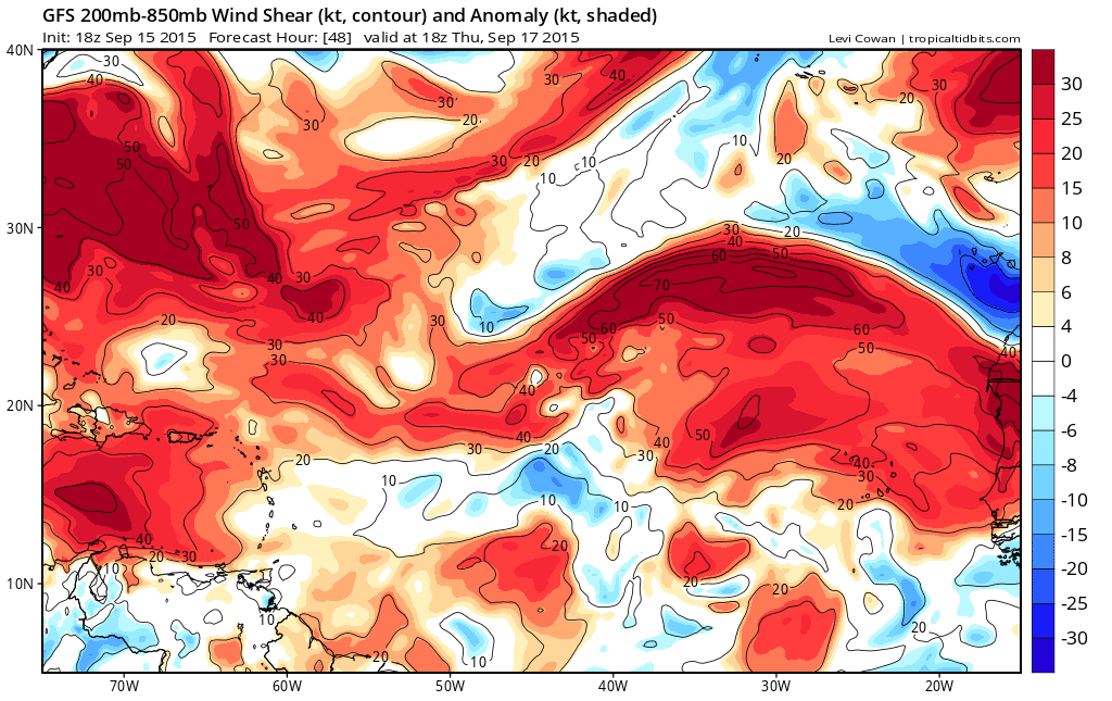
There is alot of disturbed weather in the Gulf of Mexico but there is a lot of shear across the area so development there is not favorable at all. Disturbed weather is also covering the Eastern Caribbean but there to strong shear remains an issue. The shearing pattern in 48 hours shows no real change with pockets of strong shear south of 15 N and tons of shear running across the Atlantic north of 15 north.
Some of the models continue to indicate that the tropical Atlantic systems will develop into tropical cyclones however the models have been doing this on and off for awhile so we don’t find those models reliable at all. It is hard to believe that there will be any serious changes in the long term shearing pattern that exists over the tropics. As we move toward the end of September we will begin to see the normal shift of the favored development areas to the west as activity over the tropical Atlantic begins to decrease. I still believe that if anything is going to happen it will probably be more of the home grown variety.
Be sure to download my weather app and subscribe to my weather forecasts. The download is free and the subscription is just 99 cents a month. No advertisments and no security issues.